
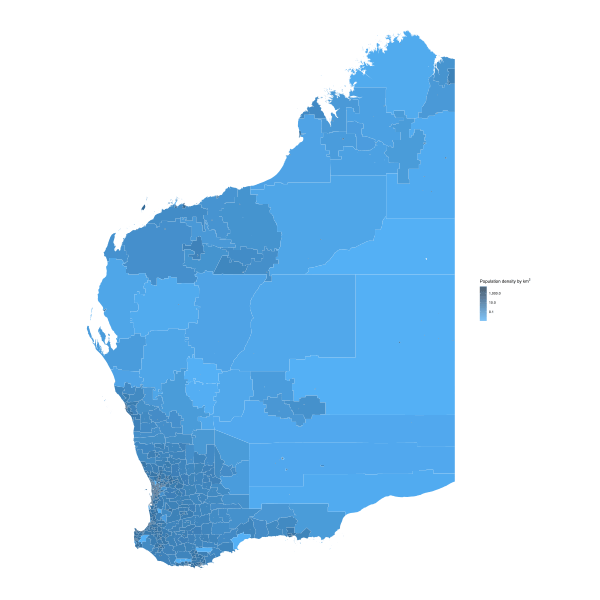
Image: WA population density by SA1 (2016)

Size of this PNG preview of this SVG file: 600 × 600 pixels. Other resolution: 240 × 240 pixels.
Original image (SVG file, nominally 1,874 × 1,874 pixels, file size: 4.3 MB)
Description: This map is intended to replace File:WApopDist2006.png, a dot density map of polygon centroids where each polygon contained 1,000 people. Data is 2016 Australian census population for Statistical Area Level 1 (SA1) regions.
Gradient scale is a base-10 logarithmic scale, representing the number of people per square kilometre in each SA1 region (SA1 population/SA1 area)
Author: Canley
Usage Terms: Creative Commons Attribution-Share Alike 3.0
License: CC-BY-SA-3.0
License Link: http://creativecommons.org/licenses/by-sa/3.0/
Attribution Required?: Yes
Image usage
The following page links to this image:

All content from Kiddle encyclopedia articles (including the article images and facts) can be freely used under Attribution-ShareAlike license, unless stated otherwise.
.svg)