
Image: WVStatehoodVote
No higher resolution available.
WVStatehoodVote.png (672 × 600 pixels, file size: 115 KB, MIME type: image/png)
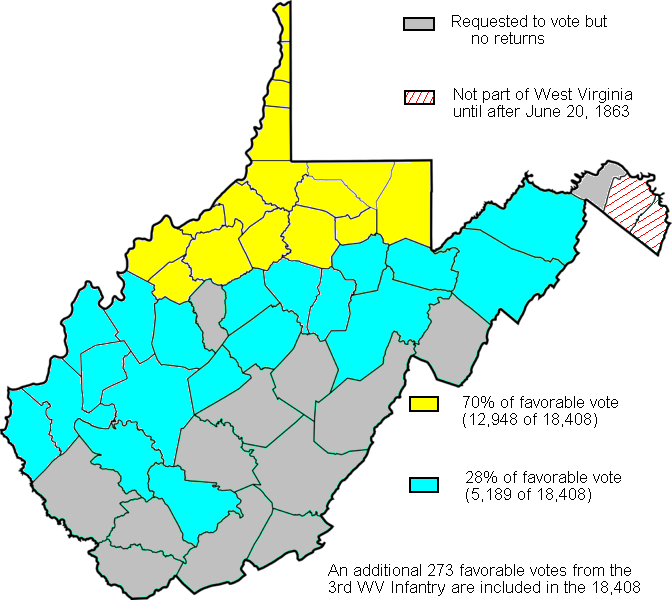
Description: Map created based on the voting results of statehood referendum on Oct. 24, 1861 in West Virginia as compiled by Richard O. Curry in "A House Divided", pgs. 141-152.
Title: WVStatehoodVote
Credit: My creation from data in R. Curry's "A House Divided" pgs. 141-152
Author: Dubyavee
Usage Terms: Public domain
License: Public domain
Attribution Required?: No
Image usage
The following page links to this image:

All content from Kiddle encyclopedia articles (including the article images and facts) can be freely used under Attribution-ShareAlike license, unless stated otherwise.