
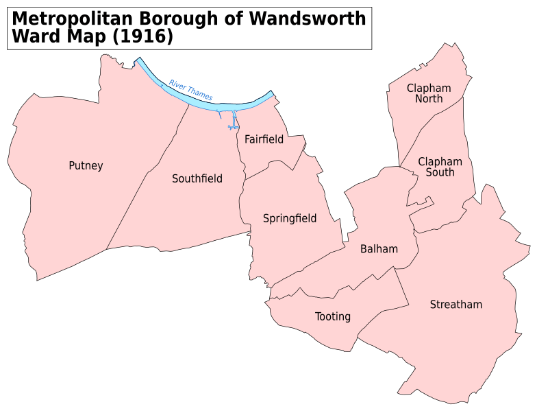
Image: Wandsworth Met. B Ward Map 1916

Description: A map showing the wards of Wandsworth Metropolitan Borough as they appeared in 1916. Based on the Ordnance Survey 'County Series 3rd Edition' Map of London (1912-14) Sheets VIII6, VIII7, VIII8, VIII10, VIII11, VIII12, VIII14, VIII15, VIII16, IX5, IX9, IX13, IX14, XII2, XII4, XII8, XIII1, XIII2, XIII5 & XIII6 at 1:2500 scale. Accessed at http://maps.nls.uk/index.html Reproduced with the permission of the National Library of Scotland. Key: District Boundaries River bank River
Title: Wandsworth Met. B Ward Map 1916
Credit: Own work
Author: Doc77can
Usage Terms: Creative Commons Attribution-Share Alike 4.0
License: CC BY-SA 4.0
License Link: http://creativecommons.org/licenses/by-sa/4.0
Attribution Required?: Yes
Image usage
The following 9 pages link to this image:
