
Image: Warszawa Powstanie 1944-09-10

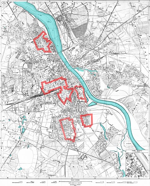
Description: The areas of Warsaw controlled by the Home Army on September 10th, 1944, during the Warsaw Uprising. This map was based on a variety of sources and is pretty accurate, but don't expect any map to be any more or any less accurate: there were no stable front-lines and the ones presented here are only for orientation. Also note that not all areas outside of the Polish zone of control were controlled by the Germans.
Title: Warszawa Powstanie 1944-09-10
Credit: Based on Image:Warszawa 1935.png Made by Halibutt in GIMP and Inkscape, basing on maps published in: Jerzy Kirchmayer (1978). Powstanie warszawskie. Warsaw: Książka i Wiedza, 576. ISBN 83-05-11080-X, and several other maps available.
Author: Halibutt
Usage Terms: Creative Commons Attribution-Share Alike 3.0
License: CC-BY-SA-3.0
License Link: http://creativecommons.org/licenses/by-sa/3.0/
Attribution Required?: Yes
Image usage
The following page links to this image:
