
Image: Watab-LongPrairieReservation1843Nicollet

Size of this preview: 800 × 491 pixels. Other resolutions: 320 × 197 pixels | 1,120 × 688 pixels.
Original image (1,120 × 688 pixels, file size: 337 KB, MIME type: image/gif)
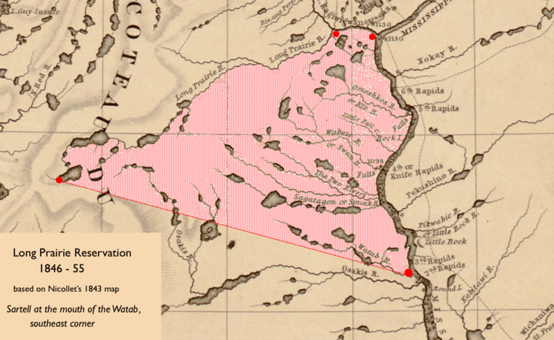
Description: Map of the 1846-55 Winnebago (Ho-Chunk) Reservation in central Minnesota based on landmarks in 1847 US Treaty with the Chippewa, using Joseph Nicolas Nicollet's 1843 map
Title: Watab-LongPrairieReservation1843Nicollet
Credit: Original publication: Map of the Hydrographical Basin of the Upper Mississippi Immediate source: http://content.mnhs.org/maps/items/show/25
Author: Joseph Nicolas Nicollet (Life time: 1786 – 1843)
Usage Terms: Public domain
License: Public domain
Attribution Required?: No
Image usage
The following 2 pages link to this image:

All content from Kiddle encyclopedia articles (including the article images and facts) can be freely used under Attribution-ShareAlike license, unless stated otherwise.