
Image: Water Level Route on US map cropped
No higher resolution available.
Water_Level_Route_on_US_map_cropped.png (675 × 466 pixels, file size: 176 KB, MIME type: image/png)
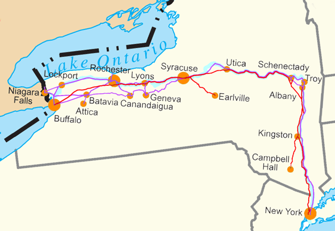
Description: Water Level Routes of the New York Central Railroad, West Shore Railroad and Erie Canal on Image:US state outline map.png. See Image:Water Level Route on US map.png for the full U.S.
Title: Water Level Route on US map cropped
Credit: Own work
Author: SPUI
Usage Terms: Public domain
License: Public domain
Attribution Required?: No
Image usage
The following 4 pages link to this image:

All content from Kiddle encyclopedia articles (including the article images and facts) can be freely used under Attribution-ShareAlike license, unless stated otherwise.