
Image: WatsonIsland

Size of this preview: 612 × 599 pixels. Other resolutions: 245 × 240 pixels | 946 × 926 pixels.
Original image (946 × 926 pixels, file size: 657 KB, MIME type: image/gif)
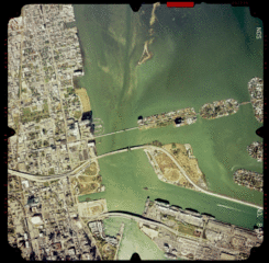
Description: Aerial photograph 5WJ68410, 1992. Scale 1:15000, azimuth 189.7, 25.80139° N, 80.17445° W. (Coastal Aerial Photography, NOAA/National Ocean Service, <http://mapfinder.nos.noaa.gov:80/ mapfinderhtml3/surround/photos/photos.html> Downloaded from http://mfproducts.nos.noaa.gov/images/Photos/5WJ68410.gif
Title: WatsonIsland
Author: See below
Usage Terms: Public domain
License: Public domain
Attribution Required?: No
Image usage
The following page links to this image:

All content from Kiddle encyclopedia articles (including the article images and facts) can be freely used under Attribution-ShareAlike license, unless stated otherwise.