
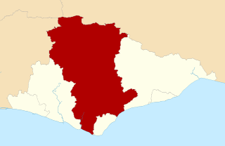
Image: Wealden East Sussex UK district map

Size of this PNG preview of this SVG file: 800 × 521 pixels. Other resolution: 320 × 208 pixels.
Original image (SVG file, nominally 1,425 × 928 pixels, file size: 411 KB)
Description: Map of East Sussex UK with Wealden district highlighted. Equirectangular map projection on WGS 84 datum, with N/S stretched 155% Geographic limits: West: 0.28W East: 0.91E North: 51.1N South: 50.7N
Title: Wealden East Sussex UK district map
Credit: Ordnance Survey OpenData, Boundary-Line product
Author: Nilfanion, created from Ordnance Survey data
Permission: Note: Derivative works can be licensed under any Creative Commons Attribution 3.0 Licence.
Usage Terms: Ordnance Survey OpenData Licence
License: OS OpenData
License Link: https://www.ordnancesurvey.co.uk/business-and-government/licensing/using-creating-data-with-os-products/os-opendata.html
Attribution Required?: Yes
Image usage
The following 2 pages link to this image:

All content from Kiddle encyclopedia articles (including the article images and facts) can be freely used under Attribution-ShareAlike license, unless stated otherwise.