
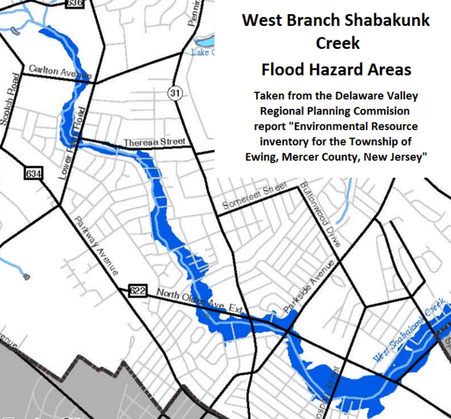
Image: West Branch Shabakunk Flood Hazard Areas

Size of this preview: 646 × 600 pixels. Other resolutions: 259 × 240 pixels | 767 × 712 pixels.
Original image (767 × 712 pixels, file size: 471 KB, MIME type: image/png)
Description: Map of flood hazard areas along the West Branch Shabakunk Creek in Ewing Township, produced by the Delaware Valley Regional Planning Commission in its report, "Environmental Resource Inventory for the Township of Ewing, Mercer County, New Jersey"
Title: West Branch Shabakunk Flood Hazard Areas
Credit: http://www.dvrpc.org/reports/05008.pdf
Author: Delaware Valley Regional Planning Commission - Federally mandated and funded inter-government agency
Usage Terms: Public domain
License: Public domain
Attribution Required?: No
Image usage
The following page links to this image:

All content from Kiddle encyclopedia articles (including the article images and facts) can be freely used under Attribution-ShareAlike license, unless stated otherwise.