
Image: Whatcomtrail2bwskagit
No higher resolution available.
Whatcomtrail2bwskagit.jpg (640 × 480 pixels, file size: 144 KB, MIME type: image/jpeg)
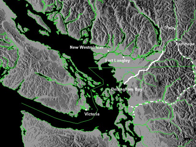
Description: Map of northwestern Washington and southwestern British Columbia showing the Whatcom Trail (solid white line) and the Skagit Trail (dotted white line). Only settlements extant in 1858 are shown.
Title: Whatcomtrail2bwskagit
Credit: created map using public-use basemap (Can MoE weather originally, but altered)
Author: Skookum1 at en.wikipedia
Usage Terms: Public domain
License: Public domain
Attribution Required?: No
Image usage
The following page links to this image:

All content from Kiddle encyclopedia articles (including the article images and facts) can be freely used under Attribution-ShareAlike license, unless stated otherwise.