
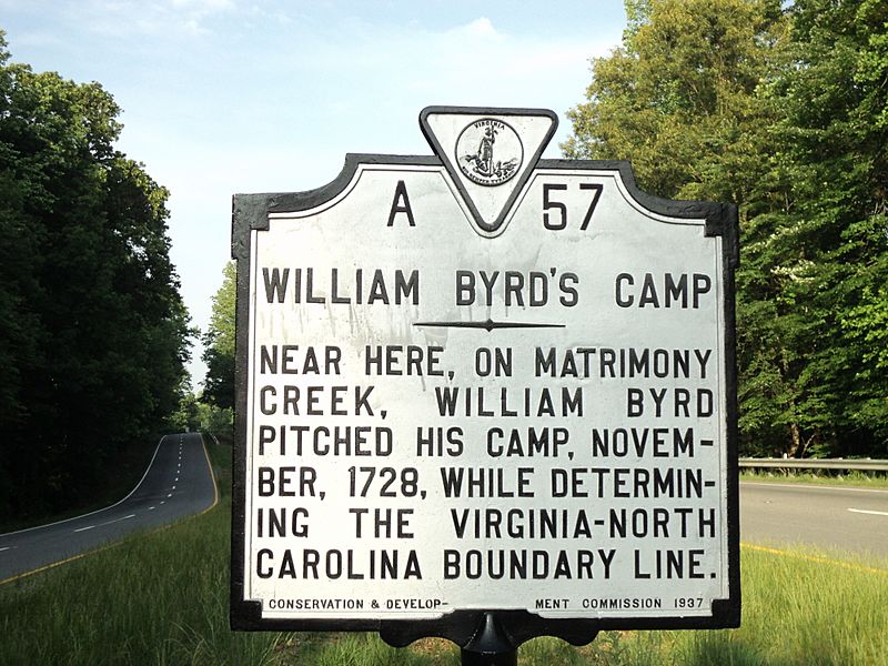
Image: William Byrd's Camp November 1728 Historic Marker Henry County Virginia

Size of this preview: 800 × 600 pixels. Other resolutions: 320 × 240 pixels | 4,000 × 3,000 pixels.
Original image (4,000 × 3,000 pixels, file size: 4.34 MB, MIME type: image/jpeg)
Description: Virginia historic marker for the camp of William Byrd II, who surveyed the dividing line between North Carolina and Virginia, and who passed through Henry County, Virginia, in November 1728. Byrd passed by Matrimony Creek, which was given its name by one of the members of Byrd's surveying party for its turbulent, 'brawling' waters, reminding the man of the state of matrimony.
Title: William Byrd's Camp November 1728 Historic Marker Henry County Virginia
Credit: Own work
Author: MarmadukePercy
Usage Terms: Creative Commons Attribution-Share Alike 3.0
License: CC BY-SA 3.0
License Link: http://creativecommons.org/licenses/by-sa/3.0
Attribution Required?: Yes
Image usage
The following 2 pages link to this image:

All content from Kiddle encyclopedia articles (including the article images and facts) can be freely used under Attribution-ShareAlike license, unless stated otherwise.