
Image: Wisconsin Pole of Inaccessibility
Size of this preview: 610 × 599 pixels. Other resolutions: 244 × 240 pixels | 628 × 617 pixels.
Original image (628 × 617 pixels, file size: 17 KB, MIME type: image/png)
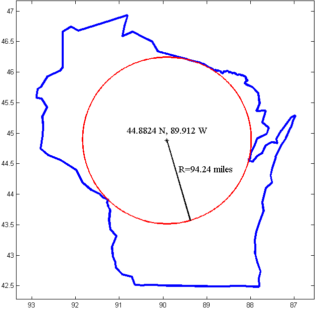
Description: The pole of inaccessibility for Wisconsin. This is the point furthest from the border of Wisconsin, and therefore furthest from any point which is not in the state. The location was calculated and the image generated using Matlab.
Title: Wisconsin Pole of Inaccessibility
Credit: This diagram was created with MATLAB R14.
Author: Mpwood33
Usage Terms: Creative Commons Attribution-Share Alike 3.0
License: CC BY-SA 3.0
License Link: http://creativecommons.org/licenses/by-sa/3.0
Attribution Required?: Yes
Image usage
There are no pages that link to this image.

All content from Kiddle encyclopedia articles (including the article images and facts) can be freely used under Attribution-ShareAlike license, unless stated otherwise.