
Image: WorldCenterOfPopulation

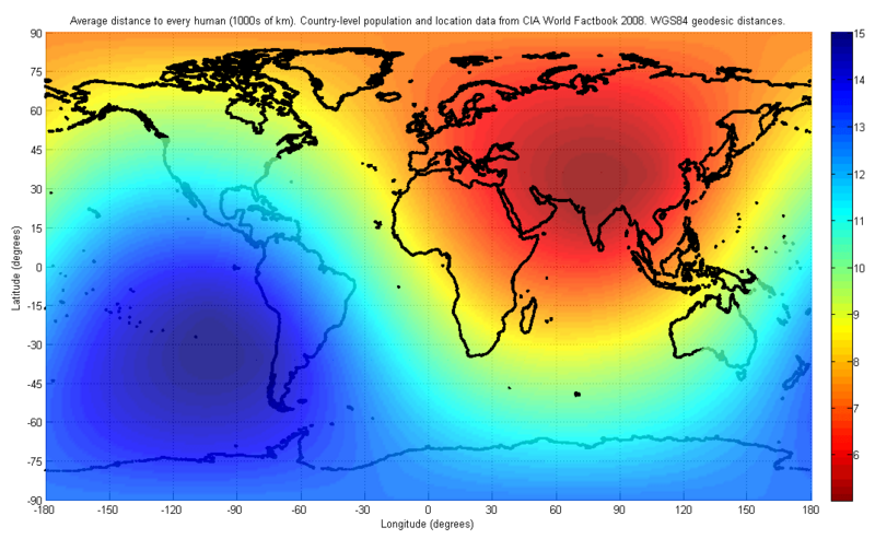
Description: The figure indicates the average distance to every human on earth, depending on location. The population and location data used are at the country-level, from the 2008 CIA World Factbook. The distance was computed first by finding the geodesic (shortest path) distance along the surface of the WGS84 reference ellipsoid to each country on the list, and then finding the weighted average of all such distances with the weight being the corresponding country's population. I have used only publicly available data for this image. The image may look slightly different in future, as world population distributions change. The image will also look different if a different distance metric is used, such as a Euclidean distance in three dimensions, which would allow for tunneling through the earth.
Title: WorldCenterOfPopulation
Credit: Own work
Author: Brhaspati
Usage Terms: Creative Commons Attribution-Share Alike 3.0
License: CC BY-SA 3.0
License Link: https://creativecommons.org/licenses/by-sa/3.0
Attribution Required?: Yes
Image usage
The following page links to this image:
