
Image: World RR Gauge Map.agr
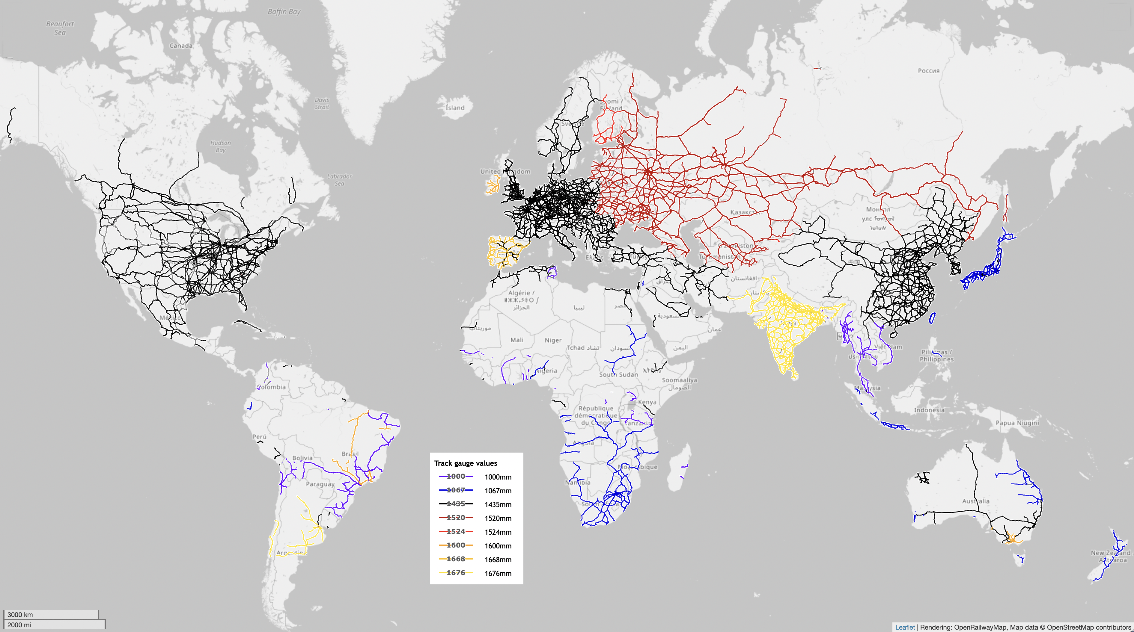
Description: Map of the world's railways, color coded to show rail gauge, the distance between tracks. Black is standard gauge, Red is Russian gauge, Yellow is Indian gauge, Orange is Iberian gauge, Blue is cape gauge and purple is meter gauge. (See inset for details.) Map produced using OpenRailwayMap which is an OpenStreetMap project.This map of world's railways was created from OpenStreetMap project data, collected by the community. This map may be incomplete, and may contain errors. Don't rely solely on it for navigation.
Title: World RR Gauge Map.agr
Credit: openstreetmap.org
Author: OpenStreetMap contributors, user:ArnoldReinhold "I release my contributions under CC0"--agr (talk) 14:52, 12 September 2022 (UTC)
Permission: OpenStreetMap data is available under the Open Database License (details). Standard style map tiles are licensed as ODbL Produced Works. Contains information from OpenStreetMap, which is made available under the Open Database License (ODbL). The ODbL does not require any particular license for maps produced from ODbL data. Prior to 1 August 2020, map tiles produced by the OpenStreetMap Foundation were licensed under the CC-BY-SA-2.0 license. Maps produced by other people may be subject to other licences.Open Database LicenseODbLhttp://opendatacommons.org/licenses/odbl/1.0/true
Usage Terms: Open Database License
License: ODbL
License Link: http://opendatacommons.org/licenses/odbl/1.0/
Attribution Required?: Yes
Image usage
The following 3 pages link to this image:
