
Image: World population density 1994 - with equator

Size of this preview: 800 × 475 pixels. Other resolutions: 320 × 190 pixels | 6,693 × 3,977 pixels.
Original image (6,693 × 3,977 pixels, file size: 1.13 MB, MIME type: image/png)
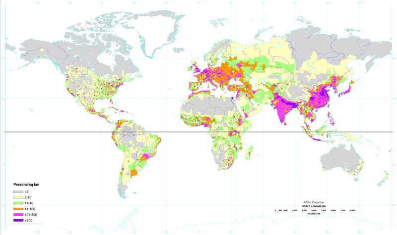
Description: World map of the population density in 1994. (A more recent population density map can be found at http://sedac.ciesin.columbia.edu/gpw/) This map clearly shows how the vast majority of the human population lives significantly north of the equator.
Title: World population density 1994 - with equator
Credit: World population density 1994.png (same map, but no black line on the equator shown)
Author: https://en.wikipedia.org/wiki/United_States_Department_of_Agriculture
Usage Terms: Public domain
License: Public domain
Attribution Required?: No
Image usage
The following 2 pages link to this image:

All content from Kiddle encyclopedia articles (including the article images and facts) can be freely used under Attribution-ShareAlike license, unless stated otherwise.