
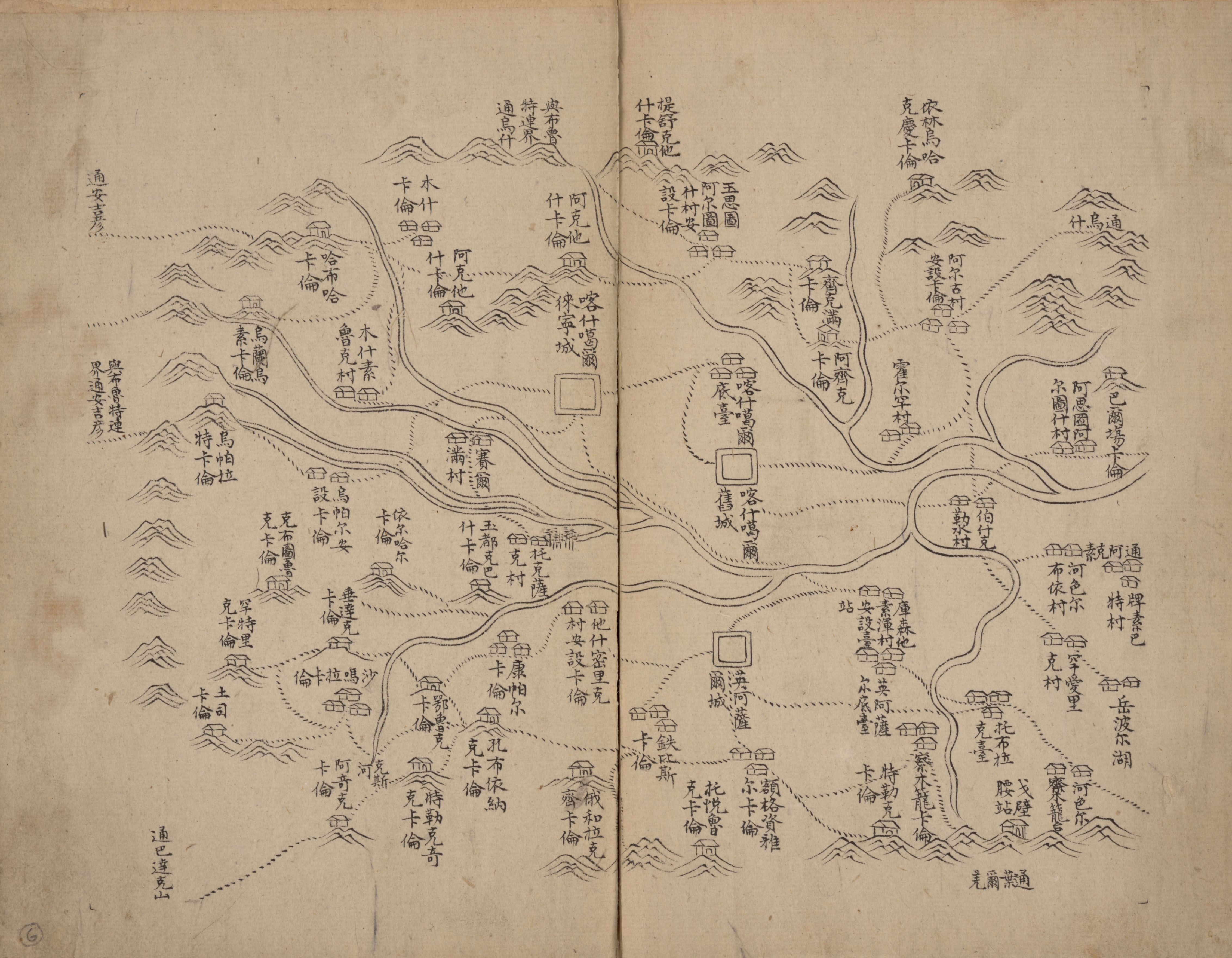
Image: Xinjiang 1759 - 16
Description: Xinjiang Quan Tu (Atlas of Xinjiang). Chart 16 - Kashgar. Shows the topography, cities, villages and roads with the military posts in the Xinjiang. Also shows the administrative system and local divisions of Xinjiang before the 24th year of Emperor Qianlong (1759). Not drawn to scale. Relief shown pictorially.
Title: Xinjiang 1759 - 16
Credit: This map is available from the United States Library of Congress's Geography & Map Division under the digital ID g7823xm.gct00164. This tag does not indicate the copyright status of the attached work. A normal copyright tag is still required. See Commons:Licensing for more information.
Author: Unknown authorUnknown author
Usage Terms: Public domain
License: Public domain
Attribution Required?: No
Image usage
The following page links to this image:
