
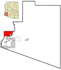
Image: Yuma County Incorporated and Unincorporated areas Quechan Tribe highlighted

Description: Locator map of the Quechan Tribal Lands and Indian reservation highlighted in red. They are primarily located within Imperial County, Southern California]]. This map also shows the incorporated areas and unincorporated areas in Yuma County, Arizona. Incorporated cities are shown in gray, and unincorporated communities or census-designated places are shown in white. Data for the borders and locations are based on maps from the Yuma County DDS Mapping Services, US Census Bureau TIGER Map Server, and ITCA Map of Tribal Homelands in Arizona. I created this map in Inkscape.
Title: Yuma County Incorporated and Unincorporated areas Quechan Tribe highlighted
Credit: My own work, based on public domain information
Author: Ixnayonthetimmay
Permission: All rights not reserved. See below.
Usage Terms: Public domain
License: Public domain
Attribution Required?: No
Image usage
The following 2 pages link to this image:
