
Inglewood, Western Australia facts for kids
Quick facts for kids InglewoodPerth, Western Australia |
|||||||||||||||
|---|---|---|---|---|---|---|---|---|---|---|---|---|---|---|---|

Beaufort Street, Inglewood, Western Australia
|
|||||||||||||||
| Population | 5,674 (2016 census) | ||||||||||||||
| • Density | 1,960/km2 (5,100/sq mi) | ||||||||||||||
| Postcode(s) | 6052 | ||||||||||||||
| Area | 2.9 km2 (1.1 sq mi) | ||||||||||||||
| Location | 5 km (3 mi) NE of Perth CBD | ||||||||||||||
| LGA(s) | City of Stirling | ||||||||||||||
| State electorate(s) | Maylands, Mount Lawley | ||||||||||||||
| Federal Division(s) | Perth | ||||||||||||||
|
|||||||||||||||
Inglewood is an inner-city suburb of Perth, Western Australia, 4 kilometres (2 mi) north-east of its central business district. It is located within the local government area of the City of Stirling.
Contents
History
With a name thought to have been derived from the Norwegian barque Inglewood (its late nineteenth century voyage was mentioned in The West Australian on 24 May 1904), the suburb of Inglewood began when land was first granted to John Gregory in 1831. It is also plausible to derive that the suburb was named after the Inglewood Gold rush region of California given the suburb was developed during the gold boom era of the 1890s by a company calling itself 'Gold Estates of Australia'. E.W. Hammer named part of the estate "Inglewood Estate" in 1895.
Regarded as part of Maylands in the early years, Inglewood was initially developed by a company called Gold Estates of Australia and a section now referred to as The Avenues was the first to be subdivided. This development included land from the railway line to North Street and eventually through to Eleventh Avenue and Dundas Road; the later subdivision was named Inglewood Estate.
Residential development
Inglewood has experienced two distinct booms in residential growth: between 1904 and 1920 single residential housing was built to accommodate the blue-collar population while more development occurred around World War Two between 1935 and 1940.
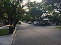
The majority of residences in Inglewood are of pre-war vintage (many are of a Federation or Californian bungalow style) and towards Mount Lawley a typical lot size is 730m2, increasing to up to 1400m2 east of Beaufort Street.
Inglewood has a high heritage value with numerous places of cultural and historical significance and many of the older dwellings have been renovated and restored to their original styles. In addition to character housing, there are 1960s apartments and modern unit developments scattered throughout the suburb.
Significant landmarks
Significant landmarks include the prominent clock tower on the corner of Beaufort Street and Dundas Road, highly visible to northbound traffic along Beaufort Street, and the Inglewood Civic Centre, opened in 1991, incorporating the local library, an autumn centre and children’s centre. Inglewood Primary School, the major school for the area, is located just off Beaufort Street. The clock tower was originally part of a picture theatre - the Civic - and shopping complex designed, built, and owned by Tom Snooks (1890–1958) a local picture-show man and builder-developer from the 1910s to the 1940s. This heritage building complex has recently (2006–2008) been redeveloped for residential purposes.
Transport
The suburb is served by a number of Transperth bus routes operated by Path Transit. The 360, 361, 362 (Alexander Heights-Perth) and 960 (Mirrabooka-Perth-Curtin University) cover Alexander Drive. The 66, 67, 68, 950 and 16 buses pass through Inglewood along Walter Road and Beaufort Street.
Demographics
Inglewood's population at the Australian Bureau of Statistics's 2016 census was 5,674. This is an increase on the 5,503 recorded at the 2011 census, 5,045 recorded at the 2006 census, and the 4,708 recorded at the 2001 census. 48.1% of residents are male, and 51.9% are female. The median age is 38, which is above the Western Australian average of 36, and 44.9% of residents over the age of 15 are married, which is below the state average of 48.8%. Out of the suburb's 2,536 dwellings, 2,282 were occupied and 254 were not. Out of the 2,282 occupied dwellings, 1,403 were detached houses, 373 were semi-detached and 497 were apartments or flats. The proportion of apartments or flats, 21.8%, is significantly higher than Western Australia's average of 5.7%. 614 were owned outright, 816 were owned with a mortgage, 772 were rented and 68 were other or not stated.
The median weekly household income was $1,832, which is higher than the state and the country, which are at $1,595 and $1,438 respectively. Major industries that residents worked in were hospitals (4.4%), state government administration (3.3%), primary education (2.8%), cafes and restaurants (2.8%), and legal services (2.6%).
The population of Inglewood is predominantly Australian born, with 65.9% of residents born in Australia, similar to the state's average of 60.3%. The next most common birthplaces are England (6.7%), New Zealand (1.9%), Italy (1.4%), India (1.4%), and Ireland (1.2%). 38.5% of residents had both parents born in Australia, and 37.8% of residents have neither parent born in Australia. The most popular religious affiliations were none (36.6%), Catholic (27.6%), Anglican (11.9%) and Eastern Orthodox (3.0%).
Education

Inglewood Primary School is public primary school on Normanby Road in Inglewood. It has approximately 600 students from Kindergarten to year 6. It was established in 1927 as North Maylands School. It was renamed North Inglewood State School in 1933. It was renamed again to its present name in 1985.
St Peter's Primary School is a Catholic primary school located on Wood Street, on Inglewood's boundary with Bedford. It has approximately 700 students in three streams from Kindergarten to Year 6. The school first opened in 1941, occupying a single house. The school moved down the street to a new site in 1942, that being its current site. Expansions occurred in the 1950s, and in 1957, a secondary school for girls named St Thomas Aquinas College opened on the same site. The two schools would undergo significant improvements and renovations over the decades that followed.
Meanwhile, St Mark’s College, a secondary school for boys, was established on Beaufort Street in Bedford. In 1989, St Thomas Aquinas College and St Mark's College merged to form Chisholm Catholic College. St Thomas Aquinas became the campus for lower school students, and St Mark's became the campus for senior school students. In 2003, the school was consolidated on the Beaufort Street site, and the Wood Street site in Inglewood became solely for St Peter's Primary School.
Images for kids
-
Harcourt Street

