
Interstate 69 facts for kids
Quick facts for kids
|
|
|---|---|
| Lua error in Module:Infobox_road/map at line 15: attempt to index field 'wikibase' (a nil value). | |
| Route information | |
| Length | 355.8 mi (572.6 km)
(original route; 1.73 mi (2.78 km) part opened near Evansville, Indiana on September 29, 2009. 42.0 mi (70.0 km) are open in MS and TN)
|
| Existed | 1956 (orig. route completed 1992)–present |
| Major junctions | |
| Original South end | |
| North end | |
| Highway system | |
| Main route of the Interstate Highway System Main • Auxiliary • Business |
|

Interstate 69 is an Interstate Highway in the United States. The main part of it goes from Indianapolis, Indiana north to Port Huron, Michigan at the Canada border. This part of the route is 355.81 miles (572.62 km) long. There are also parts of Interstate 69 in Mississippi and near Evansville, Indiana that are not currently connected to the other part. They will be connected when Interstate 69 is built from Indianapolis southwest to Texas.
Images for kids
-

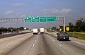
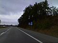
Looking on I-69 just outside Indianapolis near Pendleton
-

I-69's northern terminus at the Blue Water Bridge at the Canadian border in Port Huron, Michigan, connecting it to Highway 402 in Point Edward, Ontario
-
Upcoming connection from I-610, the North Loop to I-69 in Houston
-
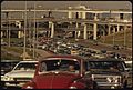
The Southwest Freeway, now I-69, in Houston in 1972
-
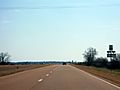
A stretch of I-69 cosigned with MS 304 in Mississippi
-
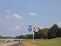
Future I-69 along with US 49, US 61, and US 278 near Clarksdale, Mississippi
-
I-69 cosigned with Western Kentucky Parkway near Dawson Springs, Kentucky
-
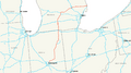
Map of the original I-69 route
-
The current US 59 will become I-69W; picture taken east of Laredo, Texas


.JPG)


