Ireland, Indiana facts for kids
Quick facts for kids
Ireland, Indiana
|
|
|---|---|
 |
|
| Country | United States |
| State | Indiana |
| County | Dubois |
| Township | Madison |
| Elevation | 469 ft (143 m) |
| Time zone | UTC-5 (Eastern (EST)) |
| • Summer (DST) | UTC-4 (EDT) |
| ZIP code |
47546
|
| Area code(s) | 812, 930 |
| FIPS code | 18-36468 |
| GNIS feature ID | 436827 |
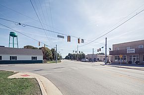
Ireland is an unincorporated community in Madison Township, Dubois County, in the U.S. state of Indiana.
History
The town was founded on land purchased from the United States government by John Stewart, a native of Ireland, on December 23, 1816. The town was once intended to be called American City, but changed to Ireland when the name was not approved by the post office department. The town was laid out by John Stewart's son James, and four others. The first town map is dated May 20, 1865, but had been a small village many years before that.
The Ireland post office has been in operation since 1853. Ireland's school system was absorbed by the Jasper school system in 1970.
On the night of February 28, 2017, an EF2 tornado associated with the February 28, 2017 tornado outbreak struck Ireland. Several homes were destroyed, however no injuries were reported.
Religion
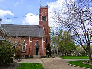
Ireland is home of St. Mary's Church, a Roman Catholic church.
Geography
Ireland is located at 38°24′53″N 86°59′58″W / 38.41472°N 86.99944°W, a few miles west of Jasper on State Road 56 in the northeast portion of Madison Township.
See also
 In Spanish: Ireland (Indiana) para niños


