
Iroquois, South Dakota facts for kids
Quick facts for kids
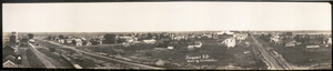
Iroquois, South Dakota
|
|
|---|---|

Location in Beadle County (and Kingsbury County) and the state of South Dakota and the state of South Dakota
|
|
| Country | United States |
| State | South Dakota |
| Counties | Kingsbury, Beadle |
| Incorporated | 1887 |
| Area | |
| • Total | 0.62 sq mi (1.61 km2) |
| • Land | 0.62 sq mi (1.61 km2) |
| • Water | 0.00 sq mi (0.00 km2) |
| Elevation | 1,401 ft (427 m) |
| Population
(2020)
|
|
| • Total | 292 |
| • Density | 417.74/sq mi (161.17/km2) |
| Time zone | UTC-6 (Central (CST)) |
| • Summer (DST) | UTC-5 (CDT) |
| ZIP code |
57353
|
| Area code(s) | 605 |
| FIPS code | 46-32020 |
| GNIS feature ID | 1255781 |
Iroquois is a city on the border of Beadle and Kingsbury counties in South Dakota, United States. The population was 292 at the 2020 census. The school building (kindergarten - twelfth grade) is located in Kingsbury County, while the school parking lot is located in Beadle County. Highway 14 runs directly through Iroquois.
Contents
History
Iroquois was laid out in 1880. The city was named after the Iroquois people. A post office called Iroquois has been in operation since 1880.
Geography
Iroquois is located at 44°21′59″N 97°51′0″W / 44.36639°N 97.85000°W (44.366437, -97.850095).
According to the United States Census Bureau, the city has a total area of 0.62 square miles (1.61 km2), all of it land.
Iroquois has been assigned the ZIP code 57353 and the FIPS place code 32020.
Demographics
| Historical population | |||
|---|---|---|---|
| Census | Pop. | %± | |
| 1890 | 181 | — | |
| 1900 | 276 | 52.5% | |
| 1910 | 578 | 109.4% | |
| 1920 | 651 | 12.6% | |
| 1930 | 531 | −18.4% | |
| 1940 | 413 | −22.2% | |
| 1950 | 413 | 0.0% | |
| 1960 | 385 | −6.8% | |
| 1970 | 375 | −2.6% | |
| 1980 | 348 | −7.2% | |
| 1990 | 328 | −5.7% | |
| 2000 | 278 | −15.2% | |
| 2010 | 266 | −4.3% | |
| 2020 | 292 | 9.8% | |
| U.S. Decennial Census | |||
2010 census
As of the census of 2010, there were 266 people, 119 households, and 76 families residing in the city. The population density was 429.0 inhabitants per square mile (165.6/km2). There were 135 housing units at an average density of 217.7 per square mile (84.1/km2). The racial makeup of the city was 98.5% White and 1.5% from two or more races. Hispanic or Latino of any race were 0.4% of the population.
There were 119 households, of which 25.2% had children under the age of 18 living with them, 54.6% were married couples living together, 5.0% had a female householder with no husband present, 4.2% had a male householder with no wife present, and 36.1% were non-families. 32.8% of all households were made up of individuals, and 13.5% had someone living alone who was 65 years of age or older. The average household size was 2.24 and the average family size was 2.86.
The median age in the city was 40.6 years. 21.8% of residents were under the age of 18; 6.4% were between the ages of 18 and 24; 25.9% were from 25 to 44; 31.2% were from 45 to 64; and 14.7% were 65 years of age or older. The gender makeup of the city was 52.3% male and 47.7% female.
See also
 In Spanish: Iroquois (Dakota del Sur) para niños
