Ixworth facts for kids
Quick facts for kids Ixworth |
|
|---|---|
 Church of St Mary, Ixworth |
|
| Population | 2,365 (2011) |
| OS grid reference | TL934704 |
| Civil parish |
|
| District |
|
| Shire county | |
| Region | |
| Country | England |
| Sovereign state | United Kingdom |
| Post town | Bury Saint Edmunds |
| Postcode district | IP31 |
| Police | Suffolk |
| Fire | Suffolk |
| Ambulance | East of England |
| EU Parliament | East of England |
Ixworth is a village and civil parish in the Borough of St Edmundsbury in the English county of Suffolk. It is 6 miles (9.7 km) north-east of Bury St Edmunds and 9 miles (14 km) south-east of Thetford on the A143 road to Diss. The parish has a population of 2,177, increasing to 2,365 at the 2011 Census. The south end of High Street and town may also be historically listed as Ixworth St Mary.
History
Ixworth was settled in Roman times and was the site of a 1st century AD Roman fort. The fort is believed to have been built as a response to Boudicca's revolt and appears to have been in use only until the end of the 1st century. The site measures 193 metres (633 ft) by 205 metres (673 ft) and was surrounded by three ditches.
After the fort went out of use a civilian settlement was established at the site, possibly with a pottery industry.
Modern Ixworth
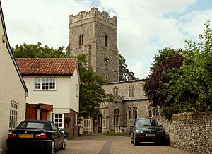
St Mary's Church lies just west of High Street. The church dates from the late 14th century with a late 15th century tower. It contains memorials to Richard Coddington who was granted the land owned by the priory following the dissolution. The church is a Grade I Listed Building.
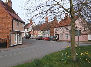
The village contains a number of other listed buildings, many on the High Street, some of which have medieval elements. A variety of local services remain in the village, including shops, a post office and public houses as well as a village hall, doctor's surgery, a retained fire station and police station sharing the same building.
Government
Ixworth is in the Borough of St Edmundsbury and elects one borough councillor. It lies in the Blackbourn division of Suffolk County Council and the West Suffolk parliamentary constituency. The parish council jointly administers Ixworth and Ixworth Thorpe.
Bangrove Wood SSSI
Bangrove Wood, around 1 mile (1.6 km) north of the village, is a Site of Special Scientific Interest (SSSI). This is an area of ancient woodland of 18.2 hectares (45 acres). The wood contains species such as ash, field maple, oak and hazel as well as wild cherry and a range of ground vegetation species.
See also
 In Spanish: Ixworth para niños


