
Jackson, Queensland facts for kids
Quick facts for kids JacksonQueensland |
|||||||||||||||
|---|---|---|---|---|---|---|---|---|---|---|---|---|---|---|---|

Welcome to Jackson sign on Warrego Highway
|
|||||||||||||||

Jackson
Location in Queensland
|
|||||||||||||||
| Population | 57 (2016 census) | ||||||||||||||
| • Density | 0.635/km2 (1.64/sq mi) | ||||||||||||||
| Established | approx 1890 | ||||||||||||||
| Postcode(s) | 4426 | ||||||||||||||
| Area | 89.7 km2 (34.6 sq mi) | ||||||||||||||
| Time zone | AEST (UTC+10:00) | ||||||||||||||
| Location |
|
||||||||||||||
| State electorate(s) | Warrego | ||||||||||||||
| Federal Division(s) | Maranoa | ||||||||||||||
|
|||||||||||||||
Jackson is a rural town and locality in the Maranoa Region, Queensland, Australia. In the 2016 census, Jackson had a population of 57 people.
The town's economy was based on the rail industry.
History
Jackson Post Office opened by July 1908 (a receiving office had been open from 1887) and closed in 1988.
Education
Jackson State School was opened on the 18th of January, 1892 and was officially closed on the 9th of December, 1983 after 91 years of service.
As a result, There are no schools in Jackson. The nearest primary schools are in Dulacca and Yuleba. The nearest secondary school is in Wallumbilla, but that school only provides education to Year 10. For Years 11 and 12, the nearest secondary schools are in Miles and Roma.
Road and Rail infrastructure
The Warrego Highway runs through from east to west. The Western Railway Line also runs through from east to west.
Images for kids
-
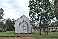
Former St Faith's Anglican church, 2008

