
Jacumba Hot Springs, California facts for kids
Quick facts for kids
Jacumba Hot Springs
|
|
|---|---|

Central Jacumba on Old Highway 80
|
|

Location of Jacumba in San Diego County, California
|
|

Jacumba Hot Springs
Location in San Diego County, California

Jacumba Hot Springs
Location in California

Jacumba Hot Springs
Location in the United States
|
|
| Country | |
| State | |
| County | San Diego |
| Area | |
| • Total | 6.126 sq mi (15.866 km2) |
| • Land | 6.119 sq mi (15.847 km2) |
| • Water | 0.007 sq mi (0.019 km2) 0.12% |
| Elevation | 3,212 ft (979 m) |
| Population
(2010)
|
|
| • Total | 561 |
| • Density | 91.58/sq mi (35.36/km2) |
| Time zone | UTC−8 (Pacific (PST)) |
| • Summer (DST) | UTC−7 (PDT) |
| ZIP Codes |
91934
|
| Area code(s) | 619 |
| FIPS code | 06-37022 |
| GNIS feature ID | 2583040 |
Jacumba Hot Springs ( hə-KOOM-bə) is an unincorporated community in the Mountain Empire area of southeastern San Diego County, California, United States. For statistical purposes, the United States Census Bureau defined Jacumba Hot Springs as a census-designated place (CDP) for the first time in the 2010 census, with a population of 561. The census definition of the area may not precisely correspond to local understanding of the area with the same name. The ZIP code is 91934 and the town lies within area code 619. Its elevation is 2,829 feet (862 m) above mean sea level (AMSL). On February 26, 2013, the United States Board on Geographic Names approved a petition by a citizen committee to change the town's name from Jacumba to Jacumba Hot Springs.
Contents
Geography
Jacumba Hot Springs is located at (32.617N, 116.188W).
The town is in a valley in the Jacumba Mountains at an altitude of 2,800 feet (850 m). The area is dry with an annual average rainfall of 11.8 inches (300 mm). It is served by Old Highway 80; Interstate 8 bypasses the town at a distance of two miles (3 km). The town is located in the Pacific time zone (GMT -08:00).
Jacumba Hot Springs is located on the Mexican border. A small settlement exists on the Mexican side, known as Jacume; the unmanned crossing was closed in 1995. The new, enlarged border fence now runs through the area. The United States Border Patrol maintains an increased presence in the area to curtail smuggling and illegal immigration.
According to the United States Census Bureau, the CDP covers an area of 6.1 square miles (15.9 km²), 99.88% of it land, and 0.12% of it water.
Demographics
| Historical population | |||
|---|---|---|---|
| Census | Pop. | %± | |
| 2010 | 561 | — | |
| U.S. Decennial Census | |||
The 2010 United States Census reported that Jacumba had a population of 561. The population density was 91.6 people per square mile (35.4/km2). The racial makeup of Jacumba was 389 (69.3%) White 322 (57.4%) non-Hispanic White), 4 (0.7%) African American, 15 (2.7%) Native American, 6 (1.1%) Asian, 0 (0.0%) Pacific Islander, 114 (20.3%) from other races, and 33 (5.9%) from two or more races. Hispanic or Latino of any race were 207 persons (36.9%).
The Census reported that 561 people (100% of the population) lived in households, 0 (0%) lived in non-institutionalized group quarters, and 0 (0%) were institutionalized.
There were 216 households, out of which 66 (30.6%) had children under the age of 18 living in them, 87 (40.3%) were opposite-sex married couples living together, 29 (13.4%) had a female householder with no husband present, 12 (5.6%) had a male householder with no wife present. There were 21 (9.7%) unmarried opposite-sex partnerships, and 0 (0%) same-sex married couples or partnerships, while 72 households (33.3%) were made up of individuals, and 24 (11.1%) had someone living alone who was 65 years of age or older. The average household size was 2.60. There were 128 families (59.3% of all households); the average family size was 3.38.
The population was spread out, with 141 people (25.1%) under the age of 18, 46 people (8.2%) aged 18 to 24, 128 people (22.8%) aged 25 to 44, 167 people (29.8%) aged 45 to 64, and 79 people (14.1%) who were 65 years of age or older. The median age was 39.9 years. For every 100 females, there were 101.8 males. For every 100 females age 18 and over, there were 102.9 males.
There were 294 housing units at an average density of 48.0 per square mile (18.5/km2), of which 123 (56.9%) were owner-occupied, and 93 (43.1%) were occupied by renters. The homeowner vacancy rate was 7.4%; the rental vacancy rate was 7.9%, while 288 people (51.3% of the population) lived in owner-occupied housing units and 273 people (48.7%) lived in rental housing units.
History
The Kumeyaay peoples occupied the Jacumba area prior to European settlement. They were probably attracted by the warm Jacumba hot spring (temperature 104 °F), one of many mineral hot springs which occur up and down the Peninsular Ranges of California. Ranchers occupied the area in the 19th century and were often in conflict with the Indians. About 15 were slain by ranchers for cattle rustling in the Jacumba Massacre of Feb 27, 1880.
Around the turn of the 20th century, the health and relaxation benefits of natural hot springs began to be commercialized. The Jacumba hot spring is prolific and delivered enough water to fill large public baths, the remains of which can still be seen. The water contains sulfur but has a pleasant clean smell. In 1919 rail service connected Jacumba to San Diego. By 1925 the town had a world class hotel, the Hotel Jacumba. In the 1930s, Jacumba had developed into a top destination and had a population of about 1,150. Many of the foremost movie stars and celebrities of the time regarded Jacumba as a prime destination for relaxation.
Jacumba's role as a prime destination continued through World War II; however as the southernmost California hot spring, it began to feel competition from more northern ones, including Murrieta and Palm Springs. After the new Interstate 8 bypassed Jacumba by two miles, most of the roadside service businesses folded and the community went into economic decline.
The Jacumba Hotel closed and was destroyed in an arson fire in 1983. The ruins stood until 1991. Today, the stub of the massive central fireplace can still be seen. The great public baths closed, the swimming pool was filled in, and the well was capped by its rights-owner.
In the 1980s, the Jacumba Motel was the only hotel facility left in Jacumba. However, the area continues to attract primarily foreign visitors and the motel has acquired rights to the spring and opened a spa. In 2002 the facility was sold with the intent of renovating it into a timeshare spa type resort. In 2006 it was resold and setup as a bed and breakfast. The facility was closed in from 2010 to 2013. It is in operation as the Jacumba Hot Springs Spa and Motel.
Places of interest
- Jacumba Motel and Spa
- DeAnza Springs Resort
- Desert View Tower
- Jays Southern Cafe

Landmarks
The community is about 1.6 miles (2.6 km) south of Interstate 8 and about 0.5 miles (0.80 km) north of the Mexican border. At 52 degrees off true north, 3.5 miles (5.6 km) distant is the summit known as Squaw Tit (3,880 feet AMSL). At 0.88 miles (1.42 km) on a bearing of 296 degrees off true North lies Jacumba Peak (3,363 ft). Jacumba Airport is one mile (1.6 km) east at 32°37′00″N 116°09′53″W / 32.61667°N 116.16472°W.
- US Geological Survey, National Geographic Names Database
- Jacumba, California, 7.5-minute quadrangle, US Geological Survey, 1997.
- Jacumba OE S, California, 7.5-minute quadrangle, US Geological Survey, 1997.
Airport
Jacumba Airport (L78) CTAF 122.8 MHz. 2500' dirt runway.
Images for kids
-
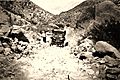
Mountain Springs grade in 1920

See also
 In Spanish: Jacumba para niños
