
Jefferson, South Carolina facts for kids
Quick facts for kids
Jefferson, South Carolina
|
|
|---|---|

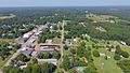
Water tower, 2011
|
|
| Nickname(s):
"J-Town"
|
|
| Motto(s):
“A small town with big city dreams”
|
|

Location of Jefferson, South Carolina
|
|
| Country | United States |
| State | South Carolina |
| County | Chesterfield |
| Incorporated | 1904 |
| Government | |
| • Type | Council |
| Area | |
| • Total | 1.81 sq mi (4.68 km2) |
| • Land | 1.80 sq mi (4.67 km2) |
| • Water | 0.01 sq mi (0.01 km2) |
| Elevation | 476 ft (145 m) |
| Population
(2010)
|
|
| • Total | 753 |
| • Estimate
(2019)
|
712 |
| • Density | 395.12/sq mi (152.55/km2) |
| Time zone | UTC−5 (Eastern (EST)) |
| • Summer (DST) | UTC−4 (EDT) |
| ZIP code |
29718
|
| Area code(s) | 843, 854 |
| FIPS code | 45-36610 |
| GNIS feature ID | 1223522 |
| Website | http://www.seejeffersonsc.com |
Jefferson is a town in western Chesterfield County, South Carolina, United States at the junction of SC routes 265 and 151. Jefferson is located in the Piedmont region of South Carolina just in the edge meeting the Sandhills region. Jefferson is located 16 miles northwest of McBee, 8 miles south of Pageland, 50 miles southeast of Charlotte, North Carolina, and 70 miles north-northeast of the state capitol Columbia. As of the 2010 census, the city population was 753.
Contents
History
Jefferson was incorporated in 1904.
Geography and Climate
Jefferson is located at 34°39′6″N 80°23′22″W / 34.65167°N 80.38944°W (34.651550, -80.389484). According to the United States Census Bureau, the town has a total area of 1.8 square miles (4.7 km2), of which, 1.8 square miles (4.7 km2) of it is land and 0.56% is water.
Neighboring towns
- Pageland, South Carolina – North
- Waxhaw, North Carolina - Northwest
- Mount Croghan, South Carolina – Northeast
- Chesterfield, South Carolina – East
- McBee, South Carolina – Southeast
- Bethune, South Carolina – South
- Kershaw, South Carolina - Southwest
- Lancaster, South Carolina – West
 |
Waxhaw | Pageland | Mount Croghan | |
| Lancaster | Chesterfield | |||
| Kershaw | Bethune | McBee |
Brewer Gold Mine
The Brewer Gold Mine is an abandoned mine located on the western border of Chesterfield County, about 1.5 miles due west of the town of Jefferson, South Carolina. Brewer Gold Company owns approximately 1,000 acres of land along a small north-south ridgeline that divides Little Fork Creek and the Lynches River. About one-quarter of the 1,000 acres has been disturbed by mining operations. Brewer Gold Mine was one of the oldest and most productive gold mines in the eastern United States.
Activities at Brewer are rumored to date to the 16th century involving Indian trade with the Spaniards. Before the Revolutionary War, the area was mined for iron. The first documented discovery of gold took place by Burrell Brewer in 1828. Brewer Gold Company, a subsidiary owned by the British Costain Limited Group (Costain), secured ownership of the mine in 1986, with the first gold production occurring in August 1987. Ore was mined using conventional open pit methods until January 1995. Rock was first fractured using drilling and blasting, and then loaded into trucks. Waste rock was used as fill for facility construction or hauled to a disposal area to the south of the Brewer Pit. Ore was hauled to the crushing area where processing for the cyanide heap-leach method began. The crushed ore was then placed on pads and a dilute cyanide solution was sprayed over the heaps and allowed to percolate through the ore, thereby dissolving the gold into solution.
Pine Cones and Pine Straw
An important local economy is based upon the long-leaf and loblolly pine, which drop both cones and needles. Casey Horton Enterprises was formed in early 2015 to gather both the pine cones and the straw. The cones are used in Christmas decorations while the pine straw is used for yard bedding. Horton Enterprises has since focused its work on the pine cone business.
Demographics
| Historical population | |||
|---|---|---|---|
| Census | Pop. | %± | |
| 1910 | 390 | — | |
| 1920 | 454 | 16.4% | |
| 1930 | 499 | 9.9% | |
| 1940 | 547 | 9.6% | |
| 1950 | 556 | 1.6% | |
| 1960 | 493 | −11.3% | |
| 1970 | 709 | 43.8% | |
| 1980 | 651 | −8.2% | |
| 1990 | 745 | 14.4% | |
| 2000 | 704 | −5.5% | |
| 2010 | 753 | 7.0% | |
| 2019 (est.) | 712 | −5.4% | |
| U.S. Decennial Census | |||
2020 census
| Race | Num. | Perc. |
|---|---|---|
| White (non-Hispanic) | 477 | 61.79% |
| Black or African American (non-Hispanic) | 245 | 31.74% |
| Native American | 2 | 0.26% |
| Asian | 13 | 1.68% |
| Other/Mixed | 23 | 2.98% |
| Hispanic or Latino | 12 | 1.55% |
As of the 2020 United States census, there were 772 people, 350 households, and 248 families residing in the town.
Recreation
The Jefferson Recreation Complex on Ogburn Drive is a multi-purpose public park that includes five baseball ballfields. In 2012, approximately 400 area youth ages three to 15 participated on 26 teams, including the building of a press box and restroom facility.
Education
Public education in Pageland is administered by Chesterfield County School District. The district operates Jefferson Elementary School, New Heights Middle School, and Central High School. Northeastern Technical College offers higher education.
Jefferson has a public library, a branch of the Chesterfield County Library System.
Infrastructure
Medical
Sandhills Medical Foundation is a community health center serving residents of Chesterfield, Kershaw, Lancaster and Sumter counties. It was founded in 1977.
Images for kids
-
A drone view of Jefferson

See also
 In Spanish: Jefferson (Carolina del Sur) para niños
