
Jefferson County, West Virginia facts for kids
Quick facts for kids
Jefferson County
|
|
|---|---|
_and_West_Virginia_State_Route_51_(Washington_Street)_in_Charles_Town,_Jefferson_County,_West_Virginia.jpg)
Jefferson County Courthouse in Charles Town
|
|

Location within the U.S. state of West Virginia
|
|
 West Virginia's location within the U.S. |
|
| Country | |
| State | |
| Founded | October 26, 1801 |
| Named for | Thomas Jefferson |
| Seat | Charles Town |
| Largest city | Charles Town |
| Area | |
| • Total | 212 sq mi (550 km2) |
| • Land | 210 sq mi (500 km2) |
| • Water | 2.0 sq mi (5 km2) 1.0%% |
| Population
(2020)
|
|
| • Total | 57,701 |
| • Density | 272.2/sq mi (105.09/km2) |
| Time zone | UTC−5 (Eastern) |
| • Summer (DST) | UTC−4 (EDT) |
| Congressional district | 2nd |
Jefferson County is located in the Shenandoah Valley in the Eastern Panhandle of West Virginia, and is the easternmost county of the U.S. state of West Virginia. As of the 2020 census, the population was 57,701. Its county seat is Charles Town. The county was founded in 1801, and today is part of the Washington metropolitan area.
Contents
History
Formation
Jefferson County was formed from Berkeley County in 1801 because the citizens of southeastern Berkeley county felt they had to travel too far to the county seat of Martinsburg. Charles Washington, the founder of Charles Town and brother to George Washington petitioned for a new county to be formed. It was named for Thomas Jefferson, author of the Declaration of Independence and third President of the United States. Virginia previously had a Jefferson County, which is now part of Kentucky. Accordingly, in the State records of Virginia, there will be listings for Jefferson County from 1780-1792 and Jefferson County from 1801-1863, neither of which is still in Virginia.
John Brown Rebellion

The county's courthouse was the site of the trial for the abolitionist John Brown after his October 1859 raid on the federal armory in Harpers Ferry. Some 90 U.S. Marines serving under then Army Colonel Robert E. Lee and Lieutenants J.E.B. Stuart and Israel Green put down the rebellion.
Brown was sentenced to death for murder, treason against the Commonwealth of Virginia, and conspiring with slaves to rebel. On 2 December 1859 John Brown was taken from the Charles Town jail a short distance to an open field and hanged. Among those attending the Brown execution was a contingent of 1500 cadets from Virginia Military Institute sent by the Governor of Virginia Henry A. Wise under the supervision of Major William Gilham and Major Thomas J. Jackson. In the ranks of a Richmond militia company stood John Wilkes Booth.
Civil War
The county was a frequent site of conflict during the civil war, as Union and Confederate lines moved back and forth along the Shenandoah Valley. Some towns in the county changed hands between the Union and Confederacy over a dozen times, including Charles Town, and especially Harpers Ferry.
Jefferson County is the only part of modern-day West Virginia not exempted from the effects of the Emancipation Proclamation (as Berkeley County and the 48 counties designated as West Virginia had been). Slaves in the county were legally free as of January 1, 1863.
The Courthouse of Charles Town is the only Courthouse in America to have held two treason trials including the trial of John Brown in 1859 and a trial regarding coal companies from the southern part of the state.
Joining West Virginia

Both Berkeley and Jefferson counties had voted for secession in the vote taken on May 23, 1861. However, these counties lying on the Potomac River in the Shenandoah Valley, with the consent of the Reorganized Government of Virginia voted in favor of annexation to West Virginia in 1863 in a dubious election supervised by the occupying Union Army. Virginia tried to nullify this after the American Civil War, but the counties remained part of West Virginia.
The question of the constitutionality of the formation of the new state was brought before the Supreme Court of the United States in the following manner: Berkeley and Jefferson County, West Virginia, counties lying on the Potomac east of the mountains, in 1863, with the consent of the Reorganized Government of Virginia, had supposedly voted in favor of annexation to West Virginia. However, many voters were absent in the Confederate Army when the vote was taken and they refused to accept the transfer upon their return. The Virginia General Assembly repealed the Act of Secession and in 1866 brought suit against West Virginia, asking the Supreme Court to declare the counties still part of Virginia. Congress, on March 10, 1866, passed a joint resolution recognizing the transfer. In 1871, the U.S. Supreme Court decided Virginia v. West Virginia, upholding the "secession" of West Virginia, including Berkeley and Jefferson counties, from Virginia. In 2011, West Virginia state delegate Larry Kump sponsored legislation to allow Morgan, Berkeley, and Jefferson counties to rejoin Virginia by popular vote.
Rural Free Delivery
In October 1896, Jefferson County became the first county in the United States to begin Rural Free Delivery service in the towns of Halltown and Uvilla.
Geography
According to the U.S. Census Bureau, the county has a total area of 212 square miles (550 km2), of which 210 square miles (540 km2) is land and 2.0 square miles (5.2 km2) (1.0%) is water. It is the only West Virginia county where the Blue Ridge Mountains and Shenandoah River that John Denver sang about in the song "Take Me Home, Country Roads" can be found. The lowest point in the state of West Virginia is located on the Potomac River (just east of Harpers Ferry) in Jefferson County, where it flows out of West Virginia and into Maryland.
National protected area
Rivers and streams
Adjacent counties
- Washington County, Maryland (north)
- Loudoun County, Virginia (east)
- Clarke County, Virginia (southwest)
- Berkeley County (northwest)
Major highways
 U.S. Highway 340
 West Virginia Route 9
 West Virginia Route 45
 West Virginia Route 51
 West Virginia Route 115 (Old West Virginia Route 9)
 West Virginia Route 230
Demographics
| Historical population | |||
|---|---|---|---|
| Census | Pop. | %± | |
| 1810 | 11,851 | — | |
| 1820 | 13,087 | 10.4% | |
| 1830 | 12,927 | −1.2% | |
| 1840 | 14,082 | 8.9% | |
| 1850 | 15,357 | 9.1% | |
| 1860 | 14,535 | −5.4% | |
| 1870 | 13,219 | −9.1% | |
| 1880 | 15,005 | 13.5% | |
| 1890 | 15,553 | 3.7% | |
| 1900 | 15,935 | 2.5% | |
| 1910 | 15,889 | −0.3% | |
| 1920 | 15,729 | −1.0% | |
| 1930 | 15,780 | 0.3% | |
| 1940 | 16,762 | 6.2% | |
| 1950 | 17,184 | 2.5% | |
| 1960 | 18,665 | 8.6% | |
| 1970 | 21,280 | 14.0% | |
| 1980 | 30,302 | 42.4% | |
| 1990 | 35,926 | 18.6% | |
| 2000 | 42,190 | 17.4% | |
| 2010 | 53,498 | 26.8% | |
| 2020 | 57,701 | 7.9% | |
| U.S. Decennial Census 1790–1960 1900–1990 1990–2000 2010–2020 |
|||
2010 census
As of the 2010 United States Census, there were 53,498 people, 19,931 households, and 13,971 families residing in the county. The population density was 255.2 inhabitants per square mile (98.5/km2). There were 22,037 housing units at an average density of 105.1 per square mile (40.6/km2). The racial makeup of the county was 87.6% white, 6.6% black or African American, 1.2% Asian, 0.2% American Indian, 0.1% Pacific islander, 1.8% from other races, and 2.6% from two or more races. Those of Hispanic or Latino origin made up 4.7% of the population. In terms of ancestry, 25.9% were German, 17.3% were English, 12.1% were Irish, and 6.6% were American.
Of the 19,931 households, 34.6% had children under the age of 18 living with them, 54.9% were married couples living together, 10.1% had a female householder with no husband present, 29.9% were non-families, and 22.7% of all households were made up of individuals. The average household size was 2.61 and the average family size was 3.07. The median age was 38.9 years.
The median income for a household in the county was $65,603 and the median income for a family was $77,185. Males had a median income of $54,959 versus $36,782 for females. The per capita income for the county was $29,733. About 4.4% of families and 8.4% of the population were below the poverty line, including 10.9% of those under age 18 and 6.9% of those age 65 or over.
Communities
Cities
- Charles Town (county seat)
- Ranson
Towns
Census-designated places
Unincorporated communities
- Aldridge
- Bakerton
- Bardane
- Blair
- Bloomery
- Blue Ridge Acres
- Browns Corner
- Clips Mill
- Duffields
- Egypt
- Engle
- Franklintown
- Gibsontown
- Halltown
- Jamestown
- Johnsontown
- Kabletown
- Kearneysville
- Keyes Ferry Acres
- Leetown
- Mannings
- Mechanicstown
- Mechlenberg Heights
- Meyerstown
- Millville
- Moler Crossroads
- Mountain Mission
- Reedson
- Rippon
- Riverside
- Silver Grove
- Skeetersville
- Summit Point
- Uvilla
- Wheatland
- Zoar
Magisterial districts

- Charles Town
- Harpers Ferry
- Kabletown
- Middleway
- Shepherdstown
Historic buildings and structures
- Middleway Historic District (1734)
- White House Farm (1740)
- Hopewell (Millville, West Virginia) (1765)
- Harewood (West Virginia) (1770)
- Mount Ellen (ca 1790)
- New Hopewell (1774), a farm comprising agricultural fields and historical buildings, located between Johnsontown and Leetown
- Happy Retreat (1780)
- Blakeley (West Virginia) (1820)
- Claymont Court (1820)
- Cedar Lawn (1825)
- Barleywood Manor (1846)
- Jacks-Manning Farm (Vinton Farm) (1848)
- Grace Episcopal Church (1851)
- Kabletown Church (1861)
- Brown Shugart House (1885)
Gallery
-
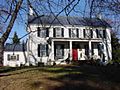
Mount Ellen
-

Happy Retreat
-
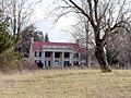
Blakeley
-
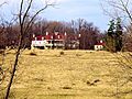
Claymont Court
-

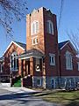
Grace Episcopal Church
-
Kabletown Church


Images for kids
-
.
US 340 and WV 9 run concurrently for a few miles in Charles Town
See also
 In Spanish: Condado de Jefferson (Virginia Occidental) para niños
