
Gauley Bridge, West Virginia facts for kids
Quick facts for kids
Gauley Bridge, West Virginia
|
|
|---|---|
 |
|

Location of Gauley Bridge in Fayette County, West Virginia.
|
|
| Country | United States |
| State | West Virginia |
| County | Fayette |
| Area | |
| • Total | 1.63 sq mi (4.22 km2) |
| • Land | 1.58 sq mi (4.10 km2) |
| • Water | 0.05 sq mi (0.12 km2) |
| Elevation | 810 ft (247 m) |
| Population
(2010)
|
|
| • Total | 614 |
| • Estimate
(2019)
|
553 |
| • Density | 349.56/sq mi (134.93/km2) |
| Time zone | UTC-5 (Eastern (EST)) |
| • Summer (DST) | UTC-4 (EDT) |
| ZIP code |
25085
|
| Area code(s) | 304 |
| FIPS code | 54-30364 |
| GNIS feature ID | 1554543 |
Gauley Bridge is a town in Fayette County, West Virginia, United States. The population was 614 at the 2010 census. The Kanawha River is formed at Gauley Bridge by the confluence of the New and Gauley Rivers. Two miles to the southeast of Gauley Bridge, in Glen Ferris, is Kanawha Falls, a popular stopping point on Midland Trail Scenic Highway.
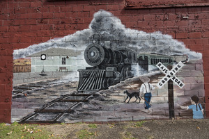
The community was named after a bridge over the Gauley River near the original town site. Gauley Bridge was close to the site of the Hawk's Nest incident, in which hundreds of lives were lost in the 1920s and 1930s.
Geography
Gauley Bridge is located at 38°10′04″N 81°11′49″W / 38.167815°N 81.197079°W (38.167815, -81.197079).
According to the United States Census Bureau, the town has a total area of 1.63 square miles (4.22 km2), of which 1.58 square miles (4.09 km2) is land and 0.05 square miles (0.13 km2) is water.
Demographics
| Historical population | |||
|---|---|---|---|
| Census | Pop. | %± | |
| 1980 | 1,177 | — | |
| 1990 | 691 | −41.3% | |
| 2000 | 738 | 6.8% | |
| 2010 | 614 | −16.8% | |
| 2019 (est.) | 553 | −9.9% | |
| U.S. Decennial Census | |||
2010 census
As of the census of 2010, there were 614 people, 279 households, and 159 families living in the town. The population density was 388.6 inhabitants per square mile (150.0/km2). There were 361 housing units at an average density of 228.5 per square mile (88.2/km2). The racial makeup of the town was 98.9% White, 0.3% Native American, and 0.8% from two or more races. Hispanic or Latino of any race were 0.5% of the population.
There were 279 households, of which 23.3% had children under the age of 18 living with them, 34.8% were married couples living together, 16.5% had a female householder with no husband present, 5.7% had a male householder with no wife present, and 43.0% were non-families. 37.6% of all households were made up of individuals, and 18.3% had someone living alone who was 65 years of age or older. The average household size was 2.20 and the average family size was 2.87.
The median age in the town was 43.5 years. 19.4% of residents were under the age of 18; 8.4% were between the ages of 18 and 24; 24.9% were from 25 to 44; 30% were from 45 to 64; and 17.3% were 65 years of age or older. The gender makeup of the town was 48.4% male and 51.6% female.
Transportation
U.S. Route 60, WV 16, and WV 39 all intersect in Downtown Gauley Bridge.
Notable person
- MacGillivray Milne, 27th Governor of American Samoa
See also
 In Spanish: Gauley Bridge (Virginia Occidental) para niños
