
Kalangadoo, South Australia facts for kids
Quick facts for kids KalangadooSouth Australia |
|||||||||||||||
|---|---|---|---|---|---|---|---|---|---|---|---|---|---|---|---|

Kalangadoo Hotel
|
|||||||||||||||

Kalangadoo
Location in South Australia
|
|||||||||||||||
| Population | 288 (2016 census) | ||||||||||||||
| Established | 1891 (town) 13 December 2001 (locality) |
||||||||||||||
| Postcode(s) | 5278 | ||||||||||||||
| Time zone | ACST (UTC+9:30) | ||||||||||||||
| • Summer (DST) | ACDT (UTC+10:30) | ||||||||||||||
| Location |
|
||||||||||||||
| LGA(s) | Wattle Range Council | ||||||||||||||
| Region | Limestone Coast | ||||||||||||||
| County | Grey | ||||||||||||||
| State electorate(s) | MacKillop | ||||||||||||||
| Federal Division(s) | Barker | ||||||||||||||
|
|||||||||||||||
|
|||||||||||||||
| Footnotes | Adjoining localities Locations |
||||||||||||||
Kalangadoo, formerly Kalangadoo East, is a locality in the Australian state of South Australia located about 348 kilometres (216 mi) south-east of the state capital of Adelaide and about 31 kilometres (19 mi) north of the regional centre of Mount Gambier.
Images for kids
-
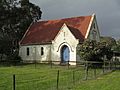
Saint Andrews Presbyterian Church, Kalangadoo


All content from Kiddle encyclopedia articles (including the article images and facts) can be freely used under Attribution-ShareAlike license, unless stated otherwise. Cite this article:
Kalangadoo, South Australia Facts for Kids. Kiddle Encyclopedia.