
Kalkaska, Michigan facts for kids
Quick facts for kids
Kalkaska, Michigan
|
|
|---|---|
|
Village
|
|
| Village of Kalkaska | |
.jpg)
Downtown Kalkaska along U.S. Route 131
|
|
,_MI_location.png)
Location within Kalkaska County
|
|

Kalkaska, Michigan
Location in Michigan
|
|
| Country | United States |
| State | Michigan |
| County | Kalkaska |
| Township | Kalkaska |
| Established | 1873 |
| Government | |
| • Type | Village council |
| Area | |
| • Total | 3.20 sq mi (8.29 km2) |
| • Land | 3.15 sq mi (8.16 km2) |
| • Water | 0.05 sq mi (0.13 km2) |
| Elevation | 1,033 ft (315 m) |
| Population
(2010)
|
|
| • Total | 2,020 |
| • Estimate
(2019)
|
2,094 |
| • Density | 664.55/sq mi (256.58/km2) |
| Time zone | UTC−5 (Eastern (EST)) |
| • Summer (DST) | UTC−4 (EDT) |
| ZIP code(s) |
49646
|
| Area code(s) | 231 |
| FIPS code | 26-42260 |
| GNIS feature ID | 0629450 |

Kalkaska (pronounced) is a village in the U.S. state of Michigan. The population was 2,020 at the 2010 census. It is the county seat of Kalkaska County. The village is in Kalkaska Township and part of the Traverse City micropolitan area.
Contents
Geography
According to the United States Census Bureau, the village has a total area of 3.17 square miles (8.21 km2), of which 3.12 square miles (8.08 km2) is land and 0.05 square miles (0.13 km2) is water.
The village is situated on an expansive plateau, along with much of Northern Michigan. The Boardman River runs through the village. The primary geography of the north and east of the village proper is flat with gentle hills, with a large amount of farmland. To the south and east, it is noticeably steeper in elevation, with larger amount of water present in the form of streams, to the north a larger amount of water is present in the form of lakes.
The primary constructors of Kalkaska's geographical make-up are ancient glaciers, along with the majority of the entire state of Michigan. Glaciers scoured the surface of Michigan during the Ice Age, creating small hills called drumlins, along with valleys and basins and the water that currently occupies them. This process is called glaciation.
Kalkaska experiences a notable amount of snowfall as it is located in a snowbelt that receives heavy amounts of lake effect snow from Lake Michigan.
Kalkaska is considered part of Northern Michigan.
Climate
This climatic region has large seasonal temperature differences, with warm to hot (and often humid) summers and cold (sometimes severely cold) winters. According to the Köppen climate classification system, Kalkaska has a humid continental climate, abbreviated "Dfb" on climate maps.
Demographics
| Historical population | |||
|---|---|---|---|
| Census | Pop. | %± | |
| 1880 | 496 | — | |
| 1890 | 1,161 | 134.1% | |
| 1900 | 1,304 | 12.3% | |
| 1910 | 1,415 | 8.5% | |
| 1920 | 866 | −38.8% | |
| 1930 | 861 | −0.6% | |
| 1940 | 1,132 | 31.5% | |
| 1950 | 1,250 | 10.4% | |
| 1960 | 1,321 | 5.7% | |
| 1970 | 1,475 | 11.7% | |
| 1980 | 1,654 | 12.1% | |
| 1990 | 1,952 | 18.0% | |
| 2000 | 2,226 | 14.0% | |
| 2010 | 2,020 | −9.3% | |
| 2019 (est.) | 2,094 | 3.7% | |
| U.S. Decennial Census | |||
2010 census
As of the census of 2010, there were 2,020 people, 871 households, and 482 families residing in the village. The population density was 647.4 inhabitants per square mile (250.0/km2). There were 1,015 housing units at an average density of 325.3 per square mile (125.6/km2). The racial makeup of the village was 95.6% White, 0.6% African American, 1.3% Native American, 0.6% Asian, 0.2% from other races, and 1.7% from two or more races. Hispanic or Latino of any race were 1.8% of the population.
There were 871 households, of which 29.2% had children under the age of 18 living with them, 33.4% were married couples living together, 16.0% had a female householder with no husband present, 6.0% had a male householder with no wife present, and 44.7% were non-families. 38.6% of all households were made up of individuals, and 18.3% had someone living alone who was 65 years of age or older. The average household size was 2.22 and the average family size was 2.90.
The median age in the village was 37.9 years. 23.4% of residents were under the age of 18; 9.8% were between the ages of 18 and 24; 25.3% were from 25 to 44; 24.3% were from 45 to 64; and 17.1% were 65 years of age or older. The gender makeup of the village was 46.9% male and 53.1% female.
History
The town was platted in 1873 by A. A. Abbott and R. L. Thompson, who owned a sawmill, and who correctly anticipated the arrival of the railroad.
On July 5, 1908, a fire began in the middle of the business block and burned most of the stores. Local photographer E. L. Beebe made a number of photographs of the fire, and the resulting postcards were widely sold, and can still be found today. Two years later, in 1910 another fire started in downtown Kalkaska. Again, in 1925 downtown Kalkaska was devastated by the largest fire since the Fire of 1908.
In 1916, the noted author Ernest Hemingway visited and fished in Kalkaska, and later immortalized the town in his story "The Battler". A historical marker has been placed at the Rugg Pond Dam, on the Rapid River, where Hemingway reportedly fished one night from the power house.
Discovery of natural gas and oil in the area during the 1970s lead to significant growth for the village; however, the growth has since subsided.
In 1993, the Kalkaska schools made national headlines when a financial crisis resulted in a two-month-long closure. Subsequent funding reform improved the outlook for Kalkaska and similar small rural districts in Michigan.
In 2014 Walmart announced plans to open a store in Kalkaska. Previously the closest store was in Traverse City, 25 miles (40 km) away. There was a debate in Kalkaska on whether the community's small town character can be preserved.
Travel and recreation
The many surrounding Lakes and streams lure travelers into the village. Kalkaska offers two major festivals, the National Trout Festival at the end of April, and the WinterFest which is held in January.
The first weekend of November brings with it the Iceman Cometh biking challenge. Kalkaska hosts the starting line for a 27.2 mile off-road biking race that runs from the heart of the village to Traverse City along the VASA Trail. The turnout for the race very easily doubles the population within the village, numbering in the several thousands. For mountain biking enthusiasts, this is a famous race, and completing the race is an achievement in itself.
The village has several parks, including the newly expanded KART trail which is planned to be connected with the TART Trail.
Trivia
A map of Kalkaska is featured on the cover of Problem Solving with C++ by Walter Savitch, the Seventh Edition (Pearson International Edition). ISBN 978-0-321-54940-2, ISBN 0-321-54940-6.
- Jobst, Jack. "Gone Fishin'", Michigan History Magazine, November/December 1995.
Education
Schools in Kalkaska are managed by Kalkaska Public Schools.
- Kalkaska High School
Kalkaska is centrally located between North Central Michigan College in Petoskey, Northwestern Michigan College in Traverse City, Kirtland College in Grayling/Gaylord, and Baker College in Cadillac.
Notable people
- Emil Frisk (1874–1922), professional baseball player for the Cincinnati Reds, Detroit Tigers, and the St. Louis Browns from 1899 to 1907
- Betty Wanless (1928–1995), All-American Girls Professional Baseball League player
- Ron Winter, former NCAA and NFL official
Images for kids
-
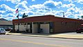
U.S. Post Office in Kalkaska
-
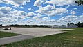
Kalkaska City Airport

.jpg)
See also
 In Spanish: Kalkaska para niños
