
Kearney, Nebraska facts for kids
Quick facts for kids
Kearney, Nebraska
|
|
|---|---|

The Great Platte River Road Archway Monument, which spans Interstate 80
|
|

Location of Kearney within Nebraska and Buffalo County
|
|
| Country | United States |
| State | Nebraska |
| County | Buffalo |
| Government | |
| • Type | Council–manager |
| Area | |
| • Total | 14.73 sq mi (38.16 km2) |
| • Land | 14.46 sq mi (37.44 km2) |
| • Water | 0.28 sq mi (0.72 km2) |
| Elevation | 2,152 ft (656 m) |
| Population
(2010)
|
|
| • Total | 30,787 |
| • Estimate
(2019)
|
33,867 |
| • Density | 2,342.60/sq mi (904.49/km2) |
| Time zone | UTC−6 (Central (CST)) |
| • Summer (DST) | UTC−5 (CDT) |
| ZIP codes |
68845, 68847, 68848 (P.O. Box), 68849 UNK
|
| Area code(s) | 308 |
| FIPS code | 31-25055 |
| GNIS feature ID | 0830442 |
Kearney is the county seat of Buffalo County, Nebraska, United States. The population was 30,787 in the 2010 census. It is home to the University of Nebraska at Kearney. The westward push of the railroad as the Civil War ended gave new birth to the community.
Contents
Geography
Kearney is located at 40°42′3″N 99°4′52″W / 40.70083°N 99.08111°W (40.700731, -99.081150). Strategically located on I-80 with convenient access to major markets like Omaha-Lincoln, Denver, Kansas City, Des Moines, Wichita and Cheyenne, Kearney is at the center of a 7-state region and 20 million people. According to the United States Census Bureau, the city has a total area of 13.00 square miles (33.67 km2), of which, 12.77 square miles (33.07 km2) is land and 0.23 square miles (0.60 km2) is water.
Demographics
| Historical population | |||
|---|---|---|---|
| Census | Pop. | %± | |
| 1880 | 1,782 | — | |
| 1890 | 8,074 | 353.1% | |
| 1900 | 5,634 | −30.2% | |
| 1910 | 6,202 | 10.1% | |
| 1920 | 7,702 | 24.2% | |
| 1930 | 8,575 | 11.3% | |
| 1940 | 9,643 | 12.5% | |
| 1950 | 12,115 | 25.6% | |
| 1960 | 14,210 | 17.3% | |
| 1970 | 19,181 | 35.0% | |
| 1980 | 21,158 | 10.3% | |
| 1990 | 24,396 | 15.3% | |
| 2000 | 27,431 | 12.4% | |
| 2010 | 30,787 | 12.2% | |
| 2019 (est.) | 33,867 | 10.0% | |
| U.S. Decennial Census 2018 Estimate |
|||
Kearney is the principal city of the Kearney, Nebraska Micropolitan Statistical Area, which consists of Buffalo and Kearney counties.
2010 census
As of the census of 2010, there were 30,787 people, 12,201 households, and 7,015 families residing in the city. The population density was 2,410.9 inhabitants per square mile (930.9/km2). There were 12,738 housing units at an average density of 997.5 per square mile (385.1/km2). The racial makeup of the city was 92.3% White, 1.0% African American, 0.3% Native American, 1.8% Asian, 3.1% from other races, and 1.4% from two or more races. Hispanic or Latino of any race were 7.3% of the population.
There were 12,201 households, of which 29.4% had children under the age of 18 living with them, 43.7% were married couples living together, 9.9% had a female householder with no husband present, 4.0% had a male householder with no wife present, and 42.5% were non-families. 30.4% of all households were made up of individuals, and 9% had someone living alone who was 65 years of age or older. The average household size was 2.36 and the average family size was 2.96 .
The median age in the city was 29 years. 22.2% of residents were under age 18; 20.5% were between ages 18 and 24; 25.6% were aged 25 to 44; 20.6% were aged 45 to 64; and 11.1% were aged 65 years or older. The gender makeup of the city was 48.9% male and 51.1% female.
History


The original settlement in the area was called Dobytown, located 2 miles (3.2 km) southeast of the present-day Kearney. Later the city was moved and renamed after the nearby Fort Kearny (with an extra "e" added, but pronounced the same), a United States Army outpost along the Oregon Trail in the middle of the 19th century. The fort was named after Colonel (later General) Stephen W. Kearny. The "e" was added by mistake sometime afterwards by postmen who consistently misspelled the town name; eventually it just stuck. The current location of the city is on the north side of the Platte River and steadily grew as a result of the influence of the railroad.
In 1912, a Catholic Diocese was centered here. This status was removed in 1917, with the creation of other dioceses. In 1997, the city began to be used as a titular see by the Catholic Church.
Attractions
Kearney is home to several museums, many of which reflect its location on the California, Mormon, Oregon, and Pony Express trails, and the Lincoln Highway.
- The Great Platte River Road Archway Monument spans Interstate 80 at mile marker 274 and contains exhibits that trace the history of the Great Platte River Road from the Oregon Trail days to the present. On December 8, 2000, while on a visit to Kearney, President Bill Clinton toured the Great Platte River Road Archway Monument. Jack Nicholson was filmed in a scene at the Archway for the movie About Schmidt.
- The Museum of Nebraska Art, the state's official art collection, houses artworks spanning 175 years, from the 19th century to the present.
- The George W. Frank House is an 1890s historic mansion located at the University of Nebraska at Kearney. The Robert M. Merryman Performing Arts Center, located in the city's Central Elementary School, is a 750-seat theatre completed in 2006.
- The 5,500 seat Viaero Event Center hosts concerts, events, and performances, and is home to the Tri-City Storm, a United States Hockey League team.
- In 2013, the Shrine Bowl State High School All-Star Football Game was moved from Lincoln to Kearney.
- Two microbreweries, Thunderhead Brewing and the Platte Valley Brewery, are located in downtown Kearney.
- The Classic Car Collection is an automotive museum containing over 210 automobiles.
Outdoor areas
- Apollo Park
- Buffalo Ridge Golf Course
- Centennial Park
- Collins Park
- Cottonmill Lake Recreation Area
- Dryden Park
- E.K. & Mary Yanney Heritage Park
- Fort Kearny State Historical Park and Recreation Area
- Harmon Park
- Harvey Park
- Kearney Country Club
- Meadowlark Hills Golf Course
- Memorial Field
- Pioneer Park
- Nina Hammer Park
- Ted Baldwin Field
- West Lincoln Way
In popular culture
Economy
Companies headquartered in Kearney include Citizens Telecommunications Company of Nebraska and The Buckle.
According to Buffalo County Economic Development, the top non-manufacturing employers in the city are:
-
Top non-manufacturing employers # Employer Employees 1 Good Samaritan Hospital 1,000+ 2 University of Nebraska at Kearney 1,000+ 3 Kearney Public Schools 750-1,000 4 Buckle (clothing retailer) 750–1,000 5 Kearney Regional Medical Center 500–750 6 HyVee 500–750 7 Cash-Wa 500-750 8 Walmart 250–500 9 Cabelas 250–500
The top manufacturing employers are:
-
Top manufacturing employers # Employer Employees 1 Baldwin Filters 1,000+ 2 Eaton 500-700 3 West Pharmaceutical Services 250–500 4 Chief Industries 100–250 5 BluePrint Engines 100–250 6 Morris Printing Group 100–250
Sports
- Kearney Yankees, 1956–1959, minor league baseball team affiliated with the New York Yankees
- Tri-City Storm, Tier I junior ice hockey team in the West Division of the United States Hockey League (USHL)
Education
Primary and secondary schools
- Kearney Public Schools operates 3 preschools, 12 elementary schools, 2 middle schools, and Kearney High School
- Zion Lutheran School
- Faith Christian School of Kearney
- Kearney West High School, at the Youth Rehabilitation and Treatment Center
- Kearney Catholic High School
Post-Secondary Schools
- Central Community College has a branch campus in Kearney.
- University of Nebraska at Kearney (UNK) is located in the city. The campus is a 235-acre (0.95 km2) residential campus with more than 37 buildings. It was founded in 1905 as Nebraska State Normal School at Kearney and became Nebraska State Teachers College in 1921. Between 1963 and 1991 the school was known as Kearney State College. The college's name was changed to University of Nebraska at Kearney in 1991, when it joined the University of Nebraska system.
Transportation
The city operates Kearney Regional Airport located east of the city. Commercial air service is available via United Express with twice-daily service to Denver International Airport, as well as a daily non-stop flight to O'Hare Airport in Chicago, IL.
The Union Pacific Railroad east-west main line runs through Kearney. The closest Amtrak station, a stop on the California Zephyr between Chicago, IL and Emeryville, CA (near San Francisco), is in Holdrege, NE, 50 km (31 miles) southwest of Kearney.
Greyhound Bus Lines stops to pick up or discharge passengers in Kearney at 112 W. Talmadge Rd.
Notable people
- Drew Anderson, MLB player
- Jon Bokenkamp, writer and producer
- Solomon Butcher, photographer of the Homestead era in Nebraska, lived in Kearney for about a decade, beginning in 1902
- Alexander H. Conner, politician
- Leslie Easterbrook, actress
- Tom Kropp, professional basketball player
- James A. Lake, evolutionary biologist
- Kyle Larson, NFL player
- Lorraine Langford, Nebraska politician
- Stephen R. Lawhead, author
- Brett Maher, NFL player
- David Martin, congressman
- Andy Pessoa, actor
- Peter George Peterson, U.S. Secretary of Commerce 1972–73, co-founder of the Blackstone Group
- Ryan Quincy, Emmy winning Animator, Producer, and Voice Actor
- Tim Schlattmann, screenwriter
- Dan Schlissel, record producer and label founder (Stand Up! Records, -ismist Recordings)
- Kathy Lou Schultz, poet and scholar
- Charlie Tuna, radio personality,
- Elizabeth T. Uldall, linguist
- Chuck Welch, artist
- Don Welch, American poet and academic, professor at the University of Nebraska at Kearney
- Dale E. Wolf, businessman and politician
Images for kids
-
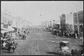
Parade of U.S. Infantry through Kearney, Nebraska (1888).

See also
 In Spanish: Kearney (Nebraska) para niños
