Kenmore Hills, Queensland facts for kids
Quick facts for kids Kenmore HillsBrisbane, Queensland |
|||||||||||||||
|---|---|---|---|---|---|---|---|---|---|---|---|---|---|---|---|

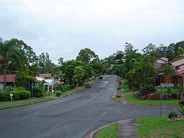
Mirbelia Street
|
|||||||||||||||
| Population | 2,402 (2016 census) | ||||||||||||||
| • Density | 511/km2 (1,320/sq mi) | ||||||||||||||
| Established | 1975 | ||||||||||||||
| Postcode(s) | 4069 | ||||||||||||||
| Area | 4.7 km2 (1.8 sq mi) | ||||||||||||||
| Time zone | AEST (UTC+10:00) | ||||||||||||||
| Location | 12 km (7 mi) W of Brisbane CBD | ||||||||||||||
| LGA(s) | City of Brisbane (Pullenvale Ward) |
||||||||||||||
| State electorate(s) | Moggill | ||||||||||||||
| Federal Division(s) | Ryan | ||||||||||||||
|
|||||||||||||||
Kenmore Hills is a suburb in the City of Brisbane, Queensland, Australia. In the 2016 census, Kenmore Hills had a population of 2,402 people.
Demographics
In the 2011 census, Kenmore Hills recorded a population of 2,577 people, 53.2% female and 46.8% male.
The median age of the Kenmore Hills population was 44 years of age, 7 years above the Australian median.
60.5% of people living in Kenmore Hills were born in Australia, compared to the national average of 69.8%; the next most common countries of birth were England 7.5%, South Africa 4.2%, New Zealand 3%, India 2.4%, Scotland 1.3%.
81.3% of people spoke only English at home; the next most common languages were 1.9% Mandarin, 1.1% German, 1% Cantonese, 0.9% Telugu, 0.8% Afrikaans.
Education
There are no schools in Kenmore Hills. The nearest primary schools are Chapel Hill State School in neighouring Chapel Hill to the east, Kenmore State School in neighbouring Kenmore to the south, and Brookfield State School in neighbouring Brookfield to the west. The nearest secondary school is Kenmore State High School in Kenmore.


