
Kent County, Michigan facts for kids
Quick facts for kids
Kent County
|
|||
|---|---|---|---|

Kent County Courthouse
|
|||
|
|||

Location within the U.S. state of Michigan
|
|||
 Michigan's location within the U.S. |
|||
| Country | |||
| State | |||
| Founded | March 2, 1831 (created) 1836 (organized) |
||
| Named for | James Kent | ||
| Seat | Grand Rapids | ||
| Largest city | Grand Rapids | ||
| Area | |||
| • Total | 872 sq mi (2,260 km2) | ||
| • Land | 847 sq mi (2,190 km2) | ||
| • Water | 25 sq mi (60 km2) 2.9%% | ||
| Population
(2020)
|
|||
| • Total | 657,974 | ||
| • Density | 766/sq mi (296/km2) | ||
| Time zone | UTC−5 (Eastern) | ||
| • Summer (DST) | UTC−4 (EDT) | ||
| Congressional districts | 2nd, 3rd | ||


Kent County is located in the U.S. state of Michigan. As of the 2020 Census, the county had a population of 657,974, making it the fourth-most populous county in Michigan, and the largest outside of Metro Detroit. Its county seat is Grand Rapids. The county was set off in 1831, and organized in 1836. It is named for New York jurist and legal scholar James Kent, who represented the Michigan Territory in its dispute with Ohio over the Toledo Strip.
Kent County is part of the Grand Rapids–Kentwood Metropolitan Statistical Area and is West Michigan's economic and manufacturing center. It is home of the Frederik Meijer Gardens, a significant cultural landmark of the Midwest. The Gerald R. Ford International Airport is the county's primary location for regional and international airline traffic.
Traditionally a massive stronghold for the Republican Party, the Democratic Party has received increased support since the 2000s, with Grand Rapids and nearby suburbs supporting the Democratic Party while more rural areas support the Republican Party. In 2008, Barack Obama became the first Democratic presidential candidate to carry the county since 1964. After Republican candidates Mitt Romney and Donald Trump carried the county in 2012 and 2016, respectively, another Democratic candidate, Joe Biden, carried the county in 2020 with the highest margin since 1964.
Contents
History
The Grand River runs through the county. On its west bank are burial mounds, remnants of the Hopewell Indians who lived there. The river valley was an important center for the fur trade in the early 19th century. After the War of 1812, Rix Robinson and Louis Campau were the earliest traders in the area. In 1826, Campau established a trading post in what is today Grand Rapids. In 1831, he bought land and platted the town. Campau considered the town's "father". One year later, government surveyor Lucius Lyon purchased land north of Campau's property. Campau surveyed and platted the village following Native American trails and Lyon had platted his property in an English grid format, which meant there were two adjoining villages, with different platting formats. Campau later merged the villages under the name of Grand Rapids.
In 1831, it was set off from Kalamazoo County. In 1838, Grand Rapids was incorporated as the county's first village. By the end of the century, stimulated by the construction of several sawmills, the area was a significant center for agriculture, logging, and manufacturing furniture.
Geography

According to the U.S. Census Bureau, the county has an area of 872 square miles (2,260 km2), of which 847 square miles (2,190 km2) is land and 25 square miles (65 km2) (2.9%) is water. Kent County's highest point is Fisk Knob Park, in Solon Township, at 1048 feet.
Rivers
The Grand River flows through the county from its eastern border to the west, and after passing through Ottawa County, empties into Lake Michigan at Grand Haven. It has three tributaries in Kent County, listed in order of convergence:
- Flat River, enters the county from the east, and joins the Grand from the north, in Lowell.
- Thornapple River, enters the county from the south, and joins the Grand in Ada.
- Rogue River, enters the county from the north, and joins the Grand in Belmont.
Trails
These hiking and biking trails run through the county:
- North Country Trail, runs north/south the length of the county, passing through Cedar Springs, Grattan and Lowell. Lowell is the trail's half-way point, and the national headquarters of the North Country Trail Association is located here.
- Thornapple Trail, begins in Kentwood and runs southeast through Dutton and Caledonia.
- White Pine Trail begins in Comstock Park and runs northeast through Belmont, Rockford, Cedar Springs, and Sand Lake.
- Kent Trails (which is singular in spite of the 's') runs north/south from John Ball Park in Grand Rapids to 84th Street in Byron Township, with an extension that runs east/west along 76th Street and north/south from 76th Street to Douglas Walker Park on 84th street.
- The Frederik Meijer Trail, which, as of November, 2008, was incomplete, runs east/west mostly along the M-6 freeway and will connect the Kent Trails and the Thornapple Trail when completed.
- Cannon Township Trail runs through Cannon Township in the eastern part of the county from Cannon Township Center on M-44. It runs along M-44 then south near Sunfish Lake Road, turning east through the Cannonsburg Cemetery, and ends at Warren Townsend Park near Cannonsburg.
Adjacent counties

- Newaygo County - north
- Montcalm County - northeast
- Muskegon County - northwest
- Ionia County - east
- Ottawa County - west
- Allegan County, - southwest
- Barry County - southeast
Demographics
| Historical population | |||
|---|---|---|---|
| Census | Pop. | %± | |
| 1840 | 2,587 | — | |
| 1850 | 12,016 | 364.5% | |
| 1860 | 30,716 | 155.6% | |
| 1870 | 50,403 | 64.1% | |
| 1880 | 73,253 | 45.3% | |
| 1890 | 109,922 | 50.1% | |
| 1900 | 129,714 | 18.0% | |
| 1910 | 159,145 | 22.7% | |
| 1920 | 183,041 | 15.0% | |
| 1930 | 240,511 | 31.4% | |
| 1940 | 246,338 | 2.4% | |
| 1950 | 288,292 | 17.0% | |
| 1960 | 363,187 | 26.0% | |
| 1970 | 411,044 | 13.2% | |
| 1980 | 444,506 | 8.1% | |
| 1990 | 500,631 | 12.6% | |
| 2000 | 574,335 | 14.7% | |
| 2010 | 602,622 | 4.9% | |
| 2020 | 657,974 | 9.2% | |
| U.S. Decennial Census 1790-1960 1900-1990 1990-2000 2010-2019 |
|||
As of the 2010 United States Census, there were 602,622 people living in the county. 76.1% were non-Hispanic White, 10.2% Black or African American, 2.4% Asian, 0.7% Native American, 4.5% of some other race and 2.6% of two or more races. 9.7% were Hispanic or Latino (of any race).

As of the census of 2000, there were 574,335 people, 212,890 households, and 144,126 families living in the county. The current estimated population is 604,323. The population density was 671 people per square mile (259/km2). There were 224,000 housing units at an average density of 262 per square mile (101/km2). The racial makeup of the county was 83.13% White, 8.93% Black or African American, 0.52% Native American, 1.86% Asian, 0.06% Pacific Islander, 3.34% from other races, and 2.16% from two or more races. 7.00% of the population were Hispanic or Latino of any race.
19.6% reported being of Dutch ancestry; 14.9% German, 13.1% English, 7.4% Irish, 7.1% Polish and 5.5% American ancestry according to the 2010 American Community Survey. 90.0% spoke only English at home, while 6.0% spoke Spanish.
There were 212,890 households, out of which 35.80% had children under the age of 18 living with them, 52.30% were married couples living together, 11.60% had a female householder with no husband present, and 32.30% were non-families. 25.60% of all households were made up of individuals, and 8.00% had someone living alone who was 65 years of age or older. The average household size was 2.64 and the average family size was 3.20.
The age distribution of the county was as follows: 28.30% were under the age of 18, 10.50% from 18 to 24, 31.20% from 25 to 44, 19.70% from 45 to 64, and 10.40% who were 65 years of age or older. The median age was 32 years. For every 100 females, there were 96.90 males. For every 100 females age 18 and over, there were 93.70 males.
The median income for a household in the county was $45,980, and the median income for a family was $54,770. Males had a median income of $39,878 versus $27,364 for females. The per capita income for the county was $21,629. 8.90% of the population and 6.30% of families were below the poverty line. 10.20% of the population under the age of 18 and 7.50% of those 65 or older were living in poverty.
Transportation
Air service
Commercial air service to Grand Rapids is provided by Gerald R. Ford International Airport (GRR). Previously named Kent County International Airport, it holds Grand Rapids' mark in modern history with the United States' first regularly scheduled airline service, beginning July 31, 1926, between Grand Rapids and Detroit.
Bus service
Public bus transportation is provided by the Interurban Transit Partnership, which brands itself as "The Rapid." Transportation is also provided by the DASH buses: the "Downtown Area Shuttle." These provide transportation to and from the parking lots in the city of Grand Rapids to various designated loading and unloading spots around the city.
Railroad
Amtrak provides direct train service to Chicago from the passenger station via the Pere Marquette line. Freight service is provided by CN, CSX Transportation, and by a local short-line railroad, the Grand Rapids Eastern Railroad.
Highways
 I-96
I-96 I-196 (Gerald R. Ford Freeway)
 I-296 (concurrent with US 131)
 US 131
 M-6 (Paul B. Henry Freeway, South Beltline Freeway)
 M-11
M-11 M-21
M-21 M-37
M-37 M-44
M-44 M-45 (Lake Michigan Drive)
 M-46
M-46 M-50
M-50 M-57
M-57- M-121
County-designated highways
 A-45
A-45 B-72
B-72
Communities

Cities
- Cedar Springs
- East Grand Rapids
- Grand Rapids (county seat)
- Grandville
- Kentwood
- Lowell
- Rockford
- Walker
- Wyoming
Villages
Census-designated places
- Byron Center
- Comstock Park
- Cutlerville
- Forest Hills
- Northview
Other unincorporated communities
Townships
- Ada Township
- Algoma Township
- Alpine Township
- Bowne Township
- Byron Township
- Caledonia Township*Cannon Township
- Cascade Township*Courtland Township
- Gaines Township*Grand Rapids Township*Grattan Township
- Lowell Township*Nelson Township
- Oakfield Township
- Plainfield Township*Solon Township
- Sparta Township
- Spencer Township
- Tyrone Township
- Vergennes Township
(* denotes Charter status)
Economy
These corporations are headquartered in Kent County, in the following communities:
- Amway, Ada
- American Seating, Grand Rapids
- Bissell Homecare, Walker
- Gordon Food Service, Wyoming
- Meijer, Walker
- Old Orchard, Sparta
- Spartan Stores, Byron Township
- Steelcase, Grand Rapids
- Universal Forest Products, Grand Rapids Township
- Wolverine Worldwide, Rockford
- X-Rite, Kentwood
- Zondervan, Cascade Township
Images for kids
-

Rockford Dam in Rockford, Michigan
-

13 Mile Road in the rural Courtland Township
-
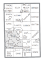
U.S. Census data map showing local municipal boundaries within Kent County. Shaded areas represent incorporated cities.
.jpeg)
.jpeg)

See also
 In Spanish: Condado de Kent (Míchigan) para niños
