
Keweenaw County, Michigan facts for kids
Quick facts for kids
Keweenaw County
|
|
|---|---|

Keweenaw County Courthouse (built 1866) in Eagle River
|
|

Location within the U.S. state of Michigan
|
|
 Michigan's location within the U.S. |
|
| Country | |
| State | |
| Founded | March 11, 1861 |
| Named for | Keweenaw Bay |
| Seat | Eagle River |
| Largest community | Eagle River(CDP) Ahmeek(village) |
| Area | |
| • Total | 5,966 sq mi (15,450 km2) |
| • Land | 540 sq mi (1,400 km2) |
| • Water | 5,426 sq mi (14,050 km2) 91% |
| Population
(2020)
|
|
| • Total | 2,046 |
| • Density | 4.0/sq mi (1.5/km2) |
| Time zone | UTC−5 (Eastern) |
| • Summer (DST) | UTC−4 (EDT) |
| Congressional district | 1st |
Keweenaw County ( kee-WƏ-naw) is a county in the Upper Peninsula of the U.S. state of Michigan, the state's northernmost county. As of the 2020 United States Census, the population was 2,046, making it Michigan's least populous county. It is also the state's largest county by total area, when the waters of Lake Superior are included in the total. The county seat is Eagle River.
The county was set off and organized in 1861. It is believed "Keweenaw" is a corruption of an Ojibwe word that means "portage" or "place where portage is made"; compare the names of the nearby Portage Lake and Portage River which together make up the Keweenaw Waterway. Keweenaw County is part of the Houghton, Michigan, Micropolitan Statistical Area. Isle Royale, a national park which no longer has year-round inhabitants, was a separate county that was incorporated into Keweenaw County in 1897.
Contents
Geography
Two land masses comprise most of the land portion of the county: Isle Royale and the northeastern half of the Keweenaw Peninsula. The county also includes the waters of Lake Superior between the two, extending to the state's water borders with Ontario and Minnesota. It is thus the largest county in Michigan by total area, at 5,966 square miles (15,450 km2), of which 540 square miles (1,400 km2) is land and 5,426 square miles (14,050 km2) (91%) is water. Of all counties (or equivalents) in the United States, Keweenaw County has the highest proportion of water area to total area.
The largest lake entirely within the county is Gratiot Lake at 1,438 acres (5.82 km2), located at the base of the county's two highest peaks: Mt. Horace Greeley at 1,550 feet (470 m) and Mt. Gratiot at 1,490 feet (450 m). Other lakes include Lac La Belle near Bete Grise Bay, Lake Medora, Lake Fanny Hooe near Copper Harbor, Lake Bailey at the base of Mt. Lookout, and Schlatter Lake at the tip of the peninsula.
National protected area
Major highways
 US 41
US 41 M-26
M-26
Adjacent counties and district
- Alger County, Michigan (east)
- Cook County, Minnesota (northwest/CST Border)
- Houghton County, Michigan (south)
- Marquette County, Michigan (southeast)
- Ontonagon County, Michigan (southwest)
- Thunder Bay District, Ontario (north)
Demographics
The 2010 United States Census indicates Keweenaw County had a population of 2,156. This decrease of 145 people from the 2000 United States Census represents a -6.3% change in population. In 2010 there were 1013 households and 614 families in the county. The population density was 4 people per square mile (2/km2). There were 2,467 housing units at an average density of 4 per square mile (2/km2). 98.5% of the population were White, 0.1% Black or African American, 0.1% Native American and 1.2% of two or more races. 0.7% were Hispanic or Latino (of any race). 38.8% were of Finnish, 14.0% German, 9.0% English, 6.6% French, French Canadian or Cajun and 5.7% Irish ancestry.
There were 1013 households, out of which 16.8% had children under the age of 18 living with them, 52.4% were married couples living together, 4.9% had a female householder with no husband present, and 39.4% were non-families. 34.2% of all households were made up of individuals, and 15.0% had someone living alone who was 65 years of age or older. The average household size was 2.12 and the average family size was 2.71.
The county population contained 17.9% under the age of 18, 5.2% from 18 to 24, 20.0% from 25 to 44, 36.0% from 45 to 64, and 24.1% who were 65 years of age or older. The median age was 51.6 years. The population is 51.3% male and 48.7% female.
The median income for a household in the county was $39,821, and the median income for a family was $48,563. The per capita income for the county was $21,218. About 16.6% of families and 17.8% of the population were below the poverty line, including 34.2% of those under age 18 and 4.0% of those age 65 or over.
Communities
Villages
Census-designated places
- Copper Harbor
- Eagle Harbor
- Eagle River (county seat)
Other unincorporated communities
Townships
- Allouez Township
- Eagle Harbor Township
- Grant Township
- Houghton Township
- Sherman Township
Images for kids
-
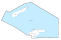
U.S. Census data map showing local municipal boundaries within Keweenaw County

See also
 In Spanish: Condado de Keweenaw para niños
