Kitzingen Rural District facts for kids
Quick facts for kids
Kitzingen
|
|
|---|---|
 |
|
| Country | |
| State | Bavaria |
| Adm. region | Unterfranken |
| Region | Würzburg |
| Capital | Kitzingen |
| Area | |
| • Total | 684 km2 (264 sq mi) |
| Population
(2006-12-31)
|
|
| • Total | 89,378 |
| • Density | 130.67/km2 (338.43/sq mi) |
| Time zone | UTC+1 (CET) |
| • Summer (DST) | UTC+2 (CEST) |
| Vehicle registration | KT |
| Website | landkreis-kitzingen.de |
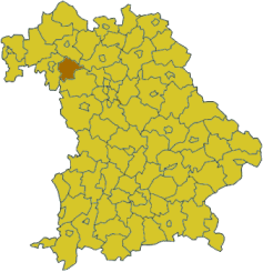
Kitzingen is a district in Bavaria, Germany.
History
The district was last changed in 1973. The old district of Gerolzhofen was split up, and half of its territory was joined with the old Kitzingen district. The city of Kitzingen lost its status as an independent city and was put into the district.
Geography
The Main River runs through the district from south to north.
Coat of arms
 |
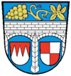
The coat of arms displays:
|
Towns and municipalities
| Towns | Municipalities | |
|---|---|---|
|
|
|

All content from Kiddle encyclopedia articles (including the article images and facts) can be freely used under Attribution-ShareAlike license, unless stated otherwise. Cite this article:
Kitzingen Rural District Facts for Kids. Kiddle Encyclopedia.
