
Kurow facts for kids
Quick facts for kids
Kurow
Te Kohurau
|
|
|---|---|
|
Rural centre
|
|

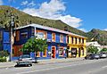
Bledisloe St (State Highway 83) in Kurow
|
|
| Country | New Zealand |
| Region | Canterbury |
| Territorial authority | Waitaki District |
| Ward | Ahuriri Ward |
| Area | |
| • Total | 4.91 km2 (1.90 sq mi) |
| Population
(2018 Census)
|
|
| • Total | 372 |
| • Density | 75.76/km2 (196.2/sq mi) |
| Time zone | UTC+12 (New Zealand Standard Time) |
| • Summer (DST) | UTC+13 (New Zealand Daylight Time) |
| Postcode |
9435
|
| Local iwi | Ngāi Tahu |

Kurow is a small town in the Waitaki District, New Zealand. It is located on the south bank of the Waitaki River, 60 kilometres (37 mi) northwest of Oamaru.
Contents
Description
The name is an Anglicised form of the name of the nearby mountain Te Kohurau.
In the 1920s the town was the base for the building of the nearby Waitaki Dam and forming Lake Waitaki in the first of a series of hydroelectric projects on the Waitaki River.
The first social security scheme for New Zealand workers was designed in the town, arising from Presbyterian Minister of Kurow Arnold Nordmeyer's experience of working with families of workers on the Waitaki hydro-electric project.
Examples of pre-European Māori cave paintings are close to the small settlement of Duntroon.
The land around the town includes summerfruit orchards, and increasing amounts of Pinot noir are being planted in the limestone soils.
The town was the terminus of the Kurow Branch railway, opened in 1881 to Hakataramea, across the Waitaki River, but cut back to Kurow in 1930. It closed in 1983: the line can be traced on the ground, and the station still building stands on Liverpool St. From 1928 until 1937, a line owned by the Public Works Department ran from Kurow to the hydroelectric project 6.4 km to the west.
Notable people from Kurow include All Black captain Richie McCaw, All Black and rugby administrator Charles Saxton and mathematician Roy Kerr. From 1929 to 1934, Dr Gervan McMillan and his wife Ethel were residents of Kurow, with Dr McMillan running a medical practice.
Demographics
Kurow is described as a rural settlement by Statistics New Zealand, and covers 4.91 km2 (1.90 sq mi). It is part of the larger Danseys Pass statistical area.
| Historical population for Kurow | ||
|---|---|---|
| Year | Pop. | ±% p.a. |
| 2006 | 348 | — |
| 2013 | 321 | −1.15% |
| 2018 | 372 | +2.99% |
Kurow had a population of 372 at the 2018 New Zealand census, an increase of 51 people (15.9%) since the 2013 census, and an increase of 24 people (6.9%) since the 2006 census. There were 165 households. There were 192 males and 180 females, giving a sex ratio of 1.07 males per female, with 54 people (14.5%) aged under 15 years, 30 (8.1%) aged 15 to 29, 144 (38.7%) aged 30 to 64, and 147 (39.5%) aged 65 or older.
Ethnicities were 91.9% European/Pākehā, 12.9% Māori, 0.0% Pacific peoples, 4.0% Asian, and 1.6% other ethnicities (totals add to more than 100% since people could identify with multiple ethnicities).
Although some people objected to giving their religion, 36.3% had no religion, 50.0% were Christian, 0.8% were Muslim and 2.4% had other religions.
Of those at least 15 years old, 27 (8.5%) people had a bachelor or higher degree, and 108 (34.0%) people had no formal qualifications. The employment status of those at least 15 was that 126 (39.6%) people were employed full-time, 51 (16.0%) were part-time, and 6 (1.9%) were unemployed.
Danseys Pass statistical area
The Danseys Pass statistical area, which also includes Duntroon, covers 711.49 km2 (274.71 sq mi) and had an estimated population of 1,060 as of June 2022, with a population density of 1.5 people per km2.
| Historical population for Danseys Pass | ||
|---|---|---|
| Year | Pop. | ±% p.a. |
| 2006 | 864 | — |
| 2013 | 915 | +0.82% |
| 2018 | 987 | +1.53% |
Danseys Pass had a population of 987 at the 2018 New Zealand census, an increase of 72 people (7.9%) since the 2013 census, and an increase of 123 people (14.2%) since the 2006 census. There were 399 households. There were 504 males and 483 females, giving a sex ratio of 1.04 males per female. The median age was 45.4 years (compared with 37.4 years nationally), with 189 people (19.1%) aged under 15 years, 141 (14.3%) aged 15 to 29, 438 (44.4%) aged 30 to 64, and 219 (22.2%) aged 65 or older.
Ethnicities were 88.1% European/Pākehā, 9.7% Māori, 8.2% Asian, and 1.5% other ethnicities (totals add to more than 100% since people could identify with multiple ethnicities).
The proportion of people born overseas was 16.1%, compared with 27.1% nationally.
Although some people objected to giving their religion, 43.5% had no religion, 42.2% were Christian, 1.2% were Hindu, 0.3% were Muslim, 1.2% were Buddhist and 3.3% had other religions.
Of those at least 15 years old, 90 (11.3%) people had a bachelor or higher degree, and 213 (26.7%) people had no formal qualifications. The median income was $29,500, compared with $31,800 nationally. 90 people (11.3%) earned over $70,000 compared to 17.2% nationally. The employment status of those at least 15 was that 399 (50.0%) people were employed full-time, 132 (16.5%) were part-time, and 12 (1.5%) were unemployed.
Education
Waitaki Valley School is a full primary school catering for years 1 to 8, with a roll of 104 students as of April 2023. The school was created from the merger in 2004 of Kurow Area, Otematata, Cattle Creek, and Hakataramea schools. It moved to its present site in 2012.
Notable people
Notable people with connections to Kurow include:
- Steve Hotton, Otago rugby player
- Roy Kerr, Mathematician
- Richie McCaw, All Black captain
- Dr Gervan McMillan and his wife Ethel were residents of Kurow from 1929 to 1934, with Dr McMillan running a medical practice there.
- Arnold Nordmeyer, minister of finance and Labour Party politician
- Charles Saxton. All Black and rugby administrator
Images for kids
-
Kurow hotel
-
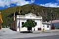
Kurow museum


