
La Plata, Maryland facts for kids
Quick facts for kids
La Plata, Maryland
|
|
|---|---|
.jpg)
Charles County Courthouse
|
|

Location of La Plata, Maryland
|
|

La Plata, Maryland
Location in Maryland

La Plata, Maryland
Location in the United States
|
|
| Country | United States |
| State | Maryland |
| County | Charles |
| Incorporated | 1888 |
| Founded by | Colonel Samuel Chapman |
| Named for | Río de la Plata |
| Area | |
| • Total | 7.43 sq mi (19.25 km2) |
| • Land | 7.40 sq mi (19.18 km2) |
| • Water | 0.03 sq mi (0.07 km2) |
| Elevation | 190 ft (58 m) |
| Population
(2020)
|
|
| • Total | 10,159 |
| • Density | 1,372.10/sq mi (529.79/km2) |
| Time zone | UTC-5 (Eastern (EST)) |
| • Summer (DST) | UTC-4 (EDT) |
| ZIP code |
20646
|
| Area code(s) | 301, 240 |
| FIPS code | 24-45750 |
| GNIS feature ID | 0585340 |
La Plata is a town in Charles County, Maryland, United States. The population was 10,159 at the 2020 census. It is the county seat of Charles County.
Contents
History
According to one of several legends, the town was given its name by Colonel Samuel Chapman, whose family owned 6,000 acres (24 km2) of land in Southern Maryland, including what would become the areas of La Plata and Port Tobacco. The Colonel traveled to Central and South America with his son George, who had contracted tuberculosis, in search of a cure. In his travels, the Colonel was impressed with the La Plata River in Argentina, so he decided to name a portion of his property "La Plata" after the river.
The town was founded in 1888 after the river flowing into the previous county seat, Port Tobacco (a few miles to the west), silted up, ending that town's utility as a port. At the same time, a new railroad line made La Plata attractive as a new county seat location. The courthouse was built there after the Port Tobacco courthouse burned down (arson suspected, but unproven). Christ Episcopal Church was dismantled stone by stone and rebuilt in La Plata. In 1940 the opening of the then "Potomac River Bridge" (later renamed the Governor Harry W. Nice Memorial Bridge), which carries U.S. Route 301 over the Potomac River, provided a link to Virginia and brought many long-distance east coast thru-travelers through the town as an alternative to using urban U.S. 1 and, later, the often-congested Interstate 95.
Geography
La Plata is located at 38°32′3″N 76°58′24″W / 38.53417°N 76.97333°W (38.534258, -76.973377).
According to the United States Census Bureau, the town has a total area of 7.45 square miles (19.30 km2), of which, 7.40 square miles (19.17 km2) is land and 0.05 square miles (0.13 km2) is water.
Climate
The climate in this area is characterized by hot, humid summers and generally mild to cool winters. According to the Köppen Climate Classification system, La Plata has a humid subtropical climate, abbreviated "Cfa" on climate maps.
Demographics
| Historical population | |||
|---|---|---|---|
| Census | Pop. | %± | |
| 1890 | 116 | — | |
| 1910 | 269 | — | |
| 1920 | 300 | 11.5% | |
| 1930 | 332 | 10.7% | |
| 1940 | 488 | 47.0% | |
| 1950 | 780 | 59.8% | |
| 1960 | 1,214 | 55.6% | |
| 1970 | 1,561 | 28.6% | |
| 1980 | 2,484 | 59.1% | |
| 1990 | 5,841 | 135.1% | |
| 2000 | 6,551 | 12.2% | |
| 2010 | 8,753 | 33.6% | |
| 2020 | 10,159 | 16.1% | |
| U.S. Decennial Census | |||
The median income for a household in the town was $56,490, and the median income for a family was $66,288. Males had a median income of $42,492 versus $32,125 for females. The per capita income for the town was $24,669. About 8.3% of families and 10.1% of the population were below the poverty line, including 12.0% of those under age 18 and 18.1% of those age 65 or over.
2010 census
As of the census of 2010, there were 8,753 people, 3,062 households, and 2,091 families residing in the town. The population density was 1,182.8 inhabitants per square mile (456.7/km2). There were 3,234 housing units at an average density of 437.0 per square mile (168.7/km2). The racial makeup of the town was 66.3% White, 26.7% African American, 0.5% Native American, 2.7% Asian, 0.1% Pacific Islander, 0.7% from other races, and 3.0% from two or more races. Hispanic or Latino of any race were 3.2% of the population.
There were 3,062 households, of which 38.0% had children under the age of 18 living with them, 48.6% were married couples living together, 15.9% had a female householder with no husband present, 3.8% had a male householder with no wife present, and 31.7% were non-families. 26.0% of all households were made up of individuals, and 11.3% had someone living alone who was 65 years of age or older. The average household size was 2.62 and the average family size was 3.17.
The median age in the town was 38.4 years. 24.4% of residents were under the age of 18; 8.9% were between the ages of 18 and 24; 27% were from 25 to 44; 26.4% were from 45 to 64; and 13.4% were 65 years of age or older. The gender makeup of the town was 48.3% male and 51.7% female.
Attractions
La Plata is largely a residential community. Some residents work for the Charles County government, while others commute to Waldorf or the Washington, D.C. and Baltimore areas for work, including to Andrews Air Force Base and Naval Air Station Patuxent River. The town is experiencing a transformation into a thriving business and commercial center, thanks to development of office buildings and the town's recent reconstruction.
Historic Mount Carmel (1790), a Catholic convent, is just outside La Plata, near the main campus of the College of Southern Maryland.
La Plata has county offices, University of Maryland Charles Regional Medical Center (recently enlarged), the main campus of the College of Southern Maryland, a community theater (Port Tobacco Players), a large outdoor athletic complex, a large construction business, two nursing homes, and a host of stores and restaurants, in addition to a twice-weekly farmers' market. At the north edge of town are Walmart and Target department stores, three supermarkets, a Lowe's home-improvement store, and two all-night drugstores. Rosewick Road is connected with St. Charles Parkway to adjacent Waldorf, providing drivers an alternative to using U.S. Route 301.
Public schools in La Plata include La Plata High School, Milton Somers Middle School, Walter Mitchell Elementary, and Mary Matula Elementary.
Tornado history
La Plata has been impacted by two major tornadoes in its history.
The first occurred on November 9, 1926. This tornado killed 16 people, thirteen of them in the La Plata Elementary School, which was destroyed. It was estimated to have been an F3 on the Fujita scale.
On April 28, 2002, an F4 tornado cut a 24-mile-long (39 km) swath through Charles County, with areas around La Plata damaged most severely. This tornado caused four deaths. Local officials credited federal- and state-assisted new construction efforts with helping them to remodel the downtown area following the tornado, as several new public buildings replaced some of those damaged there. A new La Plata Town Hall, for example, became Southern Maryland's first LEED certified building, and an old building considered historic by local residents, which housed a CVS Pharmacy store at the time of the tornado, was rebuilt in a new location after the storm. In the days after the tornado, help was provided by twenty-seven different jurisdictions, as well as the nearby Amish community in St. Mary's County.
For details on the tornado outbreak of which the 2002 tornado was a part, see the information on the Midwest to Mid-Atlantic United States tornado outbreak of 2002.
Transportation
The primary method of travel to and from La Plata is by road, and four state highways serve the town. The most significant of these is U.S. Route 301, which follows Crain Highway through the town. From La Plata, US 301 heads south across the Potomac River into Virginia, eventually reaching Richmond. To the north, US 301 passes through Waldorf before intersecting Interstate 495 and U.S. Route 50 near Bowie. From there, US 301 joins I-495 and US 50 east past Annapolis and crosses the Chesapeake Bay Bridge to the Eastern Shore of Maryland. Maryland Route 6 is the main east-west highway serving La Plata, following Port Tobacco Road and Charles Street through town. From La Plata, MD 6 heads west to Port Tobacco and continues east to Charlotte Hall. Maryland Route 225 follows Hawthorne Road westward from US 301 in La Plata, eventually reaching Maryland Route 210 near Indian Head. Finally, Maryland Route 488 follows La Plata Road northeast from MD 6 to Maryland Route 5 near Bryantown.
Notable people
- Adrian Posey, La Plata benefactor
- Tim Drummond, former Major League Baseball player
- Steve Farr, former Major League Baseball player
- Ryan Hackett, NASCAR driver
- Shane Halter, former Major League Baseball player
- Larry Johnson, NFL former football player
- Joel and Benji Madden, founders of pop/punk band Good Charlotte
- Don Money, former Major League Baseball player
- Buzz Nutter, former NFL football player
- Daryl Thompson, Major League Baseball player
Images for kids
-
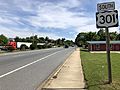
US 301 southbound just south of MD 6 in La Plata
_just_south_of_Maryland_State_Route_6_(Port_Tobacco_Road-Charles_Street)_in_La_Plata,_Charles_County,_Maryland.jpg)
See also
 In Spanish: La Plata (Maryland) para niños
