
La Uvita facts for kids
Quick facts for kids
La Uvita
|
||
|---|---|---|
|
Municipality and town
|
||

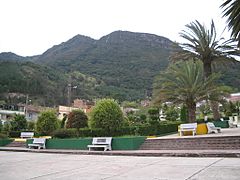
Central square of La Uvita
|
||
|
||

Location of the municipality and town of La Uvita in the Boyacá Department of Colombia
|
||
| Country | ||
| Department | Boyacá Department | |
| Province | Northern Boyacá Province | |
| Founded | 24 December 1758 | |
| Founded by | Vicente Ferrer del Río de Loza | |
| Elevation | 2,700 m (8,900 ft) | |
| Population
(2015)
|
||
| • Municipality and town | 2,523 | |
| • Urban | 1,018 | |
| Time zone | UTC-5 (Colombia Standard Time) | |
.svg)
La Uvita is a town and municipality in the Northern Boyacá Province, part of the Colombian Department of Boyacá. The urban centre is located at an altitude of 2,700 metres (8,900 ft) in the Eastern Ranges of the Colombian Andes. La Uvita borders San Mateo in the north, El Cocuy and Chita in the east, Chita and Jericó in the south and Boavita in the west.
Etymology
La Uvita is derived from Chibcha, meaning "meadow of the fertile farmlands".
History
La Uvita was founded by Vicente Ferrer del Río de Loza on December 24, 1758, as a place for the colonial inhabitants of Boavita to flee the indigenous people in Boavita.
Economy
Main economic activity of La Uvita is the manufacturing of cheese. It also serves as a touristic entry to the El Cocuy National Park.
Gallery
-
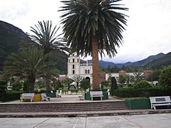
Central square
-
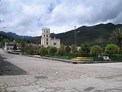
Central square and church
-
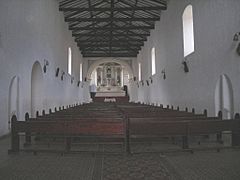
Church interior
-
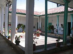
Andalusian patio


-
Monserrate Hill
-

Tabor Hill
-
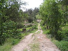
Rural road


See also
 In Spanish: La Uvita para niños
