
La Vega Province facts for kids
Quick facts for kids La Vega |
||
| Province | ||
|
||
| Country | ||
|---|---|---|
| Development region | Cibao Sur (II) | |
| Capital | La Vega | |
| - elevation | 101 m (331 ft) | |
| - coordinates | 19°13′12″N 70°31′48″W / 19.22000°N 70.53000°W | |
| Area | 2,292.5 km² (885 sq mi) | |
| Population | 447,905 (2014) | |
| Density | 195 /km² (505 /sq mi) | |
| Province since | 1844 | |
| Subdivisions | 4 municipalities 8 municipal districts |
|
| Congresspersons | 1 Senator 8 Deputies |
|
| Timezone | EST (UTC-4) | |
| Area code | 1-809 1-829 1-849 | |
| ISO 3166-2 | DO-13 | |

La Vega is a Dominican province, in the central part of the country. Its capital city is Concepción de la Vega.
It was one of the first provinces in the country; it was one of the provinces created by the first constitution of the country in 1844. Its name has always been La Vega.
Contents
Name
The province takes its name from its capital and most important city: Concepción de la Vega (usually called just La Vega). "La Vega" means "The Valley".
History
The province was created in 1844 with the municipalities of La Vega, San Francisco de Macorís and Cotuí. In 1855, Moca was included in the province as a municipality.
In 1959, the province included the municipalities of La Vega, Constanza, Jarabacoa and Monseñor Nouel (the present Bonao, and the municipal district of Cayetano Germosén. The city of Concepción de La Vega was its capital.
In 1982, the province included the municipalities La Vega, Constanza and Jarabacoa, and the municipal district of Jima Abajo. In 1996, Jima Abajo became a municipality.
Tireo was made a municipal district in 1993, Rincón and Río Verde Arriba in 1998, El Ranchito and La Sabina in 2002, Buena Vista in 2004, Manabao in 2006, and Tavera in 2010.
Location
The La Vega province has the Santiago and Espaillat provinces to the north, the Hermanas Mirabal, Duarte and Sánchez Ramírez to the east, the Monseñor Nouel and San José de Ocoa provinces to the south and the Azua and San Juan provinces to the west.
 |
Santiago | Espaillat | Hermanas Mirabal Duarte |
|
| San Juan | Sánchez Ramírez | |||
| Azua | San José de Ocoa | Monseñor Nouel |
Population
In 2014 (last national census), there were 447,905 people living in the La Vega province, and 185,101 (41.3%) living in towns and cities. The population density was 195.4 persons/km².
Its population represents 4.74% of the total population of the country and the province is ranked as the 5th (out of 31 plus the National District) more populated province.
As of 2016[update], the total estimated propulation of the province is 405,510 inhabitants.
The largest city of the province is La Vega, its head municipality or capital, with a population (in 2014) of 202,864 inhabitants.
Geography
.jpg)
The La Vega province has a total area of 2,292.5 km2 (885.1 sq mi). It has 4.7% of the area of the Dominican Republic and it is ranked as the 6th (out of 31 plus the National District) largest province.
The altitude of Concepción de la Vega, provincial capital, is 101 m (331 ft).
The Cordillera Central ("Central mountain chain") is in the western part of the province. The "Valle de la Vega Real" ("Royal Valley"), the eastern part of the Cibao Valley, is in the eastern half of the province.
In the mountains, there are several valleys with an important production of vegetables and fruits. The 3 more important of these valleys are:
- Constanza
- Jarabacoa
- Tireo
The highest mountain in the province is Alto Bandera, 2,872 m (9,423 ft) high.
The main rivers of the province are the Yaque del Norte and Camú rivers.
The most important protected areas in the province are the Scientific Reserve Ébano Verde (Reserva Científica Ébano Verde) and the Scientific Reserve Valle Nuevo (Reserva Científica de Valle Nuevo).
Climate
The climate of the province is a tropical climate, hot most of the year, but it is cooler on the mountains.
Municipalities
There are 4 municipalities and 8 municipal districts (M.D.) in the province. The municipalities and its municipal districts (M.D.) are:

| Municipality (code) |
Municipal Districts (code) | Population (2010) |
Area (km2) |
Density | Altitude (m) |
|---|---|---|---|---|---|
| La Vega (130101) | 202,864 | 410.9 | 493.7 | 89 | |
| Río Verde Arriba (130102) | 23,109 | 67.2 | 343.9 | 154 | |
| El Ranchito (130103) | 9,626 | 48.0 | 200.5 | 52 | |
| Tavera (130104) | 12,490 | 115.9 | 107.8 | 380 | |
| Concepción de la Vega (130100) | 248,089 | 642.1 | 386.4 | ||
| Constanza (130201) | 34,687 | 261.7 | 132.5 | 1177 | |
| Tireo (130202) | 15,349 | 295.3 | 52.0 | 1233 | |
| La Sabina (130203) | 9,016 | 293.4 | 30.7 | 1740 | |
| Constanza (130200)) | 59,052 | 850.4 | 69.4 | ||
| Jarabacoa (130301) | 40,556 | 313.6 | 129.3 | 536 | |
| Buena Vista (130302) | 12,232 | 98.0 | 124.8 | 557 | |
| Manabao (130303) | 4,015 | 262.4 | 1.8 | 922 | |
| Jarabacoa (130300) | 56,803 | 673.9 | 84.3 | ||
| Jima Abajo (130401) | 16,267 | 58.0 | 280.5 | 72 | |
| Rincón (130403) | 13,994 | 68.1 | 205.5 | 86 | |
| Jima Abajo (130400) | 30,261 | 126.1 | 240.0 | ||
| La Vega province (130000) | 447,905 | 2,292.4 | 195.4 | ||
Economy
The main economic activity of the province is agriculture; the main products are coffee in the mountains, rice in the southern and eastern part of the province and cacao in the low mountains and those parts of the valley close to the mountains. Vegetables and fruits are very important in the valleys in the mountains.
Other important economic activity is cattle raising. There are several industries, especially textiles and food, in La Vega.
Tourism has become a very important economic activity, mainly in Jarabacoa and Constanza.
Images for kids
-
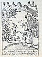
Battle of Santo Cerro.
-
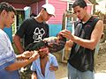
People in countryside of La Vega, Dominican Republic.
.jpg)

See also
 In Spanish: Provincia de La Vega para niños
