
Laidley, Queensland facts for kids
Quick facts for kids LaidleyQueensland |
|||||||||||||||
|---|---|---|---|---|---|---|---|---|---|---|---|---|---|---|---|

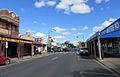
Main Street of Laidley, 2011
|
|||||||||||||||

Laidley
Location in Queensland
|
|||||||||||||||
| Population | 3,808 (2016 census) | ||||||||||||||
| • Density | 213.9/km2 (554/sq mi) | ||||||||||||||
| Established | 1858 | ||||||||||||||
| Postcode(s) | 4341 | ||||||||||||||
| Area | 17.8 km2 (6.9 sq mi) | ||||||||||||||
| Time zone | AEST (UTC+10:00) | ||||||||||||||
| Location | |||||||||||||||
| LGA(s) | Lockyer Valley Region | ||||||||||||||
| County | Churchill | ||||||||||||||
| Parish | Laidley | ||||||||||||||
| State electorate(s) | Lockyer | ||||||||||||||
| Federal Division(s) | Wright | ||||||||||||||
|
|||||||||||||||
|
|||||||||||||||
Laidley is a rural town and locality in the Lockyer Valley Region, Queensland, Australia. In the 2016 census, the locality of Laidley had a population of 3,808 people.
History

Allan Cunningham first explored the area in 1829. Cunningham named it Laidley's Plain after the Deputy Commissary General of the colony of New South Wales. The town developed around a wagon stop on the main road route between Ipswich and Toowoomba. A stop was needed after the climb over the small Little Liverpool Range west of Marburg.
By the 1850s the area was being cleared for sheep grazing. A survey for the growing village was conducted in 1858. Laidley Post Office opened on 1 February 1861. A Laidley Creek West Post Office was open from 1927 until 1955 (a receiving office had been open from 1899). A Laidley Rail Post Office opened in 1915 and closed in 1925. In the mid-1870s the railway line from Grandchester stopped at a railway station 1.5 kilometres (0.93 mi) north of the town. Between 1911 and 1955, a branch railway line ran from Laidley along the Laidley Creek to the settlement at Mulgowie. The town was the centre of the Shire of Laidley, a former local government area.
Heritage listings

Laidley has a number of heritage-listed sites, including:
- Toowoomba-Ipswich Road: Corduroy Road Remains
- 91 Patrick Street: Whitehouse's Bakery
- 134 - 138 Patrick Street: Exchange Hotel
- 140 - 142 Patrick Street: G Wyman Building
Sport and recreation

The Laidley Sports and Recreation Reserve is located between Ambrose Street (north) and Edward Street (south). It is the main sporting precinct in Laidley and sports homed at the facility include netball, soccer, rugby league, touch football, little athletics, a gymnasium and walking.
Swimming facilities: Dal Ryan War Memorial Pool, 44 John Street, Laidley. One pool is 25m long with six lanes, the other pool is for children. Barbecue facilities and a kiosk are on-site.
Laidley Bowling Club, 73 John Street. Coaching is available and the clubhouse can be booked for functions.
The Laidley Golf Club is a public twelve hole course adjacent to Lake Dyer, two kilometres from the township of Laidley on Wehlow Road off Gatton-Laidley Road. Established in 1951 at its present site, the original nine holes were designed by Ross Watson. A further three holes were designed by David Burrup in 2003. The competition course has thirteen different tees for the eighteen holes while the Social Course has fifteen different tees for the eighteen holes.
Lake Dyer Caravan & Camping Ground is situated on the shore of Lake Dyer between the villages of Laidley and Forest Hill. The lake is directly accessible from the caravan park and open to the public for recreational use.
Education
Laidley District State School is a government primary (Early Childhood-6) school for boys and girls at 230-232 Patrick Street (27°37′25″S 152°23′43″E / 27.6236°S 152.3953°E). In 2017, the school had an enrolment of 375 students with 27 teachers and 20 non-teaching staff (14 full-time equivalent). It includes a special education program.
Laidley State High School is a government secondary (7-12) school for boys and girls at 98 Alfred Street (27°38′10″S 152°24′16″E / 27.6362°S 152.4044°E). In 2017, the school had an enrolment of 694 students with 65 teachers (63 full-time equivalent) and 33 non-teaching staff (23 full-time equivalent). It includes a special education program.
St Mary's School is a Catholic primary (Prep-6) school for boys and girls at John Street (27°38′03″S 152°23′30″E / 27.6341°S 152.3916°E). In 2017, the school had an enrolment of 267 students with 23 teachers (20 full-time equivalent) and 15 non-teaching staff (10 full-time equivalent).
Images for kids
-
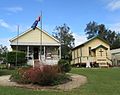
Laidley Pioneer Village, council chamber and chapel, April 2022
-
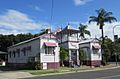
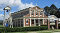
Das Neumann Haus Museum, view from William Street, April 2022
-
Laidley main street, Patrick Street, April 2022
-
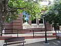
Laidley Post Office, April 2022
-
Giesemann's Buildings 1902, Patrick St, April 2022
-
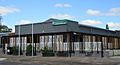
Lockyer Valley Regional Council customer service centre and library, April 2022
-
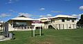
Laidley Hospital, April 2022
-
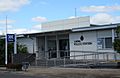
Laidley Police Station, April 2022
-
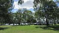
Lake Dyer camping ground, April 2022
-
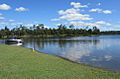
Lake Dyer, April 2022
-
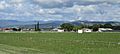
Laidley QLD rural landscape, April 2022
-
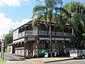
Laidley Queensland National Hotel, April 2022
-
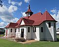
St Saviour's Anglican Church, April 2022
-
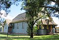
St Patrick's Catholic Church, April 2022
-
Uniting Church, April 2022


