
Lanefield, Queensland facts for kids
Quick facts for kids LanefieldIpswich, Queensland |
|||||||||||||||
|---|---|---|---|---|---|---|---|---|---|---|---|---|---|---|---|

Lane Road crossing, Main Line railway, 2015
|
|||||||||||||||

Lanefield
Location in Queensland
|
|||||||||||||||
| Population | 107 (2016 census) | ||||||||||||||
| • Density | 6.37/km2 (16.5/sq mi) | ||||||||||||||
| Postcode(s) | 4340 | ||||||||||||||
| Area | 16.8 km2 (6.5 sq mi) | ||||||||||||||
| Time zone | AEST (UTC+10:00) | ||||||||||||||
| Location |
|
||||||||||||||
| LGA(s) | City of Ipswich | ||||||||||||||
| State electorate(s) |
|
||||||||||||||
| Federal Division(s) | Blair | ||||||||||||||
|
|||||||||||||||
Lanefield is a rural locality in the City of Ipswich, Queensland, Australia. In the 2016 census, Lanefield had a population of 107 people.
Education
There are no schools in Lanefield. The nearest government primary schools are Ashwell State School in neighbouring Ashwell to the north and Rosewood State School in neighbouring Rosewood to the east. The nearest government secondary school is Rosewood State High School in Rosewood.
Images for kids
-
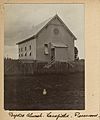
Lanefield Baptist Church, circa 1905
,_circa_1905.jpg)

All content from Kiddle encyclopedia articles (including the article images and facts) can be freely used under Attribution-ShareAlike license, unless stated otherwise. Cite this article:
Lanefield, Queensland Facts for Kids. Kiddle Encyclopedia.