Laporte, Pennsylvania facts for kids
Quick facts for kids
Laporte, Pennsylvania
|
||
|---|---|---|
|
Borough
|
||

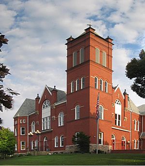
The Sullivan County Courthouse, built 1894, in Laporte
|
||
|
||

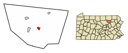
Location of Laporte in Sullivan County, Pennsylvania.
|
||
| Country | United States | |
| State | Pennsylvania | |
| County | Sullivan | |
| Settled | 1850 | |
| Incorporated (borough) | 1853 | |
| Area | ||
| • Total | 1.23 sq mi (3.19 km2) | |
| • Land | 1.07 sq mi (2.76 km2) | |
| • Water | 0.16 sq mi (0.42 km2) | |
| Elevation | 1,972 ft (601 m) | |
| Population
(2010)
|
||
| • Total | 316 | |
| • Estimate
(2019)
|
298 | |
| • Density | 279.03/sq mi (107.78/km2) | |
| Time zone | Eastern (EST) | |
| • Summer (DST) | EDT | |
| ZIP code |
18626
|
|
| Area code(s) | 570 Exhange: 946 | |
| FIPS code | 42-41512 | |
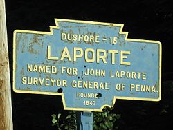
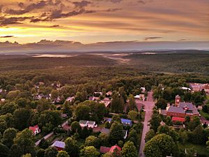
Laporte is a borough in Sullivan County, Pennsylvania, United States. The population was 316 at the 2010 census. It is the county seat of Sullivan County. Laporte is surrounded by Laporte Township. It was named for John Laporte. It is the smallest county seat in Pennsylvania by population (as of the 2000 Census), and in 1969 was one of the two smallest in the United States.
Contents
History
The Sullivan County Courthouse was added to the National Register of Historic Places in 1978.
Geography
According to the United States Census Bureau, the borough has a total area of 1.3 square miles (3.4 km2), of which 1.1 square miles (2.8 km2) is land and 0.2 square miles (0.52 km2) (12.50%) is water. Within the borough lies Lake Mokoma.
Demographics
|
||||||||||||||||||||||||||||||||||||||||||||||||||||||||||||||||||||||||||||||||
At the 2010 census, there were 316 people, 109 households, and 67 families residing in the borough. The population density was 287.3 people per square mile (112.2/km2). There were 251 housing units at an average density of 228.2 per square mile (89.1/km2). The racial makeup of the borough was 98.1% White, 0.6% African American, 0.9% Native American, and 0.3% Asian. Hispanics or Latinos of any race makes up 0.9% of the borough population.
Of the 109 households, 14.7% had children under the age of 18 living with them, 54.1% were married couples living together, 3.7% had a female householder with no husband present, and 38.5% were non-families. 34.9% of households were one person, and 22% were one person aged 65 or older. The average household size was 2.01 and the average family size was 2.54.
In the borough the population was spread out, with 8.5% under the age of 18, 49.1% from 18 to 64, and 42.4% 65 or older. The median age was 61.7 years.
The median household income was $43,750 and the median family income was $52,500. Males had a median income of $30,625 versus $25,500 for females. The per capita income for the borough was $18,762. About 3.6% of families and 7.4% of the population were below the poverty line, including 10.9% of those under the age of eighteen and none of those 65 or over.
See also
 In Spanish: Laporte (Pensilvania) para niños


