Laupen District facts for kids
Quick facts for kids
Laupen District
Amtsbezirk Laupen
|
|
|---|---|
|
District
|
|
 |
|
| Country | |
| Canton | |
| Capital | Laupen |
| Area | |
| • Total | 88 km2 (34 sq mi) |
| Population
(2007)
|
|
| • Total | 14,482 |
| • Density | 164.6/km2 (426.2/sq mi) |
| Time zone | UTC+1 (CET) |
| • Summer (DST) | UTC+2 (CEST) |
| Municipalities | 11 |
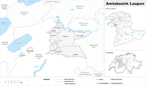
Laupen District was one of the 26 administrative districts in the canton of Bern, Switzerland. Its capital was the municipality of Laupen. The district had an area of 88 km² and consisted of 11 municipalities:
| Municipality | Population (Dec 2007) | Area (km²) |
|---|---|---|
| Clavaleyres | 50 | 1.0 |
| Ferenbalm | 1,252 | 9.2 |
| Frauenkappelen | 1,270 | 9.3 |
| Golaten | 307 | 2.8 |
| Gurbrü | 267 | 1.8 |
| Kriechenwil | 398 | 4.8 |
| Laupen | 2,777 | 4.1 |
| Mühleberg | 2,664 | 26.3 |
| Münchenwiler | 409 | 2.5 |
| Neuenegg | 4,678 | 22.0 |
| Wileroltigen | 410 | 4.1 |
The municipalities of Clavaleyres and Münchenwiler are enclaved within the canton of Fribourg.
See also
 In Spanish: Distrito de Laupen para niños

All content from Kiddle encyclopedia articles (including the article images and facts) can be freely used under Attribution-ShareAlike license, unless stated otherwise. Cite this article:
Laupen District Facts for Kids. Kiddle Encyclopedia.
