Leskov Island facts for kids
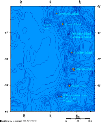
Leskov Island is a small uninhabited island in the Traversay Islands group of the South Sandwich Islands. It is less than 1 nautical mile (2 km) long, and lies 30 nautical miles (56 km) west of Visokoi Island. It was discovered in 1819 by a Russian expedition under Fabian Gottlieb von Bellingshausen, who named it for the third lieutenant on the expedition ship Vostok.
Leskov is located to the west of the main island arc of the South Sandwich Islands, and is composed of andesitic rather than basaltic lava with its highest peak reaching 190 metres (620 ft). The subduction zone forming the South Sandwich Trench lies to the east of the island arc.
The island is small and has only two named features, both named by the UK Antarctic Place-Names Committee in 1971. Bowsprit Point is the island's northeast point, named for its resemblance to a bowsprit, or prow of a ship. Rudder Point is the island's high, rocky southeast point, named in association with Bowsprit (as a rudder is at the opposite end of a ship from the bowsprit).
See also
 In Spanish: Isla Leskov para niños


