
Leslie Street Spit facts for kids

The Leslie Street Spit, or officially the Outer Harbour East Headland, is a man-made headland in Toronto, Ontario, Canada, extending from the city's east end in a roughly southwesterly direction into Lake Ontario. It is about 5 kilometres (3 mi) long. The Spit is the result of five decades of lakefilling by the Toronto Port Authority. It was conceived as an extension of Toronto Harbour, and has evolved into a largely passive recreation area. Naturalization had not been planned but the process is now actively managed by the Toronto Region Conservation Authority. A large portion of it is classified as an Environmentally Sensitive Area (ESA) and it is recognized as an Important Bird Area.
Its common name is technically incorrect, since it is not truly a spit, but Torontonians almost never use the official name. The road running along the peninsula is a southern extension of Leslie Street, hence the popular nickname.
Contents
History

The Spit is a man-made landfill that began in the 1950s when the Toronto Harbour Commission began a project to create a breakwater for Toronto's Outer Harbour. It was part of a plan to expand the capacity of the harbour in anticipation of an expected increase in shipping traffic on the Great Lakes after the Saint Lawrence Seaway opened in 1959. However, owing to the containerization revolution of the 1960s, cargo traffic began to shift to East Coast ports, and shipping volumes in Toronto fell by almost half between 1969 and 1973. Thus, the need for an outer harbour never arose, and all cargo ships calling at Toronto still use the Inner Harbour, while the Outer Harbour sees only pleasure boat traffic.
While the original need for the landform was eliminated, the site continued to receive excavation and construction waste from the building of Toronto's subways, office towers and other large projects. In the late 1970s, dredgeate from the nearby Keating Channel was also dumped on the emerging spit, which was seen as a better solution than dumping the polluted material into open water. Dredging is an ongoing process and PortsToronto continues to dump silt and mud in the Spit's embayments.
In the early 1970s, the Spit was one of up to a dozen landfill parks across the Toronto-area shoreline planned by the Toronto and Region Conservation Authority (TRCA, but then known as the Metropolitan Toronto Regional Conservation Authority). It began as a long, slender finger of bare land stretching out into the lake, and developed several lobes enclosing small bays. It was eventually colonized by a variety of plant life.
Land title
Because it was newly created land, it was owned by the Crown and held by the provincial Ministry of Natural Resources (MNR). The land set aside for the park was transferred to the TRCA in 1984. However, the MNR retains ownership of the active landfill portion of the spit.
Friends of the Spit
The Leslie Street Spit's evolution into an urban wilderness was never in the city's plans. The spit's status as such was secured by a number of organizations, with the citizens' advocacy group known as Friends of the Spit at the forefront of advocacy to naturalize the site.
Structure

The inner part of the Spit consists of three embayments. These were designed to hold dredged material from the Inner Harbour and the Keating Channel. The first embayment has now been filled. It has been capped with clean fill and is being restored by the TRCA as a marsh. The remaining two embayments have about 50 years' capacity remaining. Between the Port Lands and the Spit lies the Outer Harbour. Part of this body of water was once the edge of a marsh that was part of Ashbridge's Bay.
In the early 1980s, construction of an endikement on the eastern side of the embayments began. The endikement is designed as a rigid breakwater that protects the embayments and also deflects substantial sediment from the Inner Harbour.
Access
As late as 1973, there was no formal access to the Spit, although visits could be arranged with the Toronto Harbour Commission. However, by the summer of 1974, the Toronto Harbour Commission was providing bus service to the Spit on Sunday afternoons.
The Spit is open to the public from 5:30 am. to 9:00 p.m. on weekends and statutory holidays (with the exception of Christmas Day, Boxing Day and New Years Day), and from 4:00 p.m. to 9:00 p.m. on weekdays. It is closed during the day on weekdays owing to the ongoing construction of the spit, conducted by PortsToronto.
The Leslie Street Spit is a car-free area when the park is open, with strictly controlled vehicle access to the mooring area when the park is closed. The Spit's outermost end is known as Vicki Keith Point, after a famous Canadian swimmer. There has been an automated lighthouse there since 1974.
Tommy Thompson Park
The northern half of the Spit has been designated as Tommy Thompson Park, named after a former Toronto Parks Commissioner, and managed by the TRCA. The southern half is still an active dumping zone, managed by PortsToronto. Eventually the entire Spit will become parkland.
.jpg)
Important bird area

Quite a number of bird species are found on the Leslie Street Spit. More than 300 species of birds have been identified, 45 of which breed on the headland. Among the birds that may be observed on the headland are the ring-billed gull, the black-crowned night-heron, the double-crested cormorant, the common tern, the Caspian tern, and the herring gull.
Owing to the Leslie Street Spit's importance to so many bird species, it has been designated an Important Bird Area (IBA) by Nature Canada and Bird Studies Canada which are the Canadian partners of BirdLife International. Peninsula D has also become the site of a comprehensive bird research station, run by the TRCA. The Tommy Thompson Park Bird Research Station operates seven days a week during spring and fall migration, and runs other projects within the Greater Toronto Area throughout the rest of the year. Visitors to the station are welcome on weekends when the park is open.
Images for kids
-
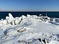
Rubble and other human-made artifacts covered by winter ice at the Leslie Spit.
-
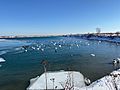
Swans, ducks, and other birds basking in the sun at the Leslie Spit in winter.
-
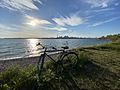
The Leslie Spit in late spring looking across the Main Harbour Channel towards the Toronto skyline.
-
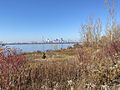
Looking towards downtown Toronto from the Leslie Spit in autumn.
-
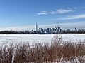
The Leslie Spit in winter looking towards downtown Toronto.
-
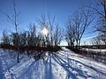
View of the setting sun from the Leslie Spit in winter
-

Northern Sawhet Owl
-
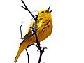
Warbler singing
-
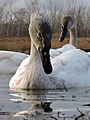
Curious young swan
-
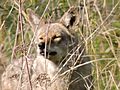
Dominant male coyote
-

Sawhet Owl
-

Moss-covered dragonfly
_in_winter.jpg)
.jpg)

_in_Autumn.jpg)
.jpg)
_in_the_winter.jpg)


