Lewis County, Tennessee facts for kids
Quick facts for kids
Lewis County
|
|
|---|---|

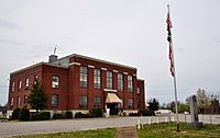
Lewis County Courthouse, April 2014
|
|

Location within the U.S. state of Tennessee
|
|
 Tennessee's location within the U.S. |
|
| Country | |
| State | |
| Founded | December 23, 1843 |
| Named for | Meriwether Lewis |
| Seat | Hohenwald |
| Largest city | Hohenwald |
| Area | |
| • Total | 282 sq mi (730 km2) |
| • Land | 282 sq mi (730 km2) |
| • Water | 0.4 sq mi (1 km2) 0.1%% |
| Population
(2020)
|
|
| • Total | 12,582 |
| • Density | 43/sq mi (17/km2) |
| Time zone | UTC−6 (Central) |
| • Summer (DST) | UTC−5 (CDT) |
| Congressional district | 7th |
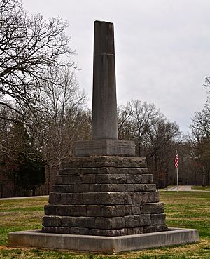
Lewis County is a county located in the U.S. state of Tennessee. As of the 2010 census, the population was 12,161. Its county seat is Hohenwald. The county is named for explorer Meriwether Lewis, who died and was buried at Grinder's Stand near Hohenwald in 1809.
Contents
History

Lewis County was formed in 1843 from parts of Perry, Hickman, Lawrence, Maury and Wayne counties. It was named for explorer Meriwether Lewis of the Lewis and Clark expedition. Lewis's grave is located at the geographic center of the county. The bill for its creation was proposed by Powhatan Gordon in the Tennessee State Senate.
On October 7, 2009, a ceremony was held at the cemetery to commemorate the bicentennial of Lewis's death. A bust of Lewis was presented to the National Park Service, which manages the site.
Geography
According to the U.S. Census Bureau, the county has a total area of 282 square miles (730 km2), of which 282 square miles (730 km2) is land and 0.4 square miles (1.0 km2) (0.1%) is water.
Adjacent counties
- Hickman County (north)
- Maury County (east)
- Lawrence County (south)
- Wayne County (southwest)
- Perry County (west)
National protected area
- Natchez Trace Parkway (part)
State protected areas
- Auntney Hollow State Natural Area
- Devil's Backbone State Natural Area
- Dry Branch State Natural Area
- Hick Hill Wildlife Management Area
- Langford Branch State Natural Area
- Laurel Hill Wildlife Management Area
- Lewis State Forest
Demographics
| Historical population | |||
|---|---|---|---|
| Census | Pop. | %± | |
| 1850 | 4,438 | — | |
| 1860 | 2,241 | −49.5% | |
| 1870 | 1,986 | −11.4% | |
| 1880 | 2,181 | 9.8% | |
| 1890 | 2,555 | 17.1% | |
| 1900 | 4,455 | 74.4% | |
| 1910 | 6,033 | 35.4% | |
| 1920 | 5,707 | −5.4% | |
| 1930 | 5,258 | −7.9% | |
| 1940 | 5,849 | 11.2% | |
| 1950 | 6,078 | 3.9% | |
| 1960 | 6,269 | 3.1% | |
| 1970 | 6,761 | 7.8% | |
| 1980 | 9,700 | 43.5% | |
| 1990 | 9,247 | −4.7% | |
| 2000 | 11,367 | 22.9% | |
| 2010 | 12,161 | 7.0% | |
| 2020 | 12,582 | 3.5% | |
| U.S. Decennial Census 1790-1960 1900-1990 1990-2000 2010-2014 |
|||
2020 census
| Race | Number | Percentage |
|---|---|---|
| White (non-Hispanic) | 11,510 | 91.48% |
| Black or African American (non-Hispanic) | 184 | 1.46% |
| Native American | 31 | 0.25% |
| Asian | 55 | 0.44% |
| Pacific Islander | 5 | 0.04% |
| Other/Mixed | 471 | 3.74% |
| Hispanic or Latino | 326 | 2.59% |
As of the 2020 United States census, there were 12,582 people, 4,715 households, and 3,175 families residing in the county.
Communities
City
- Hohenwald (county seat)
Census-designated place
Unincorporated communities
- Aethra
- Bachelder
- Blondy
- Buffalo Valley
- Gordonsburg
- Kimmins
- Kitchens
- Lomax Crossroads
- Metal Ford
- Napier
- Oak Grove
- Providence
- Riverside
- Ruppertown
- Salem
- Shubert
- Sweetwater
- Theodore
- Voorhies
- West Hohenwald
Education
The county is served by Lewis County High School.
See also
 In Spanish: Condado de Lewis (Tennessee) para niños


