Liddington Castle facts for kids
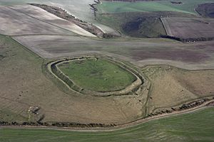
Aerial photograph of Liddington Castle
|
|
| Alternative name | Liddington Camp |
|---|---|
| Coordinates | 51°30′57″N 1°42′01″W / 51.51584°N 1.70020°W |
| OS grid reference | SU209797 |
| Altitude | 277 m (909 ft) |
| Part of | The Ridgeway |
| Area | 3 hectares (7.4 acres) |
| History | |
| Founded | 7th Century BC |
| Periods | Late Bronze Age and Iron Age |
| Site notes | |
| Excavation dates | 1976 |
| Public access | yes |
| Designation | Scheduled Monument Number 1016312 |
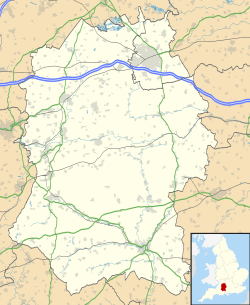
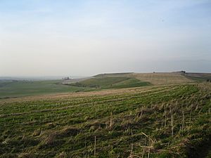
Liddington Castle, locally called Liddington Camp, is a late Bronze Age and early Iron Age univallate hill fort in the English county of Wiltshire. At 277 metres (909 ft), it is the highest point in the Borough of Swindon.
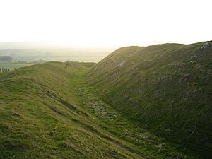
It is sited on a commanding high point close to The Ridgeway and covers an area of 3 hectares (7.4 acres). Liddington Castle was one of the earliest hill forts in Britain, with first occupation dating to the 7th century BC. The earthworks consist of a relatively simple oval bank of timber and earth fronted by a ditch, with opposing causewayed entrances on the east and west sides. The western entrance was later blocked off and the eastern one may have been lined with sarsen stones. A palisade of wooden posts may have lined the top of the bank. During a later phase the bank and ditch were improved and a rampart of dumped chalk, excavated from the enlarged ditch, increased the height of the bank.
The site was disturbed by flint mining between 1896 and 1900. The archaeologist A. D. Passmore collected "everything of human manufacture which was found" during this period, and the artefacts were deposited in the Ashmolean Museum. Passmore wrote about these findings in the Wiltshire Archaeological and Natural History Magazine in 1914 (issue 38).
The hillfort was partially excavated in 1976 (sponsored by Lamar University and University of Birmingham). The excavation revealed a large pit 1.5 metres (4 ft 11 in) in diameter and at least 2.4 metres (7 ft 10 in) deep. The bottom of the feature was not reached and it was interpreted by the archaeologists who dug it as a ritual shaft. Similar shafts have been recorded at Wapley Hill in Herefordshire and Cadbury Castle in Devon. The excavation also suggested the rampart was constructed in four phases, the latest being in during the Saxon period. Finds of pottery suggest Liddington Castle was abandoned during the fifth century BC, with perhaps some later re-occupation during the Roman period. The excavation uncovered four fragments of human bone.
Liddington Castle is sometimes suggested as a possible site of Mount Badon and thus the location of the late fifth-century AD Battle of Mount Badon mentioned in Gildas's De Excidio et Conquestu Britanniae, Nennius's Historia Brittonum and Annales Cambriae. There is, however, no archaeological evidence to indicate activity during this later period.
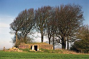
During World War 2, the hilltop surrounding Liddington Castle was used as a Starfish site (bombing decoy designed to appear as a burning town or city). Evidence of this use remains in the form of the surviving command bunker, located 1 kilometre (0.62 mi) north-east of the fort, and a metal trough used to simulate explosions and fire.
Liddington Castle was the favourite haunt of local writer of natural history and rural life, Richard Jefferies, who spent much of his spare time walking through the wide chalk expanses of the Marlborough Downs. It was on this summit that he relates in The Story of My Heart that his unusual sensitivity to nature began to induce in him a powerful inner awakening - a desire for a larger existence or reality.
Images for kids


