List of State Register of Heritage Places in the City of Albany facts for kids
The State Register of Heritage Places is maintained by the Heritage Council of Western Australia. As of 2023[update], 471 places are heritage-listed in the City of Albany, of which 95 are on the State Register of Heritage Places.
List
The Western Australian State Register of Heritage Places, as of 2023[update], lists the following 95 state registered places within the City of Albany:
| Place name | Place # | Street number | Street name | Suburb or town | Co-ordinates | Notes & former names | Photo |
|---|---|---|---|---|---|---|---|
| St Joseph's Convent (former) | 1 | 142-152 | Aberdeen Street | Albany | 35°01′16″S 117°53′07″E / 35.021129°S 117.885320°E | St Joseph's School for Young Ladies, Community Centre | 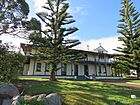 |
| St Joseph's Church, Bell & Belltower | 2 | 120-140 | Aberdeen Street | Albany | 35°01′18″S 117°53′08″E / 35.02166°S 117.885417°E | 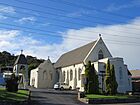 |
|
| The Albany Club | 3 | 23 | Aberdeen Street | Albany | 35°01′31″S 117°53′06″E / 35.025141°S 117.884909°E | Aberdeen House, Residence (former) | 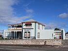 |
| Albany State School Group (former) | 16 | 117-121 | Serpentine Road | Albany | 35°01′22″S 117°52′57″E / 35.02267°S 117.882631°E | Albany State School, Albany Infants School, Educational Resources Centre, Albany Primary School |  |
| Camfield House | 17 | 172 | Serpentine Road | Albany | 35°01′12″S 117°52′42″E / 35.02°S 117.878234°E | Annesfield |  |
| Patrick Taylor Cottage | 19 | 37-39 | Duke Street | Albany | 35°01′37″S 117°52′52″E / 35.027006°S 117.881087°E | Albany Historical Society Folk Museum | 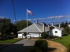 |
| Wollaston House | 20 | 54 | Duke Street | Albany | 35°01′36″S 117°52′48″E / 35.026651°S 117.879917°E | 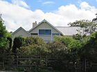 |
|
| Wesley Church Group, Albany | 21 | 12 | Duke Street | Albany | 35°01′34″S 117°52′51″E / 35.02615°S 117.88086°E | Methodist Church | 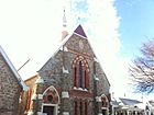 |
| Albany Masonic Hall | 23 | 58-60 | Spencer Street | Albany | 35°01′32″S 117°53′16″E / 35.025504°S 117.887825°E | Old Masonic Hall, Plantagenet Lodge No 1454 |  |
| Albany Forts | 26 | 7 | Forts Road | Mount Clarence | 35°01′51″S 117°54′40″E / 35.030722°S 117.91125°E | Nissen Hut, Princess Royal Battery/Barracks |  |
| The Rocks | 28 | 182-188 | Grey Street | Albany | 35°01′27″S 117°52′38″E / 35.02414°S 117.87717°E | Government House, Government Cottage | 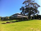 |
| Melville House | 29 | 5-9 | Hotchin Avenue | Albany | 35°01′23″S 117°52′50″E / 35.023044°S 117.880676°E | J.F.T. Hassell's Home | 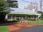 |
| Old Albany Post Office | 30 | 33 | Stirling Terrace | Albany | 35°01′39″S 117°53′14″E / 35.0275°S 117.8871°E | Penny Post, Custom's House |  |
| Matthew Cull's House | 31 | 250 | Middleton Road | Albany | 35°01′00″S 117°53′32″E / 35.016606°S 117.892167°E | ||
| Strawberry Hill Farm & Gardens | 32 | 168-170 | Middleton Road | Albany | 35°01′05″S 117°54′01″E / 35.018194°S 117.900139°E | Old Farm, Strawberry Hill | 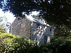 |
| Desert Mounted Corps Memorial | 34 | Apex Driveive | Albany | 35°01′31″S 117°53′46″E / 35.025352°S 117.896037°E | Lone Pine Memorial | 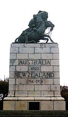 |
|
| Old Gaol, Albany | 37 | 2-4 | Parade Street | Albany | 35°01′42″S 117°52′48″E / 35.0283°S 117.8801°E | 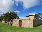 |
|
| Residency Museum | 39 | Residency Road | Albany | 35°01′43″S 117°52′51″E / 35.028642°S 117.880828°E | 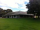 |
||
| Major Lockyer Memorial | 40 | 2-4 | Princess Royal Drive | Albany | 35°01′45″S 117°52′51″E / 35.029041°S 117.880851°E |  |
|
| House, 25 Rowley Street | 42 | 25 | Rowley Street | Albany | 35°01′25″S 117°53′16″E / 35.023702°S 117.887764°E | ||
| Albany Pilot Station (former) | 43 | Semaphore Point | Albany | 35°02′10″S 117°54′40″E / 35.036102°S 117.911203°E | Pilots' Houses | ||
| Pyrmont | 44 | 110 | Serpentine Road | Mira Mar | 35°01′18″S 117°52′55″E / 35.021627°S 117.882009°E |  |
|
| Hawthorndene | 46 | 22-26 | Seymour Street | Albany | 35°01′03″S 117°54′12″E / 35.017482°S 117.90327°E | ||
| Sir Richard & Lady Spencer's Grave | 48 | 39 | Seymour Street | Albany | 35°00′57″S 117°54′09″E / 35.0158°S 117.902394°E | ||
| Albany Court House Complex | 51 | 184-190 | Stirling Terrace | Albany | 35°02′S 117°53′E / 35.03°S 117.88°E | Police Station & Court House, Public Works, Albany Justice Complex |  |
| Drew Robinson & Co (former) | 52 | 82-84 | Stirling Terrace | Albany | 35°01′36″S 117°53′09″E / 35.0268°S 117.8857°E | Albany Light Opera Company Building, Dylan's on the Tce, Adelaide Steamship Co Bld | 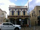 |
| Rotunda | 53 | Stirling Terrace | Albany | 35°01′38″S 117°53′07″E / 35.0272°S 117.8853°E | Queen's Park Rotunda & Gardens, Jubilee Bandstand |  |
|
| Albany House | 58 | 119-125 | York Street | Albany | 35°02′S 117°53′E / 35.03°S 117.88°E | Western QBE Insurance, Union Bank; ANZ Bank | 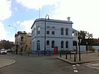 |
| Argyle House | 59 | 42-50 | Stirling Terrace | Albany | 35°01′38″S 117°53′12″E / 35.02723°S 117.8868°E | 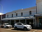 |
|
| Western Australian Bank (former) | 60 | 142-144 | Stirling Terrace | Albany | 35°01′36″S 117°53′03″E / 35.026777°S 117.884294°E | Gt Southern Development Commission, Haynes Robinson, Bank of New South Wales- NSW | 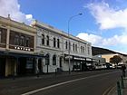 |
| Ballybane Tearooms (former) | 61 | 168-180 | Stirling Terrace | Albany | 35°01′36″S 117°52′57″E / 35.026798°S 117.882622°E | R Bell & Co Store, Backerei und Konditorei | 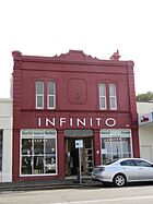 |
| Glasgow House | 62 | 56-58 | Stirling Terrace | Albany | 35°01′37″S 117°53′11″E / 35.026943°S 117.886424°E | 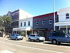 |
|
| Edinburgh House | 63 | 52-54 | Stirling Terrace | Albany | 35°01′37″S 117°53′12″E / 35.026959°S 117.886533°E |  |
|
| National Bank (former) | 64 | 86-94 | Stirling Terrace | Albany | 35°01′36″S 117°53′08″E / 35.026724°S 117.88562°E | Vancouver Guest House & Cafe |  |
| Royal George Hotel | 65 | 60-70 | Stirling Terrace | Albany | 35°01′37″S 117°53′11″E / 35.02705°S 117.8865°E | 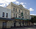 |
|
| Edward Barnett & Co Building (former) | 66 | 96-102 | Stirling Terrace | Albany | 35°01′35″S 117°53′08″E / 35.026524°S 117.885449°E | The Terrace Centre, Commercial Building |  |
| White Star Hotel | 67 | 72-80 | Stirling Terrace | Albany | 35°01′36″S 117°53′10″E / 35.0268°S 117.8861°E | White Hart Hotel site | 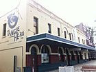 |
| Buildings | 68 | Corner | Stirling Terrace & Spencer Street | Albany | 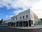 |
||
| Vancouver Arts Centre Group | 69 | 77-87 | Vancouver Street | Albany | 35°01′35″S 117°52′29″E / 35.026389°S 117.874722°E | Albany Cottage Hospital |  |
| St John's Church | 71 | York Street | Albany | 35°01′24″S 117°52′59″E / 35.02325°S 117.883167°E | Church of St John the Evangelist |  |
|
| St John's Rectory | 73 | York Street | Albany | 35°01′32″S 117°52′58″E / 35.025571°S 117.882676°E | Rectory of St. John's Anglican Church |  |
|
| Albany Town Hall | 74 | 217 | York Street | Albany | 35°01′24″S 117°52′59″E / 35.023417°S 117.883167°E | 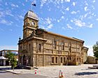 |
|
| Law Offices (former), Albany | 75 | 133-135 | York Street | Albany | 35°01′35″S 117°53′00″E / 35.026405°S 117.883348°E | York House, Offices |  |
| Empire Buildings | 77 | 146-152 | Stirling Terrace | Albany | 35°01′36″S 117°53′02″E / 35.02672°S 117.88394°E |  |
|
| Scots Uniting Church | 78 | 168-174 | York Street | Albany | 35°01′30″S 117°53′03″E / 35.024873°S 117.884052°E | Scots Church, Presbyterian Church | 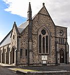 |
| Taxi Rank & Women's Rest Room | 79 | 826 | Stirling Terrace | Albany | 35°01′38″S 117°52′59″E / 35.027188°S 117.883096°E | Cabmen's Shelter, Victoria Square | 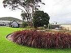 |
| Quaranup Complex | 84 | Quaranup Road, Geak Point, on the Vancouver Peninsula | Albany | 35°03′09″S 117°54′49″E / 35.052417°S 117.9135°E | Quarantine Station, Camp Quaranup | 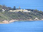 |
|
| Lower Kalgan River Bridge & Jetty Group | 89 | Albany-Nanarup Road | Kalgan | 34°56′55″S 117°58′41″E / 34.948525°S 117.97799°E | The Fruit Landing, Kalgan Bridge MRWA 4332 | 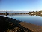 |
|
| Albany Fish Ponds | 109 | Festing Street | Mount Melville | 35°01′32″S 117°52′12″E / 35.025511°S 117.870018°E | Hares Folly, Maley's Stream | ||
| Whaling Station (former), Cheyne Beach | 1796 | Hassell Beach | Albany | 34°52′47″S 118°24′30″E / 34.879647°S 118.408447°E | |||
| Albany Snake Run Skateboard Park | 1972 | 162 | Hare Street | Mount Clarence | 35°01′10″S 117°53′52″E / 35.0195°S 117.897861°E | Snake Run Skate Park, Skateboard Track | 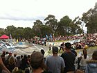 |
| Whaling Cove (Ruins) | 2994 | Barker Bay, access by Quaranup Road | Albany | 35°03′24″S 117°55′36″E / 35.05669°S 117.926667°E | The Fisheries | ||
| Point King Lighthouse Ruin | 3212 | Point King | Albany | 35°02′06″S 117°55′06″E / 35.035028°S 117.91825°E | 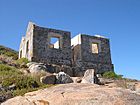 |
||
| Albany Deepwater Jetty | 3238 | Princess Royal Harbour | Albany | 35°01′54″S 117°53′10″E / 35.031529°S 117.886246°E | |||
| Albany Railway Station & Bond Store | 3262 | 43-77 | Proudlove Parade | Albany | 35°01′41″S 117°53′10″E / 35.027974°S 117.885978°E | Bonded Store, Luggage Room, Railway Institute, Tourist Bureau | 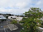 |
| London Hotel | 3339 | 160-162 | Stirling Terrace | Albany | 35°01′36″S 117°52′59″E / 35.0268°S 117.8831°E |  |
|
| Sealers' Oven | 3343 | Waychinicup National Park | 34°53′41″S 118°20′02″E / 34.894611°S 118.333972°E | ||||
| Breaksea Island and Lighthouse | 3353 | King George Sound | Albany | 35°03′48″S 118°03′16″E / 35.063292°S 118.05447°E |  |
||
| 1915 Block, Albany Primary School | 3463 | 70-88 | Albany Highway | Centennial Park | 35°01′09″S 117°52′53″E / 35.019294°S 117.881318°E | Albany Junior Primary School, Albany Infants' School | |
| St John's Church Group | 3514 | 149-163 | York Street | Albany | 35°01′32″S 117°52′58″E / 35.025686°S 117.882781°E | Church, Rectory & Peppermint Trees |  |
| Albany Co-operative Society Building (former) | 3555 | 46 | Frederick Street | Albany | 35°01′34″S 117°53′14″E / 35.026027°S 117.887133°E | Albany Historical Society Headquarters, Former Albany Co-op, Alcona Guest House, P&O, Railway Barracks (former) |  |
| Hillside | 3572 | 6 | Cliff Street | Albany | 35°01′21″S 117°52′42″E / 35.022399°S 117.878211°E | Hillside Lodge | |
| Albany Town Jetty | 3607 | Lot 580 | Princess Royal Drive | Albany | 35°01′54″S 117°53′11″E / 35.031774°S 117.886416°E | ||
| Cheynes Beach Whaling Station | 3644 | Frenchman Bay, King George Sound | Albany | 35°05′41″S 117°57′35″E / 35.094722°S 117.959722°E | Whaleworld, Albany Whaling Station |  |
|
| Ballymena | 3919 | Willyung Road | King River | 34°56′13″S 117°53′55″E / 34.936809°S 117.898615°E | Ardens Gardens, Strathmore | ||
| Albany Golf Course | 4177 | 164 | Golf Links Roads, Seppings & Collingwood Park | Albany | 35°00′46″S 117°55′08″E / 35.01272°S 117.918799°E | Albany Park, Albany Golf Links |  |
| Albany Fire Station & Fire Officer's House | 4276 | 71 | Collie Street | Albany | 35°01′29″S 117°52′54″E / 35.024766°S 117.881632°E | 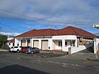 |
|
| WA Christmas Tree | 4344 | Corner | Suffolk Street & Middleton Road | Albany | 35°01′03″S 117°53′24″E / 35.017396°S 117.889971°E | Nyutsia floribunda | |
| Stirling Terrace Precinct, Albany | 14922 | Stirling Terrace | Albany | 35°01′37″S 117°53′06″E / 35.027038°S 117.884873°E |  |
||
| Lower Kalgan River Road Bridge | 15422 | Albany-Nanarup Road | Lower Kalgan | 34°56′55″S 117°58′43″E / 34.948615°S 117.978566°E | Old WAGR 4332 |  |
|
| St Joseph's Lodge (former) | 15433 | 154-160 | Aberdeen Street | Albany | 35°01′14″S 117°53′07″E / 35.020684°S 117.885365°E | New Camfield House, Former Clergy Housing |  |
| Lockup & Residence | 15451 | 35 | Collie Street | Albany | 35°01′37″S 117°52′56″E / 35.026879°S 117.882185°E | Part of the Albany Court House Complex (51) |  |
| House | 15468 | 184-210 | Stirling Terrace | Albany | 35°01′35″S 117°52′55″E / 35.026458°S 117.881920°E | 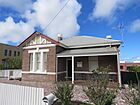 |
|
| Residence, 206 Grey Street, Albany | 15495 | 206 | Grey Street | Albany | 35°01′30″S 117°52′31″E / 35.024996°S 117.875143°E | ||
| Mouchemore's Cottage and Net Shed, Albany | 15513 | 1 | Parade Street | Albany | 35°01′44″S 117°52′47″E / 35.028856°S 117.8796°E |  |
|
| Everett Buildings | 15548 | 34-40 | Stirling Terrace | Albany | 35°01′38″S 117°53′13″E / 35.02721°S 117.88697°E | Shops & Albany Backpackers, Tree of Life | 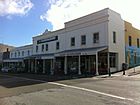 |
| Commercial Building | 15550 | 104-106 | Stirling Terrace | Albany | 35°01′37″S 117°53′07″E / 35.026881°S 117.885202°E | Albany Curtain Centre | 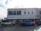 |
| Commercial Building | 15551 | 108-110 | Stirling Terrace | Albany | 35°01′35″S 117°53′07″E / 35.026497°S 117.885213°E | Paint & Protective Coating |  |
| Drew Robinson & Co (former) | 15552 | 130-140 | Stirling Terrace | Albany | 35°01′35″S 117°53′04″E / 35.02642°S 117.884516°E | Harris Scarfe, Boans, Stirlings | 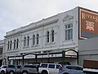 |
| Commercial Building | 15553 | 164-166 | Stirling Terrace | Albany | 35°01′36″S 117°52′59″E / 35.026723°S 117.882941°E | Golf Shop, Liquor Store | |
| Kookas Restaurant Building | 15554 | 204-208 | Stirling Terrace | Albany | 35°01′38″S 117°52′53″E / 35.027222°S 117.881518°E | Resident's House and Commissariat Office | 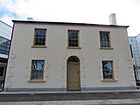 |
| Garryowen | 15562 | 42 | Vancouver Street | Albany | 35°01′31″S 117°52′43″E / 35.025333°S 117.878655°E | ||
| King River Hall | 15588 | Millbrook Road | King River | 34°56′04″S 117°53′45″E / 34.934401°S 117.895924°E | |||
| US Navy Submariners' Memorial, World War II | 15618 | Princess Royal Fortress | Albany | 35°01′53″S 117°54′48″E / 35.031501°S 117.913338°E | Part of Albany Forts Precinct (26) | 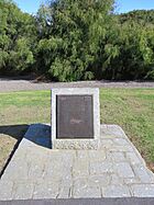 |
|
| Kalgan River Jetty | 15636 | south of the Lower Kalgan River Bridge | Kalgan River Jetty | 34°56′56″S 117°58′38″E / 34.9488°S 117.9772°E | The Fruit Landing, Lower Kalgan Ferry | 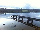 |
|
| Eclipse Island & Lighthouse | 15740 | Eclipse Island | Albany | 35°10′58″S 117°53′12″E / 35.182778°S 117.886667°E |  |
||
| Albany Memorial Park Cemetery | 15756 | 263-275 | Middleton Road | Albany | 35°01′04″S 117°53′22″E / 35.0178°S 117.8894°E | Old Albany Cemetery, Middleton Road Cemetery,, Pioneer Cemetery, Memorial Park Cemetery |  |
| St Joseph's Catholic Church Group | 16297 | 120-160 | Aberdeen Street | Albany | 35°01′18″S 117°53′08″E / 35.02166°S 117.885417°E | St Joseph's School for Young Ladies, St Joseph's Presbytery |  |
| Frenchman Bay Whaling Station (former) | 16612 | Whalers Beach, Frenchman Bay | Albany | 35°05′33″S 117°56′53″E / 35.092619°S 117.948156°E | Norwegian Whaling Station, Whaler's Beach | 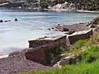 |
|
| Albany Railway Station/Tourist Bureau | 24543 | 45-55 | Proudlove Parade | Albany | 35°01′41″S 117°53′10″E / 35.027974°S 117.885978°E | 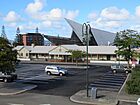 |
|
| Former Headmaster's House | 24544 | 117-121 | Serpentine Road | Albany | 35°01′22″S 117°52′56″E / 35.022881°S 117.882244°E | Governor's Residence | 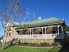 |
| Customs Bonded Warehouse | 24545 | 57-77 | Proudlove Parade | Albany | 35°01′41″S 117°53′11″E / 35.028078°S 117.886505°E | 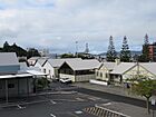 |
|
| Educational Resources Centre | 24547 | 117-121 | Serpentine Road | Albany | 35°01′21″S 117°52′56″E / 35.022441°S 117.882158°E | Albany Primary School | 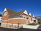 |
| Lower Kalgan Bridge Trusses | 24562 | Nanarup Road | Lower Kalgan | 34°56′54″S 117°58′36″E / 34.948408°S 117.976730°E | 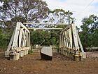 |
||
| Albany Seaboard Bulk Fuel Oil Depot | 26441 | Princess Royal Drive | Albany | 35°01′19″S 117°51′42″E / 35.0218962°S 117.861798°E |

All content from Kiddle encyclopedia articles (including the article images and facts) can be freely used under Attribution-ShareAlike license, unless stated otherwise. Cite this article:
List of State Register of Heritage Places in the City of Albany Facts for Kids. Kiddle Encyclopedia.
