List of World Heritage Sites in Eastern Europe facts for kids
The United Nations Educational, Scientific and Cultural Organization (UNESCO) has designated 77 World Heritage Sites in Western Europe. These sites are in 9 countries. There are eight sites which are shared between countries.
Legend
The list below uses a definition of Western Europe which includes the United Kingdom and Ireland.
- Site – named after the World Heritage Committee's official designation
- Location – sorted by country, followed by the region at the regional or provincial level and geocoordinates. In the case of multinational or multi-regional sites, the names are sorted alphabetically.
- Criteria – as defined by the World Heritage Committee
- Area – in hectares and acres, followed by buffer zones if applicable. A value of zero implies that no data has been published by UNESCO
- Year – during which the site was added to the World Heritage List
- Description – brief information about the site, including reasons for qualifying as an endangered site, if applicable
Sites
* Trans-border site
| Site | Image | Location | Criteria | Area ha (acre) |
Year | Description | Refs |
|---|---|---|---|---|---|---|---|
| Ancient City of Nessebar | 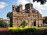 |
Nesebar, Burgas Province, 42°39′22″N 27°43′48″E / 42.65611°N 27.73000°E |
Cultural: (iii), (iv) |
27 (67); buffer zone 1,246 (3,080) | 1983 | ||
| Ancient City of Tauric Chersonese and its Chora | 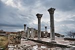 |
Crimea, 44°36′39″N 33°29′29″E / 44.61083°N 33.49139°E |
Cultural: (ii), (v) |
259 (640); buffer zone 3,041 (7,510) | 2013 | ||
| Architectural Ensemble of the Trinity Sergius Lavra in Sergiev Posad | 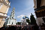 |
Sergiyev Posad, Moscow Oblast, 56°18′37″N 38°7′52″E / 56.31028°N 38.13111°E |
Cultural: (ii), (iv) |
|
1993 | ||
| Architectural, Residential and Cultural Complex of the Radziwill Family at Nesvizh | 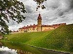 |
Nesvizh, Minsk Region, 53°13′22″N 26°41′29″E / 53.22278°N 26.69139°E |
Cultural: (ii), (iv), (vi) |
|
2005 | ||
| Auschwitz Birkenau, German Nazi Concentration and Extermination Camp (1940–1945) | 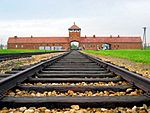 |
Oświęcim County, Lesser Poland, 50°4′0″N 19°21′0″E / 50.06667°N 19.35000°E |
Cultural: (vi) |
|
1979 | ||
| Bardejov | 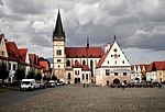 |
Bardejov, Bardejov District, Prešov Region, 49°17′36″N 21°16′45″E / 49.29333°N 21.27917°E |
Cultural: (iii), (iv) |
|
2000 | ||
| Belovezhskaya Pushcha / Białowieża Forest |  |
Grodno Region, 52°30′N 23°35′E / 52.500°N 23.583°E |
Natural: (vii) |
92,669 (228,990) | 1979 | ||
| Boyana Church |  |
Boyana, Sofia, 42°39′0″N 23°16′0″E / 42.65000°N 23.26667°E |
Cultural: (ii), (iii) |
0.68 (1.7); buffer zone 14 (35) | 1979 | ||
| Budapest, including the Banks of the Danube, the Buda Castle Quarter and Andrássy Avenue | 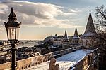 |
Budapest, 47°28′57″N 19°4′14″E / 47.48250°N 19.07056°E |
Cultural: (ii), (iv) |
473 (1,170); buffer zone 494 (1,220) | 1987 | ||
| Castle of the Teutonic Order in Malbork |  |
Malbork, Pomeranian Voivodeship, 54°2′30″N 19°2′0″E / 54.04167°N 19.03333°E |
Cultural: (ii), (iii), (iv) |
18 (44) | 1997 | The Castle in Malbork was built by the Teutonic Knights. | |
| Caves of Aggtelek Karst and Slovak Karst | 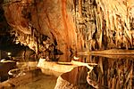 |
Rožňava and Spišská Nová Ves Districts, Košice Region 48°28′33″N 20°29′13″E / 48.47583°N 20.48694°E |
Natural: (vii) |
56,651 (139,990); buffer zone 86,797 (214,480) | 1995 | ||
| Centennial Hall in Wrocław |  |
Wrocław, Lower Silesian Voivodeship, 51°6′25″N 17°4′37″E / 51.10694°N 17.07694°E |
Cultural: (i), (ii), (iv) |
37 (91); buffer zone 190 (470) | 2006 | ||
| Church of the Ascension, Kolomenskoye | 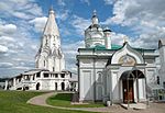 |
Kolomenskoye, Moscow, 55°39′20″N 37°40′26″E / 55.65556°N 37.67389°E |
Cultural: (ii) |
|
1994 | The Church of the Ascension was built in 1532. | |
| Citadel, Ancient City and Fortress Buildings of Derbent |  |
Derbent, Dagestan, 42°3′11″N 48°17′50″E / 42.05306°N 48.29722°E |
Cultural: (iii), (iv) |
9.70 (24.0); buffer zone 2.00 (4.9) | 2003 | ||
| Churches of Moldavia |  |
Suceava County (Moldavia), 47°46′42″N 25°42′46″E / 47.77833°N 25.71278°E |
Cultural: (i), (iv) |
|
1993 | ||
| Churches of Peace in Jawor and Świdnica | 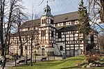 |
Jawor and Świdnica, Lower Silesian Voivodeship, 51°3′15″N 16°11′45″E / 51.05417°N 16.19583°E |
Cultural: (iii), (iv), (vi) |
0.23 (0.57); buffer zone 12 (30) | 2001 | ||
| Cracow's Historic Centre | 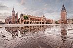 |
Kraków, Lesser Poland, 50°4′0″N 19°57′35″E / 50.06667°N 19.95972°E |
Cultural: (iv) |
150 (370); buffer zone 1,057 (2,610) | 1978 | Kraków Old Town is the historic central district of Kraków, Poland. | |
| Cultural and Historic Ensemble of the Solovetsky Islands |  |
Arkhangelsk Oblast, 65°5′0″N 35°40′0″E / 65.08333°N 35.66667°E |
Cultural: (iv) |
28,834 (71,250) | 1992 | ||
| Curonian Spit |  |
Neringa and Klaipėda district, Klaipėda County, 55°16′28″N 20°57′45″E / 55.27444°N 20.96250°E |
Cultural: (v) |
|
2000 | ||
| Dacian Fortresses of the Orastie Mountains | 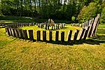 |
Hunedoara and Alba Counties (Transylvania), 45°37′23″N 23°18′43″E / 45.62306°N 23.31194°E |
Cultural: (ii), (iii), (iv) |
|
1999 | ||
| Danube Delta |  |
Tulcea County (Dobruja), 45°5′N 29°30′E / 45.083°N 29.500°E |
Natural: (vii), (x) |
1999 | |||
| Early Christian Necropolis of Pécs (Sopianae) | 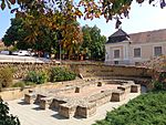 |
Pécs, Baranya County, 46°4′28″N 18°13′40″E / 46.07444°N 18.22778°E |
Cultural: (iii), (iv) |
3.76 (9.3) | 2000 | ||
| Ensemble of the Ferapontov Monastery |  |
Vologda Oblast, 59°57′0″N 38°34′0″E / 59.95000°N 38.56667°E |
Cultural: (i), (iv) |
|
2000 | ||
| Ensemble of the Novodevichy Convent | 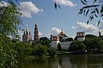 |
Moscow, 55°43′34″N 37°33′18″E / 55.72611°N 37.55500°E |
Cultural: (i), (iv), (vi) |
5.18 (12.8); buffer zone 47 (120) | 2004 | ||
| Fertö / Neusiedlersee Cultural Landscape |  |
Burgenland 47°43′9″N 16°43′22″E / 47.71917°N 16.72278°E |
Cultural: (v) |
52 (130); buffer zone 40 (99) | 2001 | ||
| Gardens and Castle at Kroměříž |
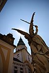 |
Kroměříž, Zlín Region, 49°18′0″N 17°22′38″E / 49.30000°N 17.37722°E |
Cultural: (ii), (iv) |
75 (190); buffer zone 441 (1,090) | 1998 | ||
| Historic and Architectural Complex of the Kazan Kremlin | 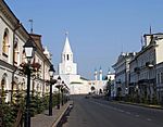 |
Kazan, Tatarstan, 55°47′28″N 49°5′42″E / 55.79111°N 49.09500°E |
Cultural: (ii), (iii), (iv) |
|
2000 | ||
| Historic Centre of Saint Petersburg and Related Groups of Monuments | 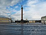 |
Saint Petersburg, 59°57′0″N 30°19′6″E / 59.95000°N 30.31833°E |
Cultural: (i), (ii), (iv), (vi) |
|
1990 | ||
| Historical Centre of the City of Yaroslavl |  |
Yaroslavl, Yaroslavl Oblast, 57°39′10″N 39°52′34″E / 57.65278°N 39.87611°E |
Cultural: (ii), (iv) |
|
2005 | ||
| Historic Centre of Český Krumlov |
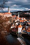 |
Český Krumlov, South Bohemian Region, 48°49′0″N 14°19′0″E / 48.81667°N 14.31667°E |
Cultural: (iv) |
52 (130); buffer zone 1,073 (2,650) | 1992 | ||
| Historic Centre of Prague |  |
Prague, 50°5′23″N 14°25′10″E / 50.08972°N 14.41944°E |
Cultural: (ii), (iv), (vi) |
866 (2,140); buffer zone 8,963 (22,150) | 1992 | ||
| Historic Centre of Sighişoara |
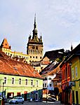 |
Sighișoara, Mureș County (Transylvania), 46°13′4″N 24°47′32″E / 46.21778°N 24.79222°E |
Cultural: (iii), (v) |
|
1999 | ||
| Historic Centre of Telč | 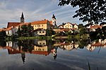 |
Telč, Vysočina Region, 49°34′49″N 15°56′31″E / 49.58028°N 15.94194°E |
Cultural: (i), (iv) |
36 (89); buffer zone 297 (730) | 1992 | ||
| Historic Centre of Warsaw | 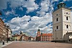 |
Warsaw, Masovian Voivodeship, 52°15′59″N 21°0′42″E / 52.26639°N 21.01167°E |
Cultural: (ii), (vi) |
26 (64) | 1980 | Warsaw's Old Town was established in the 13th century. | |
| Historic Monuments of Novgorod and Surroundings |  |
Novgorod, Novgorod Oblast, 58°32′0″N 31°17′0″E / 58.53333°N 31.28333°E |
Cultural: (ii), (iv), (vi) |
|
1992 | ||
| Historic Town of Banská Štiavnica and the Technical Monuments in its Vicinity | 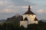 |
Banská Štiavnica and Banská Štiavnica District, Banská Bystrica Region, 48°27′40″N 18°54′0″E / 48.46111°N 18.90000°E |
Cultural: (iv), (v) |
20,632 (50,980); buffer zone 62,128 (153,520) | 1993 | ||
| Holašovice Historical Village Reservation | 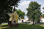 |
Holašovice, Jankov, South Bohemian Region, 48°57′35″N 14°15′10″E / 48.95972°N 14.25278°E |
Cultural: (ii), (iv) |
11 (27); buffer zone 368 (910) | 1998 | ||
| Holy Trinity Column in Olomouc | 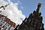 |
Olomouc, Olomouc Region, 49°35′55″N 17°16′10″E / 49.59861°N 17.26944°E |
Cultural: (i), (iv) |
0.02 (0.049) | 2000 | ||
| Hortobágy National Park - the Puszta |
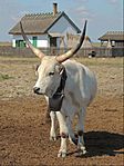 |
Borsod-Abaúj-Zemplén, Heves, Hajdú-Bihar and Jász-Nagykun-Szolnok Counties, 47°35′40″N 21°9′24″E / 47.59444°N 21.15667°E |
Cultural: (iv), (v) |
|
1999 | ||
| Jewish Quarter and St Procopius' Basilica in Třebíč | 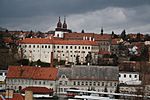 |
Třebíč, Vysočina Region, 49°13′2″N 15°52′44″E / 49.21722°N 15.87889°E |
Cultural: (ii), (iii) |
5.73 (14.2); buffer zone 143 (350) | 2003 | ||
| Kalwaria Zebrzydowska: the Mannerist Architectural and Park Landscape Complex and Pilgrimage Park | 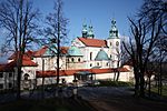 |
Kalwaria Zebrzydowska, Lesser Poland, 49°52′0″N 19°40′0″E / 49.86667°N 19.66667°E |
Cultural: (ii), (iv) |
|
1999 | ||
| Kyiv: Saint-Sophia Cathedral and Related Monastic Buildings, Kyiv-Pechersk Lavra |  |
Kyiv, 50°27′9″N 30°31′1″E / 50.45250°N 30.51694°E |
Cultural: (i), (ii), (iii), (iv) |
29 (72); buffer zone 220 (540) | 1990 | Saint Sophia Cathedral was a cathedral temple of Kyiv in 1037-1299. | |
| Kizhi Pogost | 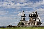 |
Medvezhyegorsky District, Republic of Karelia, 62°4′17″N 35°13′39″E / 62.07139°N 35.22750°E |
Cultural: (i), (iv), (v) |
|
1990 | ||
| Kremlin and Red Square, Moscow | 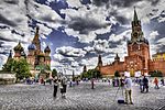 |
Moscow, 55°44′45″N 37°37′47″E / 55.74583°N 37.62972°E |
Cultural: (i), (ii), (iv), (vi) |
|
1990 | ||
| Kutná Hora: Historical Town Centre with the Church of St Barbara and the Cathedral of Our Lady at Sedlec |
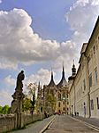 |
Kutná Hora and Kutná Hora District, Central Bohemian Region, 49°11′0″N 15°27′0″E / 49.18333°N 15.45000°E |
Cultural: (ii), (iv) |
62 (150); buffer zone 650 (1,600) | 1995 | ||
| Lednice-Valtice Cultural Landscape | 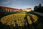 |
Břeclav District, South Moravian Region, 48°46′33″N 16°46′30″E / 48.77583°N 16.77500°E |
Cultural: (i), (ii), (iv) |
14,320 (35,400) | 1996 | ||
| Levoča, Spišský Hrad and the Associated Cultural Monuments |  |
Prešov and Košice Regions, 48°59′58″N 20°46′3″E / 48.99944°N 20.76750°E |
Cultural: (iv) |
1,351 (3,340); buffer zone 12,581 (31,090) | 1993 | ||
| Litomyšl Castle | 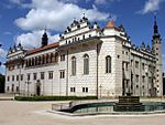 |
Litomyšl, Pardubice Region, 49°52′25″N 16°18′52″E / 49.87361°N 16.31444°E |
Cultural: (ii), (iv) |
|
1999 | ||
| L'viv – the Ensemble of the Historic Centre | 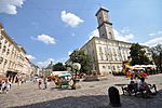 |
Lviv, Lviv Oblast, 49°50′30″N 24°1′55″E / 49.84167°N 24.03194°E |
Cultural: (ii), (v) |
120 (300); buffer zone 2,441 (6,030) | 1998 | ||
| Madara Rider |  |
Madara, Shumen Province, 43°18′0″N 27°9′0″E / 43.30000°N 27.15000°E |
Cultural: (i), (iii) |
1.20 (3.0); buffer zone 502 (1,240) | 1979 | ||
| Medieval Town of Toruń |  |
Toruń, Kuyavian-Pomeranian Voivodeship, 53°0′36″N 18°37′10″E / 53.01000°N 18.61944°E |
Cultural: (ii), (iv) |
48 (120); buffer zone 300 (740) | 1997 | ||
| Millenary Benedictine Abbey of Pannonhalma and its Natural Environment | 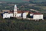 |
Pannonhalma, Győr-Moson-Sopron County, 47°33′32″N 17°47′4″E / 47.55889°N 17.78444°E |
Cultural: (iv), (vi) |
47 (120) | 1996 | ||
| Mir Castle Complex | 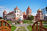 |
Karelichy, Grodno Region, 53°27′4″N 26°28′22″E / 53.45111°N 26.47278°E |
Cultural: (ii), (iv) |
|
2000 | ||
| Monastery of Horezu |  |
Horezu, Vâlcea County (Wallachia), 45°11′0″N 24°1′0″E / 45.18333°N 24.01667°E |
Cultural: (ii) |
22 (54); buffer zone 57 (140) | 1993 | ||
| Muskauer Park / Park Mużakowski | 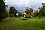 |
Saxony, 51°34′46″N 14°43′35″E / 51.57944°N 14.72639°E |
Cultural: (i), (iv) |
348 (860); buffer zone 1,205 (2,980) | 2004 | ||
| Old City of Zamość | 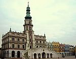 |
Zamość, Lublin Voivodeship, 50°43′0″N 23°16′0″E / 50.71667°N 23.26667°E |
Cultural: (iv) |
75 (190); buffer zone 215 (530) | 1992 | ||
| Old Village of Hollókő and its Surroundings | 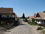 |
Nógrád County, 47°59′40″N 19°31′45″E / 47.99444°N 19.52917°E |
Cultural: (v) |
145 (360) | 1987 | ||
| Pilgrimage Church of St John of Nepomuk at Zelená Hora |
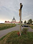 |
Žďár nad Sázavou, Vysočina Region, 49°34′49″N 15°56′31″E / 49.58028°N 15.94194°E |
Cultural: (iv) |
0.64 (1.6); buffer zone 628 (1,550) | 1994 | ||
| Pirin National Park | 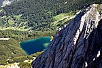 |
Pirin Mountains, Blagoevgrad Province, 41°40′0″N 23°30′0″E / 41.66667°N 23.50000°E |
Natural: (vii), (viii), (ix) |
38,350 (94,800); buffer zone 1,078 (2,660) | 1983 | ||
| Primeval Beech Forests of the Carpathians and the Ancient Beech Forests of Germany |
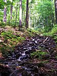 |
Mecklenburg-Vorpommern, Brandenburg, Thuringia, Hesse, 49°5′10″N 22°32′10″E / 49.08611°N 22.53611°E |
Natural: (ix) |
|
2007 | ||
| Residence of Bukovinian and Dalmatian Metropolitans |
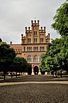 |
Chernivtsi, Chernivtsi Oblast (Bukovina), 48°17′48″N 25°55′29″E / 48.29667°N 25.92472°E |
Cultural: (ii), (iii), (iv) |
8.00 (19.8); buffer zone 245 (610) | 2011 | ||
| Rila Monastery | 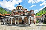 |
Rila, Kyustendil Province, 42°7′0″N 23°24′0″E / 42.11667°N 23.40000°E |
Cultural: (vi) |
11 (27); buffer zone 1,290 (3,200) | 1983 | ||
| Rock-Hewn Churches of Ivanovo | 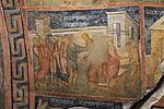 |
Ivanovo, Ruse Province, 43°43′0″N 25°58′0″E / 43.71667°N 25.96667°E |
Cultural: (i), (iii) |
172 (430) | 1979 | ||
| Srebarna Nature Reserve | 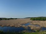 |
Srebarna, Silistra Province, 44°6′51.98″N 27°4′41.02″E / 44.1144389°N 27.0780611°E |
Natural: (x) |
638 (1,580); buffer zone 673 (1,660) | 1983 | ||
| Struve Geodetic Arc | 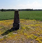 |
|
Cultural: (ii), (iii), (vi) |
|
2005 | ||
| Thracian Tomb of Kazanlak | 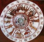 |
Kazanlak, Stara Zagora Province, 42°37′0″N 25°24′0″E / 42.61667°N 25.40000°E |
Cultural: (i), (iii), (iv) |
0.02 (0.049); buffer zone 7.09 (17.5) | 1979 | ||
| Thracian Tomb of Sveshtari | 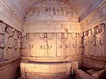 |
Sveshtari, Razgrad Province, 43°40′0.01″N 26°40′0.01″E / 43.6666694°N 26.6666694°E |
Cultural: (i), (iii) |
648 (1,600) | 1985 | ||
| Tokaj Wine Region Historic Cultural Landscape |
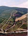 |
Borsod-Abaúj-Zemplén County, 48°9′N 21°21′E / 48.150°N 21.350°E |
Cultural: (iii), (v) |
13,255 (32,750); buffer zone 74,879 (185,030) | 2002 | ||
| Tugendhat Villa in Brno | 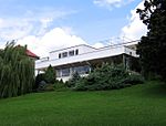 |
Brno, South Moravian Region, 49°12′26″N 16°36′58″E / 49.20722°N 16.61611°E |
Cultural: (ii), (iv) |
0.73 (1.8); buffer zone 2,825 (6,980) | 2001 | ||
| Villages with Fortified Churches in Transylvania | 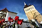 |
Alba, Brașov, Harghita, Mureș and Sibiu counties (Transylvania), 46°8′9″N 24°46′23″E / 46.13583°N 24.77306°E |
Cultural: (iv) |
553 (1,370); buffer zone 3,728 (9,210) | 1993 | ||
| Virgin Komi Forests |  |
Komi Republic, 65°4′N 60°9′E / 65.067°N 60.150°E |
Natural: (vii), (ix) |
3,280,000 (8,100,000) | 1995 | ||
| Vlkolínec | 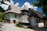 |
Ružomberok District, Žilina Region, 49°2′0″N 19°17′0″E / 49.03333°N 19.28333°E |
Cultural: (iv), (v) |
4.90 (12.1); buffer zone 321 (790) | 1993 | ||
| Western Caucasus | 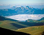 |
Krasnodar Krai, 44°0′N 40°0′E / 44.000°N 40.000°E |
Natural: (ix), (x) |
298,903 (738,610) | 1999 | ||
| White Monuments of Vladimir and Suzdal | 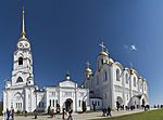 |
Vladimir and Suzdal, Vladimir Oblast, 56°9′0″N 40°25′0″E / 56.15000°N 40.41667°E |
Cultural: (i), (ii), (iv) |
|
1992 | ||
| Wieliczka and Bochnia Royal Salt Mines | 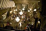 |
Wieliczka, Lesser Poland, 49°58′45″N 20°3′50″E / 49.97917°N 20.06389°E |
Cultural: (iv) |
969 (2,390); buffer zone 244 (600) | 1978 | ||
| Wooden Churches of Maramureş |
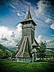 |
Maramureș (Transylvania), 47°49′15″N 24°3′21″E / 47.82083°N 24.05583°E |
Cultural: (iv) |
|
1999 | ||
| Wooden Churches of Southern Little Poland |  |
Lesser Poland Voivodeship and Podkarpackie Voivodeship, 49°45′0″N 21°14′0″E / 49.75000°N 21.23333°E |
Cultural: (iii), (iv) |
8.26 (20.4); buffer zone 242 (600) | 2003 | ||
| Wooden Churches of the Slovak part of the Carpathian Mountain Area | 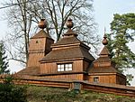 |
Košice, Banská Bystrica, Žilina and Prešov Regions, 49°20′10″N 19°33′30″E / 49.33611°N 19.55833°E |
Cultural: (iii), (iv) |
2.56 (6.3); buffer zone 90 (220) | 2008 | ||
| Wooden Tserkvas of the Carpathian Region in Poland and Ukraine | 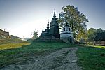 |
49°32′2″N 21°1′56″E / 49.53389°N 21.03222°E |
Cultural: (iii), (iv) |
|
2013 |

All content from Kiddle encyclopedia articles (including the article images and facts) can be freely used under Attribution-ShareAlike license, unless stated otherwise. Cite this article:
List of World Heritage Sites in Eastern Europe Facts for Kids. Kiddle Encyclopedia.
