List of tallest buildings and structures in Nottingham facts for kids
This list of tallest buildings and structures in Nottingham ranks the tallest buildings as well as structures within the City of Nottingham by height. Currently the tallest structure in Nottingham is the Eastcroft Incinerator, standing at 91 m (299 ft). However, the tallest building in Nottingham is Victoria Centre Flats A, standing at 75 m (246 ft).
St. Peter's Church in Nottingham was built in 1480, and was the tallest building in Nottingham for 361 years. High rise development in Nottingham was most active during the 1960s when many residential flats and tower blocks were constructed. However, several of these have been demolished or renovated during the 1980s and 2010s. High rise development slowed during the 1970s, and since 2000 only a few high rise buildings have been constructed.
Contents
Tallest existing buildings and structures
The tallest existing buildings and structures above 40 metres (131 ft), as of March 2022, in Nottingham and outer suburbs are listed below.
| Rank | Name (alternate names) | Image | Height | Floors | Year | Use | Coordinates | Notes | |
|---|---|---|---|---|---|---|---|---|---|
| 1 | Eastcroft Energy from Waste Facility (Eastcroft Incinerator) |
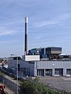 |
91 m | 299 ft | 1970 | Chimney | 52°56′47″N 1°08′07″W / 52.946379°N 1.135228°W |
|
|
| 2 | Victoria Centre Flats A | 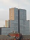 |
75 m | 246 ft | 26 | 1972 | Residential | 52°57′26″N 1°08′50″W / 52.957261°N 1.147263°W |
|
| 3 | Mapperley radio mast |  |
71 m | 233 ft | Transmitter | 52°58′24″N 1°07′45″W / 52.9734550°N 1.129210058°W | |||
| 4= | Pine View (Buckland Court) |
 |
62 m | 203 ft | 21 | 1967 | Residential | 52°57′36″N 1°10′19″W / 52.960003°N 1.171941°W |
|
| 4= | Lenton radio mast |  |
62 m | 203 ft | Transmitter | 52°56′30″N 1°10′35″W / 52.941756°N 1.176364°W | |||
| 6= | Bowman Telephone Exchange (BT) | 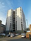 |
61 m | 200 ft | 13 | 1978 | Telephone Exchange
Office |
52°57′22″N 1°08′27″W / 52.956094°N 1.140956°W | |
| 6= | UoN Chimney | 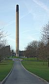 |
61 m | 200 ft | 1968 | Chimney | 52°56′24″N 1°11′32″W / 52.939972°N 1.192139°W | ||
| 6= | Burrows Court | 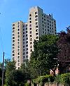 |
61 m | 200 ft | 21 | 1967 | Residential | 52°57′24″N 1°07′34″W / 52.956642°N 1.126121°W |
|
| 6= | Nottingham Council House |  |
61 m | 200 ft | 1929 | City Hall Mercantile |
52°57′12″N 1°08′55″W / 52.953452°N 1.148558°W |
|
|
| 10 | Aspire | 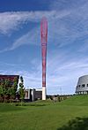 |
60 m | 197 ft | 2008 | Sculpture | 52°57′06″N 1°11′05″W / 52.951549°N 1.184603°W |
|
|
| 11 | Southchurch Court | 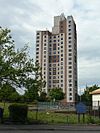 |
59 m | 194 ft | 20 | 1969 | Residential | 52°54′42″N 1°10′16″W / 52.911688°N 1.170988°W | |
| 12 | Tower Building, UoN |  |
57.9 m | 190 ft | 17 | 1966 | University | 52°56′32″N 1°11′19″W / 52.942221°N 1.188617°W | |
| 13 | All Hallows Church, Gedling | 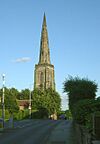 |
54.8 m | 180 ft | 1230 | Church | 52°58′37″N 1°04′50″W / 52.97699°N 1.08050°W |
|
|
| 14 | Ash View (Bampton Court) |
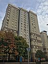 |
54.5 m | 179 ft | 18 | 1968 | Residential | 52°57′38″N 1°10′23″W / 52.960438°N 1.173084°W | |
| 15= | Victoria Centre Flats B |  |
53.3 m | 175 ft | 18 | 1972 | Residential | 52°57′23″N 1°08′49″W / 52.956324°N 1.146999°W | |
| 15= | All Saints' Church |  |
53.3 m | 175 ft | 1864 | Church | 52°57′37″N 1°09′41″W / 52.960185°N 1.161265°W | ||
| 17 | High Point (Braidwood Court / The Pinnacle) |
 |
52.7 m | 173 ft | 19 | 1970 | Residential | 52°57′59″N 1°10′06″W / 52.966283°N 1.168435°W | |
| 18= | Unity Square Phase 1 |  |
50 m | 160 ft | 11 | 2022 | Governmental Office | 52°56′47″N 1°08′53″W / 52.946366°N 1.148105°W | |
| 18= | Cranbrook House | 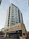 |
50 m | 164 ft | 14 | 1963 | Residential | 52°57′15″N 1°08′29″W / 52.954244°N 1.141358°W | |
| 18= | City Hospital Chimney |  |
50 m | 164 ft | 1969 | Chimney | 52°59′29″N 1°09′08″W / 52.991363°N 1.152244°W |
|
|
| 20 | Marco Island (Royal Mail Building) |
 |
47.9 m | 157 ft | 15 | 2005 | Residential Mercantile Parking |
52°57′20″N 1°08′31″W / 52.955655°N 1.142021°W |
|
| 21= | Oak View (Mellors Court) |
 |
46 m | 151 ft | 16 | 1968 | Residential | 52°57′36″N 1°10′22″W / 52.959899°N 1.172862°W | |
| 21= | Mapperley Ridge DAB mast | 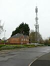 |
46 m | 151 ft | Transmitter | 52°58′35″N 1°07′57″W / 52.9763682°N 1.132584931°W | |||
| 23= | IQ Newtown House |  |
45.7 m | 150 ft | 14 | 1962 | Residential
Mercantile |
52°57′06″N 1°09′12″W / 52.951766°N 1.153302°W |
|
| 23= | Newton Building, NTU |  |
45.7 m | 150 ft | 10 | 1956 | University | 52°57′24″N 1°09′07″W / 52.956537°N 1.152034°W |
|
| 23= | St Paul's Church, Daybrook | 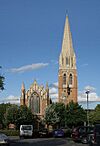 |
45.7 m | 150 ft | 1897 | Church | 53°00′02″N 1°08′17″W / 53.000613°N 1.137917°W |
|
|
| 23= | St Andrews Church | 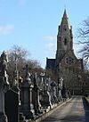 |
45.7 m | 150 ft | 1871 | Church | 52°57′55″N 1°09′08″W / 52.965182°N 1.152196°W | ||
| 23= | Nottingham Cathedral (The Cathedral Church of St. Barnabas) |
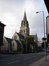 |
45.7 m | 150 ft | 1844 | Church | 52°57′17″N 1°09′26″W / 52.954677°N 1.157120°W | ||
| 23= | St. Peter's Church | 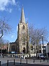 |
45.7 m | 150 ft | 1480 | Church | 52°57′08″N 1°08′55″W / 52.952260°N 1.148517°W |
|
|
| 29 | Nottingham One Tower | 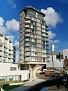 |
45.6 m | 150 ft | 14 | 2014 | Residential Office |
52°56′57″N 1°08′32″W / 52.949182°N 1.142128°W |
|
| 30= | Kingston Court | 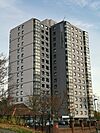 |
45.1 m | 148 ft | 16 | 1966 | Residential | 52°57′07″N 1°08′02″W / 52.952016°N 1.133915°W | |
| 30= | Colwick Woods Court |  |
45.1 m | 148 ft | 16 | 1966 | Residential | 52°57′03″N 1°07′07″W / 52.950875°N 1.118489°W | |
| 30= | Woodthorpe Court | 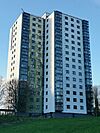 |
45.1 m | 148 ft | 16 | 1965 | Residential | 52°59′01″N 1°08′13″W / 52.983679°N 1.137077°W | |
| 30= | Winchester Court | 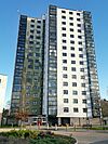 |
45.1 m | 148 ft | 16 | 1965 | Residential | 52°58′58″N 1°08′12″W / 52.982709°N 1.136757°W | |
| 30= | Bentinck Court | 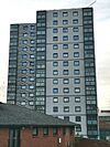 |
45.1 m | 148 ft | 16 | 1965 | Residential | 52°57′09″N 1°08′09″W / 52.952629°N 1.135947°W | |
| 30= | Manvers Court | 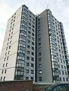 |
45.1 m | 148 ft | 16 | 1964 | Residential | 52°57′07″N 1°08′07″W / 52.951944°N 1.135365°W | |
| 36 | Colwick Wood radio mast | 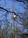 |
45 m | 148 ft | 1995 | Transmitter | 52°57′11″N 1°06′43″W / 52.9530147°N 1.11198794°W | ||
| 37= | Market Square House |  |
44.5 m | 146 ft | 12 | 1966 | Office Mercantile |
52°57′12″N 1°09′06″W / 52.953226°N 1.151686°W |
|
| 37= | Pitcher & Piano (The Unitarian Church) | 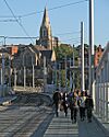 |
44.5 m | 146 ft | 2 | 1876 | Public house | 52°57′03″N 1°08′43″W / 52.950911°N 1.145220°W |
|
| 39 | The Litmus Building |  |
44 m | 144 ft | 14 | 2007 | Residential | 52°57′24″N 1°08′37″W / 52.956746°N 1.143654°W | |
| 40= | Global Point (Academy Heights / Kaplan Residences) |
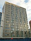 |
43 m | 141 ft | 14 | 2014 | Residential Shops Restaurant |
52°57′11″N 1°09′12″W / 52.953116°N 1.153461°W | |
| 40= | E.ON Trinity House | 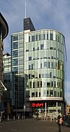 |
43 m | 141 ft | 9 | 2012 | Office | 52°57′23″N 1°09′00″W / 52.956485°N 1.150024°W | |
| 40= | Leonardo Hotel | 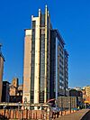 |
43 m | 141 ft | 13 | 2005 | Hotel | 52°56′54″N 1°08′26″W / 52.948444°N 1.140655°W | |
| 43 | Britannia Hotel | 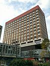 |
42.6 m | 140 ft | 14 | 1969 | Hotel | 52°57′08″N 1°09′14″W / 52.952352°N 1.153812°W | |
| 44 | Queens Medical Centre Chimney |  |
42 m | 138 ft | 1971 | Chimney | 52°56′45″N 1°11′05″W / 52.945736°N 1.184647°W | ||
| 45 | The Vantage |  |
40 m | 130 ft | 14 | 2021 | Rental Apartments Public Parking Fitness Centre |
52°56′44″N 1°09′08″W / 52.945610°N 1.152340°W | |
Tallest under construction, approved and proposed
Below are sub-sections for the tallest under construction, approved and proposed buildings and structures in Nottingham.
Under construction
This lists buildings that are under construction in Nottingham over 40 m (130 ft).
| Rank | Name (alternate names) | Image | Height | Floors | Year | Use | Coordinates | Notes | |
|---|---|---|---|---|---|---|---|---|---|
| 1 | Island Quarter Hotel | 73.15 m | 240.0 ft | 20 | 2023 | Hotel Rental Apartments |
|
||
| 2 | Hotel Indigo / Staybridge Suite | 70 m | 230 ft | 18 | 2023 | Hotel |
|
||
Approved
This lists buildings that have been approved for, but are yet to start, construction in Nottingham over 40 m (130 ft).
| Rank | Name (alternate names) | Height | Floors | Year | Use | Coordinates | Notes | |
|---|---|---|---|---|---|---|---|---|
| 1 | Three Wilford Road | 105 m | 344 ft | 23 | 2024 | Residential Rental Apartments |
52°56′45″N 1°09′08″W / 52.9459°N 1.1521°W |
|
| 2 | Unity Square Phase 2 | 60 m | 200 ft | 15 | 2023 | Commercial Office Governmental Office |
52°56′47″N 1°08′57″W / 52.9463°N 1.1491°W |
|
| 3 | London Road Centre | 48 m | 157 ft | 13 | 2023 | Office Restaurant |
52°56′36″N 1°08′21″W / 52.9432°N 1.1391°W | |
| 4= | Arkwright Street | 45 m | 148 ft | 13 | 2023 | Residential Office |
52°56′42″N 1°08′50″W / 52.9450°N 1.1473°W |
|
| 4= | Island Quarter Apartments | 45 m | 148 ft | 18 | Rental Apartments Shops |
|
||
Proposed
This lists buildings that have been proposed but are yet to receive approval to be built in Nottingham over 40 m (130 ft).
| Rank | Name (alternate names) | Height | Floors | Year | Use | Coordinates | Notes | |
|---|---|---|---|---|---|---|---|---|
| 1 | Glasshouse Street | 121.92 m | 400.0 ft | 43 | 2025 | Rental Apartments Residential |
52°57′30″N 1°08′48″W / 52.9583°N 1.1467°W | This building will become Nottingham's tallest building and tower over its current No.1, Victoria Flats A, as well as becoming Nottingham's tallest structure, bypassing the chimney at Eastcroft Incinerator. |
| 2 | 1–4 Queen's Road | 68 m | 223 ft | 26 | 2023 | Rental Apartments Hotel |
52°56′49″N 1°08′27″W / 52.9470°N 1.1407°W | |
| 3 | Guildhall Hotel | 45 m | 148 ft | 15 | Hotel | 52°57′25″N 1°09′02″W / 52.9569°N 1.1505°W | ||
Tallest unbuilt and demolished
Below are sub-sections for the tallest unbuilt and demolished buildings and structures in Nottingham.
Tallest unbuilt buildings and structures
This lists proposals for the construction of buildings in Nottingham that were planned to rise at least 40 metres (131 ft), for which planning permission was rejected or which were otherwise withdrawn.
| Rank | Name (alternate names) | Image | Height | Floors | Use | Notes | |
|---|---|---|---|---|---|---|---|
| 1 | Whyte Tower 1 (Lower Parliament Street Tower 1) |
151 m | 495 ft | 54 | Residential Hotel Office |
||
| 2 | Christian Centre | 93 m | 305 ft | Church | |||
| 3 | No. 1 Brook Street Tower 1 | 80 m | 260 ft | 25 | Residential Mercantile |
||
| 4 | Whyte Tower 2 | 78 m | 256 ft | 25 | Commercial Office Hotel |
||
| 5 | No. 1 Brook Street Tower 2 | 46.8 m | 154 ft | 12 | Residential Mercantile |
||
Tallest demolished buildings and structures
This list shows the tallest buildings in structures in Nottingham of at least 40 metres (131 ft) in height that have been demolished.
| Rank | Name (alternate names) | Image | Height | Floors | Completed | Demolished | Use | Coordinates | Notes | |
|---|---|---|---|---|---|---|---|---|---|---|
| 1= | Evans Court | 61 m | 200 ft | 20 | 1971 | 1985 | Residential | 52°59′01″N 1°10′57″W / 52.983611°N 1.1825°W | ||
| 1= | Auburn Court | 61 m | 200 ft | 20 | 1971 | 1985 | Residential | 52°58′58″N 1°10′55″W / 52.982778°N 1.181944°W | ||
| 1= | Wicklow Court | 61 m | 200 ft | 20 | 1971 | 1985 | Residential | 52°59′01″N 1°11′03″W / 52.983611°N 1.184167°W | ||
| 1= | Mill Court | 61 m | 200 ft | 20 | 1971 | 1985 | Residential | 52°59′02″N 1°11′07″W / 52.983889°N 1.185278°W | ||
| 5 | Holy Trinity Church | 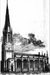 |
54 m | 177 ft | 1841 | 1958 | Church | 52°57′22″N 1°08′56″W / 52.956111°N 1.148889°W |
|
|
| 6= | Willoughby Court | 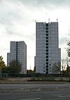 |
48.1 m | 158 ft | 17 | 1967 | 2015 | Residential | 52°56′58″N 1°10′22″W / 52.949562°N 1.172836°W | |
| 6= | Newgate Court | 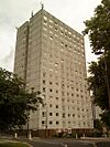 |
48.1 m | 158 ft | 17 | 1967 | 2016 | Residential | 52°57′04″N 1°10′22″W / 52.951145°N 1.172764°W | |
| 6= | Lenton Court |  |
48.1 m | 158 ft | 17 | 1967 | 2013 | Residential | 52°57′01″N 1°10′23″W / 52.950361°N 1.173155°W | |
| 6= | Digby Court |  |
48.1 m | 158 ft | 17 | 1967 | 2014 | Residential | 52°56′59″N 1°10′19″W / 52.949776°N 1.172003°W | |
| 6= | Abbey Court |  |
48.1 m | 158 ft | 17 | 1967 | 2014 | Residential | 52°57′02″N 1°10′20″W / 52.950619°N 1.172340°W | |
| 11 | Highcross Court | 43.3 m | 142 ft | 15 | 1966 | 2012 | Residential | 52°57′34″N 1°10′10″W / 52.959339°N 1.169399°W | ||
Timeline of tallest buildings and structures
Tallest structures in Nottinghamshire


