
Liverpool, Texas facts for kids
Quick facts for kids
Liverpool, Texas
|
|
|---|---|

Albert Finkle County Park in Liverpool
|
|

Location of Liverpool, Texas
|
|
 |
|
| Country | United States |
| State | Texas |
| County | Brazoria |
| Area | |
| • Total | 1.09 sq mi (2.83 km2) |
| • Land | 1.09 sq mi (2.83 km2) |
| • Water | 0.00 sq mi (0.00 km2) |
| Elevation | 20 ft (6 m) |
| Population
(2010)
|
|
| • Total | 482 |
| • Estimate
(2019)
|
551 |
| • Density | 503.66/sq mi (194.42/km2) |
| Time zone | UTC-6 (Central (CST)) |
| • Summer (DST) | UTC-5 (CDT) |
| ZIP code |
77577
|
| Area code(s) | 281, 832 |
| FIPS code | 48-43120 |
| GNIS feature ID | 1361569 |
Liverpool is a city in Brazoria County, Texas, United States, named after the city of Liverpool in England. It is located along the Union Pacific Railroad and County Road 171 northeast of Angleton and south of Alvin. The population was 482 at the 2010 census.
Contents
History
In October 2009, Mike Peters, the mayor of Liverpool, was found dead on the Union Pacific Railroad tracks that run through Liverpool.
Geography
Liverpool is located in northeastern Brazoria County at 29°17′57″N 95°16′39″W / 29.29917°N 95.27750°W (29.299272, -95.277470). It is bordered on the east by Chocolate Bayou. The city limits extend northwest on either side of Main Street for 2 miles (3 km) to reach Texas State Highway 35. From that point it is 14 miles (23 km) southwest to Angleton, the county seat, and 8 miles (13 km) northeast to the center of Alvin.
According to the United States Census Bureau, Liverpool has a total area of 1.1 square miles (2.8 km2), all of it land.
Demographics
As of the census of 2000, there were 404 people, 152 households, and 115 families residing in the city. The population density was 425.4 people per square mile (164.2/km2). There were 189 housing units at an average density of 199.0/sq mi (76.8/km2). The racial makeup of the city was 88.61% White, 0.74% African American, 1.49% Native American, 0.25% Asian, 6.68% from other races, and 2.23% from two or more races. Hispanic or Latino of any race were 9.90% of the population.
There were 152 households, out of which 30.3% had children under the age of 18 living with them, 60.5% were married couples living together, 9.2% had a female householder with no husband present, and 24.3% were non-families. 19.7% of all households were made up of individuals, and 9.9% had someone living alone who was 65 years of age or older. The average household size was 2.66 and the average family size was 3.03.
In the city, the population was spread out, with 25.7% under the age of 18, 8.2% from 18 to 24, 33.4% from 25 to 44, 23.0% from 45 to 64, and 9.7% who were 65 years of age or older. The median age was 35 years. For every 100 females, there were 112.6 males. For every 100 females age 18 and over, there were 109.8 males.
The median income for a household in the city was $48,750, and the median income for a family was $51,042. Males had a median income of $36,875 versus $30,938 for females. The per capita income for the city was $19,492. About 7.0% of families and 6.6% of the population were below the poverty line, including 7.4% of those under age 18 and none of those age 65 or over.
| Historical population | |||
|---|---|---|---|
| Census | Pop. | %± | |
| 1970 | 319 | — | |
| 1980 | 602 | 88.7% | |
| 1990 | 396 | −34.2% | |
| 2000 | 404 | 2.0% | |
| 2010 | 482 | 19.3% | |
| 2019 (est.) | 551 | 14.3% | |
| U.S. Decennial Census | |||
Education
Primary and secondary schools
Public schools
Students in Liverpool attend schools in the Alvin Independent School District.
Residents attend Alvin High School.
Colleges and universities
Additionally, Alvin Community College, located in nearby Alvin, provides basic undergraduate courses and adult education. Liverpool is in the ACC taxation zone. The Texas Legislature designated Alvin ISD as being in the Alvin CC zone.
Images for kids
-
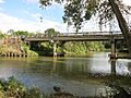
CR 171 bridge over Chocolate Bayou
-
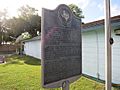
Historical marker at US Post Office


See also
 In Spanish: Liverpool (Texas) para niños
